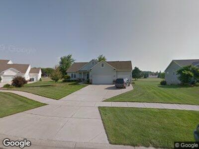
5195 Bunker Ct SE Unit 24 Caledonia, MI 49316
Estimated Value: $409,000 - $624,000
2
Beds
2
Baths
1,690
Sq Ft
$294/Sq Ft
Est. Value
About This Home
This home is located at 5195 Bunker Ct SE Unit 24, Caledonia, MI 49316 and is currently estimated at $497,697, approximately $294 per square foot. 5195 Bunker Ct SE Unit 24 is a home located in Kent County with nearby schools including Dutton Elementary School, Emmons Lake Elementary School, and Caledonia Elementary School.
Ownership History
Date
Name
Owned For
Owner Type
Purchase Details
Closed on
May 25, 2020
Sold by
Patrick Michael A and Patrick Cathy J
Bought by
Patrick Michael A and Patrick Cathy J
Current Estimated Value
Purchase Details
Closed on
Jun 30, 2006
Sold by
Vanhaaften Eric and Vanhaaften Mary
Bought by
Patrick Micheal A and Patrick Cathy J
Home Financials for this Owner
Home Financials are based on the most recent Mortgage that was taken out on this home.
Original Mortgage
$216,000
Interest Rate
6.73%
Mortgage Type
Purchase Money Mortgage
Purchase Details
Closed on
Jun 21, 2005
Sold by
Rivertown Development Llc
Bought by
Vanhaaften Eric and Vanhaaften Mary
Purchase Details
Closed on
Jun 25, 2004
Sold by
Rivertown Development Llc
Bought by
Vanhaaften Eric and Vanhaaften Mary
Create a Home Valuation Report for This Property
The Home Valuation Report is an in-depth analysis detailing your home's value as well as a comparison with similar homes in the area
Home Values in the Area
Average Home Value in this Area
Purchase History
| Date | Buyer | Sale Price | Title Company |
|---|---|---|---|
| Patrick Michael A | -- | None Available | |
| Patrick Micheal A | $270,000 | Metropolitan Title Company | |
| Vanhaaften Eric | $48,000 | Metropolitan Title Company | |
| Vanhaaften Eric | -- | Fatic |
Source: Public Records
Mortgage History
| Date | Status | Borrower | Loan Amount |
|---|---|---|---|
| Closed | Patrick Michael A | $165,000 | |
| Closed | Patrick Michael A | $200,000 | |
| Closed | Patrick Michael A | $207,500 | |
| Closed | Patrick Micheal A | $216,000 |
Source: Public Records
Tax History Compared to Growth
Tax History
| Year | Tax Paid | Tax Assessment Tax Assessment Total Assessment is a certain percentage of the fair market value that is determined by local assessors to be the total taxable value of land and additions on the property. | Land | Improvement |
|---|---|---|---|---|
| 2024 | $2,911 | $202,600 | $0 | $0 |
| 2023 | $2,784 | $187,300 | $0 | $0 |
| 2022 | $3,867 | $172,000 | $0 | $0 |
| 2021 | $2,585 | $157,200 | $0 | $0 |
| 2020 | $2,563 | $149,000 | $0 | $0 |
| 2019 | $367,637 | $142,800 | $0 | $0 |
| 2018 | $3,609 | $136,400 | $0 | $0 |
| 2017 | $3,453 | $128,600 | $0 | $0 |
| 2016 | $3,322 | $122,000 | $0 | $0 |
| 2015 | $3,239 | $122,000 | $0 | $0 |
| 2013 | -- | $108,900 | $0 | $0 |
Source: Public Records
Map
Nearby Homes
- 7434 Bramling Dr SE
- 7506 Curry St SE
- 5044 Apollo Ln SE
- 7396 Unicorn Ave SE
- 7323 Kraft Ave SE
- 5480 Mammoth Dr
- 7267 Brighton Ln
- 5484 Mammoth Dr
- 7469 Traditional Ct
- 7269 Mammoth Ct SE
- 7484 Traditional Ct
- 7256 Brighton Ln SE
- 7263 Mammoth Ct
- 5490 Mammoth Dr SE
- 7262 Brighton Ln SE
- 5661 Walnut Run Ct SE
- 7293 Graymoor St SE
- 7299 Graymoor St SE
- 7287 Graymoor St SE
- 7266 Graymoor St SE
- 5195 Bunker Ct SE Unit 24
- 5209 Bunker Ct SE Unit 23
- 5187 Bunker Ct SE Unit 25
- 7695 Green Links Dr SE Unit 22
- 5184 Bunker Ct SE Unit 26
- 5200 Bunker Ct SE Unit 28
- 5190 Bunker Ct SE Unit 27
- 7683 Green Links Dr SE Unit 21
- 7715 Green Links Dr SE
- 7718 Green Links Dr SE
- 7694 Green Links Dr SE Unit 44
- 7669 Green Links Dr SE
- 7669 Green Links Dr SE Unit 20
- 5225 76th St SE
- 7727 Green Links Dr SE Unit 30
- 5195 76th St SE
- 5191 76th St SE
- 7687 Broadview Dr SE Unit 19
- 5254 Wade St SE
- 5254 Wade St SE Unit 2