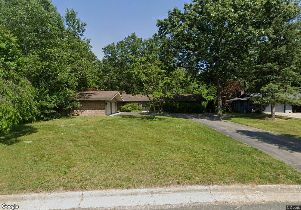
5196 Burning Tree Rd Kalamazoo, MI 49009
Estimated Value: $380,000 - $451,425
5
Beds
4
Baths
4,196
Sq Ft
$102/Sq Ft
Est. Value
About This Home
This home is located at 5196 Burning Tree Rd, Kalamazoo, MI 49009 and is currently estimated at $429,606, approximately $102 per square foot. 5196 Burning Tree Rd is a home located in Kalamazoo County with nearby schools including 12th Street Elementary School, Portage West Middle School, and Portage Central High School.
Ownership History
Date
Name
Owned For
Owner Type
Purchase Details
Closed on
Jul 28, 2003
Sold by
White Mark S and White Beth
Bought by
Grahek Gerald P and Grahek Geraldine K
Current Estimated Value
Home Financials for this Owner
Home Financials are based on the most recent Mortgage that was taken out on this home.
Original Mortgage
$120,000
Interest Rate
6.23%
Mortgage Type
Purchase Money Mortgage
Create a Home Valuation Report for This Property
The Home Valuation Report is an in-depth analysis detailing your home's value as well as a comparison with similar homes in the area
Home Values in the Area
Average Home Value in this Area
Purchase History
| Date | Buyer | Sale Price | Title Company |
|---|---|---|---|
| Grahek Gerald P | $222,500 | Chicago Title |
Source: Public Records
Mortgage History
| Date | Status | Borrower | Loan Amount |
|---|---|---|---|
| Previous Owner | Grahek Gerald P | $120,000 | |
| Closed | Grahek Gerald P | $75,000 |
Source: Public Records
Tax History
| Year | Tax Paid | Tax Assessment Tax Assessment Total Assessment is a certain percentage of the fair market value that is determined by local assessors to be the total taxable value of land and additions on the property. | Land | Improvement |
|---|---|---|---|---|
| 2025 | $1,446 | $173,900 | $0 | $0 |
| 2024 | $1,405 | $162,700 | $0 | $0 |
| 2023 | $1,339 | $150,100 | $0 | $0 |
| 2022 | $4,388 | $135,300 | $0 | $0 |
| 2021 | $4,264 | $127,700 | $0 | $0 |
| 2020 | $4,164 | $125,500 | $0 | $0 |
| 2019 | $3,808 | $122,200 | $0 | $0 |
| 2018 | $2,345 | $121,600 | $0 | $0 |
| 2017 | -- | $121,900 | $0 | $0 |
| 2016 | -- | $117,600 | $0 | $0 |
| 2015 | -- | $104,700 | $10,700 | $94,000 |
| 2014 | -- | $104,700 | $0 | $0 |
Source: Public Records
Map
Nearby Homes
- 5456 Stoney Brook Rd
- 7341 Salerno Cir
- 4610 Geneva Ave
- 5464 Cypress Bay Dr
- 4691 Ashton Farms Blvd
- 6035 S 12th St
- 5820 Boxthorn Trail
- 5944 Gavin Ln
- 5250 Queen Victoria Ln
- 5950 Boxthorn Trail
- 5978 Boxthorn Trail
- 6732 Bay Ridge Rd
- 6061 Equestrian Woods Ct
- 7795 W Saint Andrews Cir Unit 10
- 6107 Equestrian Woods Ct Unit 267
- 5083 Brinson Ln
- 5122 Brinson Ln
- 7182 Breton Woods Ct
- 3649 Tartan Cir
- 5125 Buxton Trail
- 5190 Burning Tree Rd
- 5186 Burning Tree Rd
- 5175 Stoney Brook Rd
- 5193 Burning Tree Rd
- 5176 Burning Tree Rd
- 7440 Thrasher Ln
- 7426 Thrasher Ln
- 5151 Stoney Brook Rd
- 5173 Burning Tree Rd
- 5222 Burning Tree Rd
- 5166 Burning Tree Rd
- 5273 Stoney Brook Rd
- 5258 Stoney Brook Rd
- 7466 Thrasher Ln
- 7404 Thrasher Ln
- 5188 Stoney Brook Rd
- 5163 Burning Tree Rd
- 5132 Thrasher Ct
- 5166 Stoney Brook Rd
- 5156 Burning Tree Rd
Your Personal Tour Guide
Ask me questions while you tour the home.