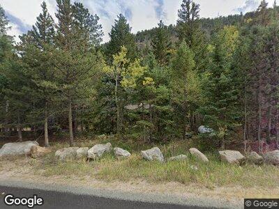
Estimated Value: $378,691 - $468,000
2
Beds
1
Bath
748
Sq Ft
$567/Sq Ft
Est. Value
About This Home
This home is located at 51964 State Highway 72, Lyons, CO 80540 and is currently estimated at $424,173, approximately $567 per square foot. 51964 State Highway 72 is a home located in Boulder County with nearby schools including Lyons Elementary School and Lyons Middle/Senior High School.
Ownership History
Date
Name
Owned For
Owner Type
Purchase Details
Closed on
Jun 29, 2021
Sold by
Hamby Lola C
Bought by
Stephen And Lola Hamby Living Trust
Current Estimated Value
Purchase Details
Closed on
Jul 17, 1992
Bought by
Hardee Lucas
Purchase Details
Closed on
Aug 27, 1985
Bought by
Hardee Lucas
Purchase Details
Closed on
Jun 28, 1985
Bought by
Hardee Lucas
Purchase Details
Closed on
Nov 30, 1973
Bought by
Hardee Lucas
Create a Home Valuation Report for This Property
The Home Valuation Report is an in-depth analysis detailing your home's value as well as a comparison with similar homes in the area
Home Values in the Area
Average Home Value in this Area
Purchase History
| Date | Buyer | Sale Price | Title Company |
|---|---|---|---|
| Stephen And Lola Hamby Living Trust | -- | None Available | |
| Hardee Lucas | $70,000 | -- | |
| Hardee Lucas | -- | -- | |
| Hardee Lucas | -- | -- | |
| Hardee Lucas | $29,000 | -- |
Source: Public Records
Mortgage History
| Date | Status | Borrower | Loan Amount |
|---|---|---|---|
| Open | Lucas Hardee | $127,500 | |
| Closed | Lucas Hardee | $200,000 |
Source: Public Records
Tax History Compared to Growth
Tax History
| Year | Tax Paid | Tax Assessment Tax Assessment Total Assessment is a certain percentage of the fair market value that is determined by local assessors to be the total taxable value of land and additions on the property. | Land | Improvement |
|---|---|---|---|---|
| 2024 | $1,597 | $18,251 | -- | $18,251 |
| 2023 | $1,597 | $18,251 | $2,117 | $19,819 |
| 2022 | $1,747 | $18,973 | $2,446 | $16,527 |
| 2021 | $1,767 | $19,520 | $2,517 | $17,003 |
| 2020 | $1,198 | $13,278 | $3,289 | $9,989 |
| 2019 | $1,180 | $13,278 | $3,289 | $9,989 |
| 2018 | $843 | $9,576 | $3,168 | $6,408 |
| 2017 | $834 | $10,586 | $3,502 | $7,084 |
| 2016 | $760 | $8,573 | $2,627 | $5,946 |
| 2015 | $722 | $11,144 | $1,672 | $9,472 |
| 2014 | $964 | $11,144 | $1,672 | $9,472 |
Source: Public Records
Map
Nearby Homes
- 3154 Riverside Dr
- 2637 Riverside Dr
- 2426 Riverside Dr
- 727 Overland Dr
- 600 Rock Lake Rd Unit 12
- 600 Rock Lake Rd
- 820 Riverside Dr
- 818 Riverside Dr
- 818 Riverside Dr Unit A
- 555 Riverside Dr
- 10 Kittle Ct
- 212 Valley Rd
- 585 Taylor Rd
- 223 Taylor Rd
- 928 Ski Rd
- 147 Cedar Dr
- 1134 Highway 7 Business
- 11563 Peak To Peak Dr
- 287 S Skinner Rd
- 73 Spruce St
