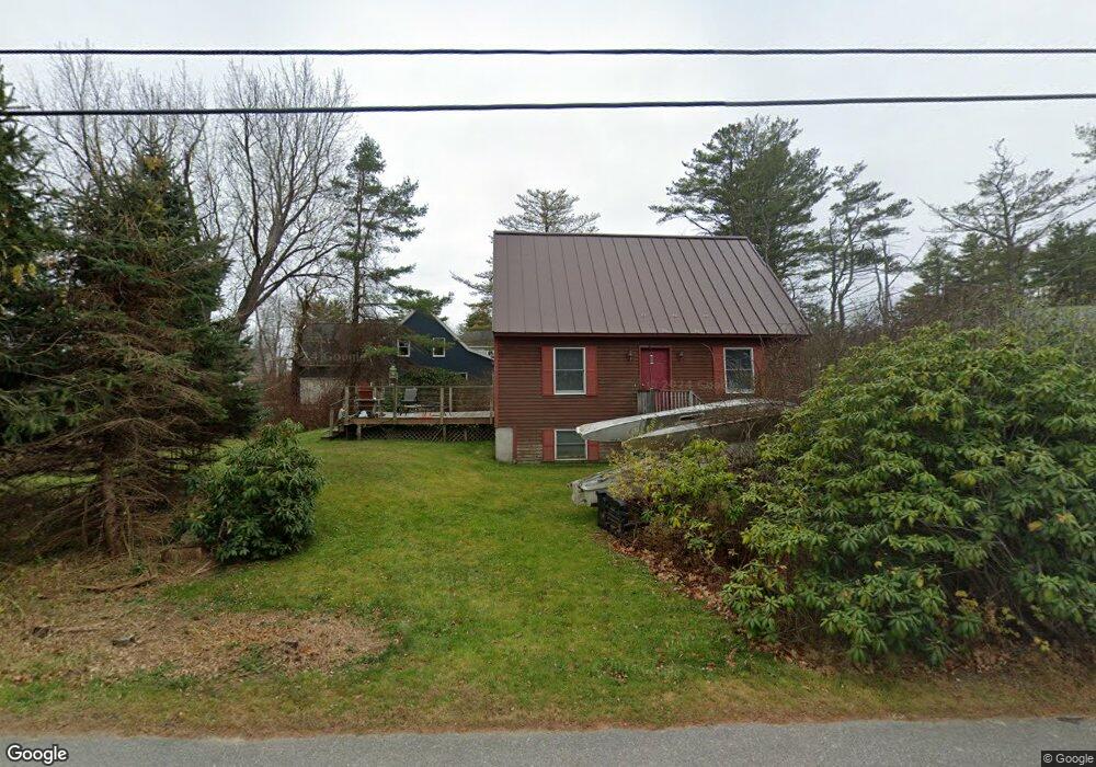
52 Byram Ave Freeport, ME 04032
Estimated Value: $607,525 - $1,083,000
3
Beds
2
Baths
1,414
Sq Ft
$603/Sq Ft
Est. Value
About This Home
This home is located at 52 Byram Ave, Freeport, ME 04032 and is currently estimated at $852,381, approximately $602 per square foot. 52 Byram Ave is a home located in Cumberland County with nearby schools including Morse Street School, Mast Landing School, and Freeport Middle School.
Create a Home Valuation Report for This Property
The Home Valuation Report is an in-depth analysis detailing your home's value as well as a comparison with similar homes in the area
Home Values in the Area
Average Home Value in this Area
Tax History
| Year | Tax Paid | Tax Assessment Tax Assessment Total Assessment is a certain percentage of the fair market value that is determined by local assessors to be the total taxable value of land and additions on the property. | Land | Improvement |
|---|---|---|---|---|
| 2025 | $5,433 | $392,300 | $187,900 | $204,400 |
| 2024 | $5,118 | $383,400 | $179,000 | $204,400 |
| 2023 | $4,674 | $339,900 | $162,700 | $177,200 |
| 2022 | $4,402 | $322,500 | $145,300 | $177,200 |
| 2021 | $4,305 | $322,500 | $145,300 | $177,200 |
| 2020 | $4,166 | $297,600 | $134,500 | $163,100 |
| 2019 | $4,010 | $280,400 | $126,900 | $153,500 |
| 2018 | $3,865 | $256,800 | $114,700 | $142,100 |
| 2017 | $3,706 | $247,900 | $112,400 | $135,500 |
| 2016 | $3,528 | $223,300 | $97,900 | $125,400 |
| 2015 | $3,468 | $206,400 | $87,500 | $118,900 |
| 2014 | $3,261 | $206,400 | $87,500 | $118,900 |
| 2013 | $3,387 | $213,700 | $97,200 | $116,500 |
Source: Public Records
Map
Nearby Homes
- 58 Maquoit Dr
- 70 Maquoit Dr
- 71 Merganser Way
- 10 Lower Flying Point Rd
- 52 Birch Point Rd
- 83 Central Ave
- 29 S Freeport Rd
- 46 Blackstone Club Rd
- 7 Shearwater Way
- 26 Harvest Ridge Rd Unit 24
- 20 Harvest Ridge Rd Unit 23
- 11 Orchard Hill Rd
- 853 Mere Point Rd
- 15 Linwood Rd Unit 15
- Map 80 Lot 18-0 White Island
- 15 Tinkers Way
- 39 Hunter Rd
- 10 Durham Rd
- 10 Prout Rd
- 1 Mallard Pond Rd
Your Personal Tour Guide
Ask me questions while you tour the home.