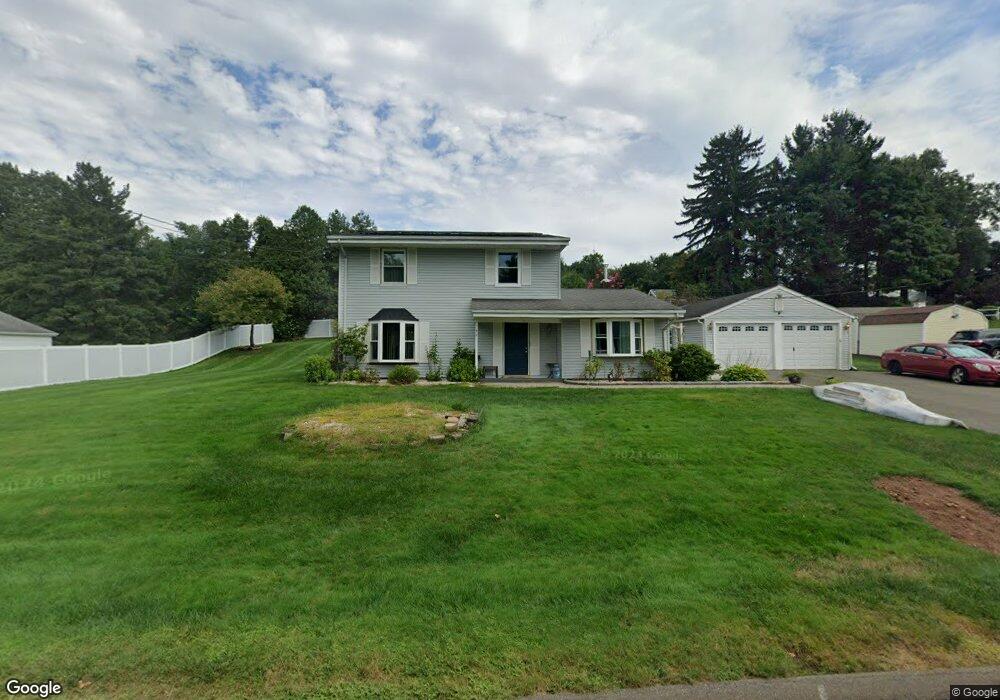
52 Fieldbrook Rd Middletown, CT 06457
Westfield NeighborhoodEstimated Value: $355,000 - $427,000
4
Beds
2
Baths
1,700
Sq Ft
$231/Sq Ft
Est. Value
About This Home
This home is located at 52 Fieldbrook Rd, Middletown, CT 06457 and is currently estimated at $392,383, approximately $230 per square foot. 52 Fieldbrook Rd is a home located in Middlesex County with nearby schools including Moody School and Middletown High School.
Ownership History
Date
Name
Owned For
Owner Type
Purchase Details
Closed on
Mar 9, 2015
Sold by
Perry Gary D and Perry Carmen I
Bought by
Perry Carmen I
Current Estimated Value
Home Financials for this Owner
Home Financials are based on the most recent Mortgage that was taken out on this home.
Original Mortgage
$238,634
Outstanding Balance
$184,043
Interest Rate
3.87%
Mortgage Type
FHA
Estimated Equity
$208,340
Purchase Details
Closed on
Aug 25, 1988
Sold by
Restaino Lucy
Bought by
Perry Gary D
Create a Home Valuation Report for This Property
The Home Valuation Report is an in-depth analysis detailing your home's value as well as a comparison with similar homes in the area
Home Values in the Area
Average Home Value in this Area
Purchase History
| Date | Buyer | Sale Price | Title Company |
|---|---|---|---|
| Perry Carmen I | -- | -- | |
| Perry Gary D | $165,000 | -- |
Source: Public Records
Mortgage History
| Date | Status | Borrower | Loan Amount |
|---|---|---|---|
| Open | Perry Carmen I | $238,634 | |
| Previous Owner | Perry Gary D | $252,557 | |
| Previous Owner | Perry Gary D | $253,750 |
Source: Public Records
Tax History Compared to Growth
Tax History
| Year | Tax Paid | Tax Assessment Tax Assessment Total Assessment is a certain percentage of the fair market value that is determined by local assessors to be the total taxable value of land and additions on the property. | Land | Improvement |
|---|---|---|---|---|
| 2024 | $5,896 | $184,610 | $66,200 | $118,410 |
| 2023 | $5,546 | $184,610 | $66,200 | $118,410 |
| 2022 | $4,949 | $131,920 | $44,130 | $87,790 |
| 2021 | $4,811 | $128,540 | $44,130 | $84,410 |
| 2020 | $4,818 | $128,540 | $44,130 | $84,410 |
| 2019 | $5,072 | $134,590 | $44,130 | $90,460 |
| 2018 | $4,605 | $126,690 | $44,130 | $82,560 |
| 2017 | $4,728 | $133,360 | $48,160 | $85,200 |
| 2016 | $4,636 | $133,360 | $48,160 | $85,200 |
| 2015 | $4,536 | $133,360 | $48,160 | $85,200 |
| 2014 | $4,538 | $133,360 | $48,160 | $85,200 |
Source: Public Records
Map
Nearby Homes
- 833 East St
- 23 Falmouth Ct
- 65 Inverness Ln
- 12 Inverness Ln
- 1 Forest Glen Cir Unit 1
- 112 Carriage Crossing Ln Unit 112
- 48 Carriage Crossing Ln Unit 8108
- 27 Carriage Crossing Ln Unit 27
- 224 Carriage Crossing Ln Unit 224
- 135 Carriage Crossing Ln Unit 135
- 34 Apple Ln
- 292 Poplar Rd
- 455 East St
- 49 Rising Trail Dr Unit 49
- 36 Rising Trail Dr Unit 36
- 46 Rising Trail Dr
- 52 Rising Trail Dr
- 29 Talias Trail
- 115 Webster Ln Unit 115
- 56 Burgundy Hill Ln Unit 56
- 38 Fieldbrook Rd
- 45 Fieldbrook Rd
- 59 Fieldbrook Rd
- 66 Fieldbrook Rd
- 771 East St
- 781 East St
- 761 East St
- 33 Fieldbrook Rd
- 24 Fieldbrook Rd
- 791 East St
- 17 Fieldbrook Rd
- 749 East St
- 6 Grove Hill Rd
- 801 East St
- 66 Delwood Ave
- 78 Fieldbrook Rd
- 78 Delwood Ave
- 54 Delwood Ave
- 16 Grove Hill Rd
- 30 Glenwood Terrace