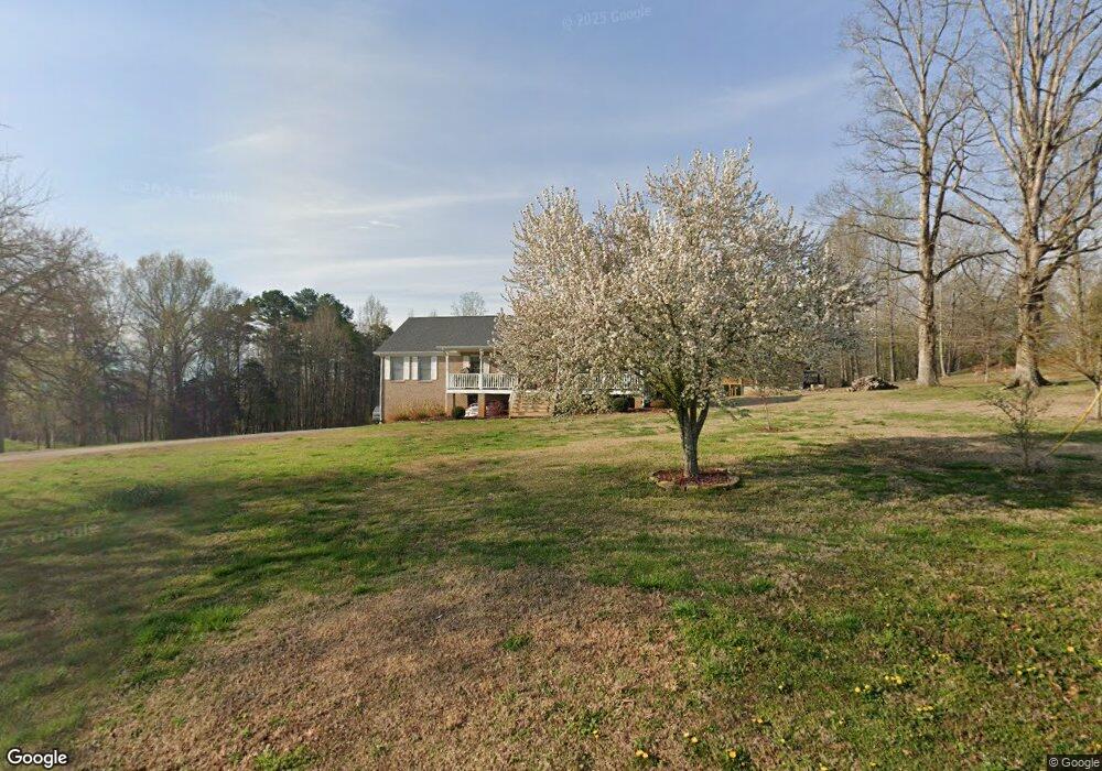
52 Lang Rd Dunlap, TN 37327
Estimated Value: $320,168 - $384,000
3
Beds
2
Baths
1,680
Sq Ft
$213/Sq Ft
Est. Value
About This Home
This home is located at 52 Lang Rd, Dunlap, TN 37327 and is currently estimated at $358,292, approximately $213 per square foot. 52 Lang Rd is a home located in Sequatchie County with nearby schools including Griffith Elementary School, Sequatchie County Middle School, and Sequatchie County High School.
Ownership History
Date
Name
Owned For
Owner Type
Purchase Details
Closed on
Jan 24, 2005
Current Estimated Value
Purchase Details
Closed on
Jan 14, 2005
Bought by
Miller Andrew & Wife % America Home Mortgage
Purchase Details
Closed on
Jan 13, 2005
Bought by
Ewton Jonathan
Purchase Details
Closed on
Nov 5, 2003
Bought by
Ewton Johnthan
Purchase Details
Closed on
Jan 15, 2003
Bought by
Ewtin Waymon S
Purchase Details
Closed on
Jun 5, 1985
Bought by
Merriman Thomas Lynn
Create a Home Valuation Report for This Property
The Home Valuation Report is an in-depth analysis detailing your home's value as well as a comparison with similar homes in the area
Home Values in the Area
Average Home Value in this Area
Purchase History
| Date | Buyer | Sale Price | Title Company |
|---|---|---|---|
| -- | -- | -- | |
| Miller Andrew & Wife % America Home Mortgage | $16,100 | -- | |
| Ewton Jonathan | -- | -- | |
| Ewton Johnthan | -- | -- | |
| Ewtin Waymon S | $38,000 | -- | |
| Merriman Thomas Lynn | $38,000 | -- |
Source: Public Records
Tax History
| Year | Tax Paid | Tax Assessment Tax Assessment Total Assessment is a certain percentage of the fair market value that is determined by local assessors to be the total taxable value of land and additions on the property. | Land | Improvement |
|---|---|---|---|---|
| 2025 | $1,268 | $69,025 | $6,375 | $62,650 |
| 2024 | $1,268 | $69,025 | $6,375 | $62,650 |
| 2023 | $1,268 | $69,025 | $6,375 | $62,650 |
| 2022 | $1,034 | $42,350 | $5,725 | $36,625 |
| 2021 | $1,034 | $42,350 | $5,725 | $36,625 |
| 2020 | $1,034 | $42,350 | $5,725 | $36,625 |
| 2019 | $1,034 | $42,350 | $5,725 | $36,625 |
| 2018 | $1,034 | $42,350 | $5,725 | $36,625 |
| 2017 | $1,034 | $42,350 | $5,725 | $36,625 |
| 2016 | $1,027 | $39,975 | $4,400 | $35,575 |
| 2015 | $1,027 | $39,975 | $4,400 | $35,575 |
| 2014 | $1,027 | $39,975 | $4,400 | $35,575 |
Source: Public Records
Map
Nearby Homes
- 87 Happy Valley Rd
- 029003.0 Smith Mountain Rd
- 029003.00 Smith Mountain Rd
- 029 Smith Mountain Rd
- 2900300 Smith Mountain Rd
- 029 003 Smith Mountain Rd
- 1473 Old York Hwy N
- 202 Austin Rd
- 2398 Old York Hwy
- 2426 Old York Hwy
- 563 Old Union Rd
- 496 Boyd Rd
- 2482 Old York Hwy
- 2496 Old York Hwy
- 18298 Rankin Ave
- 0 U S 127 Unit 21317616
- 116 Maple St
- 48 River Dr
- 50 River Dr
- 1086 River Ridge Dr
- 0 Smith Mountain Rd
- 0 Smith Mountain Rd Unit 1204233
- 0 Smith Mountain Rd Unit 9384
- 0 Smith Mountain Rd Unit 963735
- 0 Smith Mountain Rd Unit 1156996
- 1442 Old Union Rd
- 1526 Old Union Rd
- 112 Lang Rd
- 1 Lang Rd
- 65 Lang Rd
- 26 Smith Mountain Rd
- 28 Smith Mountain Rd
- 0 Lang Rd
- 23 Smith Mountain Rd
- 25 Smith Mountain Rd
- 123 Lang Rd
- 27 Smith Mountain Rd
- 21 Smith Mountain Rd
- 1402 Old Union Rd
- 301 Lang Rd
Your Personal Tour Guide
Ask me questions while you tour the home.