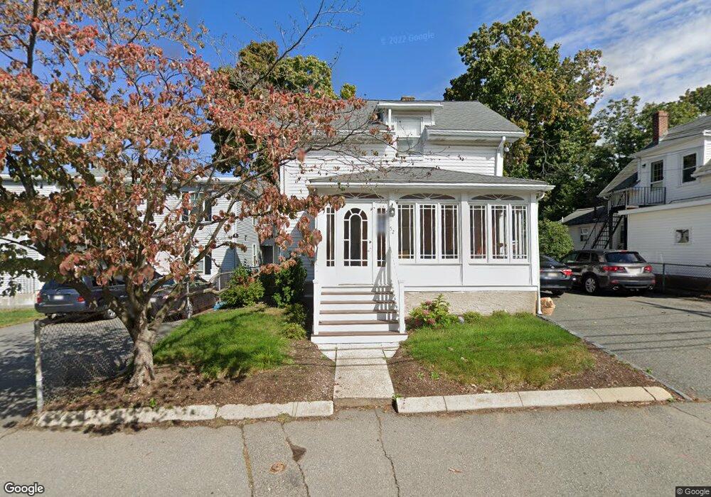
52 Maple St Waltham, MA 02453
South Side NeighborhoodEstimated Value: $714,000 - $1,016,000
3
Beds
3
Baths
1,304
Sq Ft
$641/Sq Ft
Est. Value
About This Home
This home is located at 52 Maple St, Waltham, MA 02453 and is currently estimated at $835,351, approximately $640 per square foot. 52 Maple St is a home located in Middlesex County with nearby schools including William F. Stanley Elementary School, John W. Mcdevitt Middle School, and Waltham Sr High School.
Ownership History
Date
Name
Owned For
Owner Type
Purchase Details
Closed on
May 2, 2018
Sold by
Waxberg Richard L
Bought by
Macdonald Douglas J
Current Estimated Value
Home Financials for this Owner
Home Financials are based on the most recent Mortgage that was taken out on this home.
Original Mortgage
$399,000
Outstanding Balance
$343,947
Interest Rate
4.45%
Mortgage Type
New Conventional
Estimated Equity
$491,404
Purchase Details
Closed on
Mar 14, 1997
Sold by
Marjo Rt
Bought by
Waxberg Richard L
Home Financials for this Owner
Home Financials are based on the most recent Mortgage that was taken out on this home.
Original Mortgage
$105,000
Interest Rate
7.79%
Mortgage Type
Purchase Money Mortgage
Create a Home Valuation Report for This Property
The Home Valuation Report is an in-depth analysis detailing your home's value as well as a comparison with similar homes in the area
Home Values in the Area
Average Home Value in this Area
Purchase History
| Date | Buyer | Sale Price | Title Company |
|---|---|---|---|
| Macdonald Douglas J | $420,000 | -- | |
| Waxberg Richard L | $140,000 | -- |
Source: Public Records
Mortgage History
| Date | Status | Borrower | Loan Amount |
|---|---|---|---|
| Open | Macdonald Douglas J | $399,000 | |
| Previous Owner | Waxberg Richard L | $105,000 |
Source: Public Records
Tax History Compared to Growth
Tax History
| Year | Tax Paid | Tax Assessment Tax Assessment Total Assessment is a certain percentage of the fair market value that is determined by local assessors to be the total taxable value of land and additions on the property. | Land | Improvement |
|---|---|---|---|---|
| 2025 | $5,437 | $553,700 | $328,900 | $224,800 |
| 2024 | $5,130 | $532,200 | $328,900 | $203,300 |
| 2023 | $5,090 | $493,200 | $299,600 | $193,600 |
| 2022 | $5,124 | $460,000 | $273,500 | $186,500 |
| 2021 | $4,716 | $416,600 | $247,500 | $169,100 |
| 2020 | $4,749 | $397,400 | $234,500 | $162,900 |
| 2019 | $5,282 | $417,200 | $232,100 | $185,100 |
| 2018 | $4,811 | $381,500 | $214,900 | $166,600 |
| 2017 | $4,547 | $362,000 | $195,400 | $166,600 |
| 2016 | $4,152 | $339,200 | $172,600 | $166,600 |
| 2015 | $4,076 | $310,400 | $169,300 | $141,100 |
Source: Public Records
Map
Nearby Homes
- 29 Cherry St Unit 2
- 85 Crescent St
- 15 Alder St Unit 1
- 6 Cushing St Unit 1
- 55-57 Crescent St
- 659 Moody St Unit 2
- 61 Hall St Unit 9
- 61 Hall St Unit 7
- 42 Alder St
- 40 Myrtle St Unit 9
- 73 Orange St Unit 2
- 81 Alder St
- 5-7 Chester Ave
- 31-37 Washington Ave
- 7-11.5 Felton
- 25 Tolman St Unit 2
- 308 Newton St Unit 1
- 138 Myrtle St Unit 2
- 39 Floyd St Unit 2
- 24 Tolman St Unit A
- 86 Adams St
- 86 Adams St Unit 4
- 86 Adams St Unit 3
- 86 Adams St Unit 2
- 86 Adams St Unit 1
- 56 Maple St
- 78 Adams St Unit 80
- 62 Maple St
- 94 Adams St
- 66 Maple St Unit 2
- 66 Maple St Unit 1
- 64 Maple St Unit 66
- 64 Maple St Unit 2
- 59 Maple St
- 61 Maple St Unit 2 - 1
- 45 Chestnut St Unit 4
- 45 Chestnut St Unit 3
- 45 Chestnut St Unit 2
- 45 Chestnut St Unit 1
- 45 Chestnut St