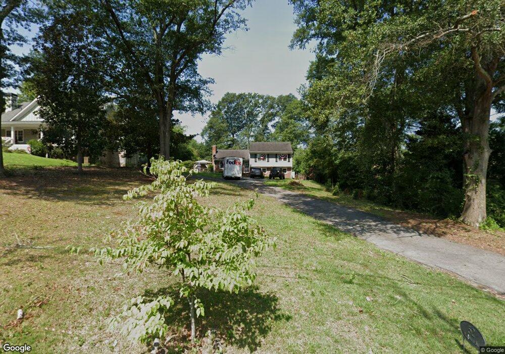
52 McDonald St SW Marietta, GA 30064
Whitlock NeighborhoodEstimated Value: $499,000 - $638,000
3
Beds
2
Baths
1,348
Sq Ft
$415/Sq Ft
Est. Value
About This Home
This home is located at 52 McDonald St SW, Marietta, GA 30064 and is currently estimated at $559,688, approximately $415 per square foot. 52 McDonald St SW is a home located in Cobb County with nearby schools including A.L. Burruss Elementary School, Marietta Sixth Grade Academy, and Marietta Middle School.
Ownership History
Date
Name
Owned For
Owner Type
Purchase Details
Closed on
Oct 17, 2019
Sold by
Peter Mary
Bought by
Fusco Michael and Fusco Peter Mary
Current Estimated Value
Home Financials for this Owner
Home Financials are based on the most recent Mortgage that was taken out on this home.
Original Mortgage
$249,287
Outstanding Balance
$217,208
Interest Rate
3.7%
Mortgage Type
Stand Alone Refi Refinance Of Original Loan
Estimated Equity
$342,480
Purchase Details
Closed on
Dec 27, 2013
Sold by
Spetnagel Melissa Ravan
Bought by
Peter Mary
Home Financials for this Owner
Home Financials are based on the most recent Mortgage that was taken out on this home.
Original Mortgage
$160,000
Interest Rate
4.29%
Mortgage Type
New Conventional
Create a Home Valuation Report for This Property
The Home Valuation Report is an in-depth analysis detailing your home's value as well as a comparison with similar homes in the area
Home Values in the Area
Average Home Value in this Area
Purchase History
| Date | Buyer | Sale Price | Title Company |
|---|---|---|---|
| Fusco Michael | -- | -- | |
| Peter Mary | $240,000 | -- | |
| Peter Mary | -- | -- |
Source: Public Records
Mortgage History
| Date | Status | Borrower | Loan Amount |
|---|---|---|---|
| Open | Fusco Michael | $249,287 | |
| Previous Owner | Peter Mary | $160,000 |
Source: Public Records
Tax History Compared to Growth
Tax History
| Year | Tax Paid | Tax Assessment Tax Assessment Total Assessment is a certain percentage of the fair market value that is determined by local assessors to be the total taxable value of land and additions on the property. | Land | Improvement |
|---|---|---|---|---|
| 2025 | $1,516 | $179,200 | $74,400 | $104,800 |
| 2024 | $1,516 | $179,200 | $74,400 | $104,800 |
| 2023 | $1,516 | $179,200 | $74,400 | $104,800 |
| 2022 | $1,118 | $132,180 | $74,400 | $57,780 |
| 2021 | $1,135 | $132,180 | $74,400 | $57,780 |
| 2020 | $1,067 | $124,180 | $66,400 | $57,780 |
| 2019 | $744 | $123,348 | $62,400 | $60,948 |
| 2018 | $744 | $123,348 | $62,400 | $60,948 |
| 2017 | $595 | $103,236 | $58,400 | $44,836 |
| 2016 | $596 | $103,236 | $58,400 | $44,836 |
| 2015 | $720 | $95,988 | $56,268 | $39,720 |
| 2014 | $744 | $95,988 | $0 | $0 |
Source: Public Records
Map
Nearby Homes
- 25 Whitlock Square SW
- 73 Whitlock Square SW
- 96 McDonald St SW
- 21 Whitlock Dr SW
- 59 Trammell St SW
- 266 Crescent Cir SW
- 0 Polk St NW Unit 1523635
- 207 Walthall St NW
- 325 Polk St NW
- 557 Henry Dr
- 32 Durham St SW
- 285 Kennesaw Ave NW
- 303 Kennesaw Ave NW
- 250 Green St SE
- 307 Green St SE
- 319 Atlanta St SE Unit 406
- 327 Stewart Ave NW
- 40 McDonald St SW
- 64 McDonald St SW
- 30 McDonald St SW
- 49 Whitlock Square SW
- 53 Whitlock Square SW
- 33 Whitlock Square SW
- 76 McDonald St SW
- 26 McDonald St SW
- 57 Whitlock Square Southwest Square SW
- 57 Whitlock Square SW
- 29 Whitlock Square SW
- 43 McDonald St SW
- 77 Whitlock Square SW
- 0 McDonald St SW Unit 7488066
- 0 McDonald St SW Unit 7393983
- 0 McDonald St SW Unit 7139364
- 0 McDonald St SW Unit 8746003
- 0 McDonald St SW Unit 8693153
- 0 McDonald St SW Unit 8575747
- 0 McDonald St SW Unit 7203954