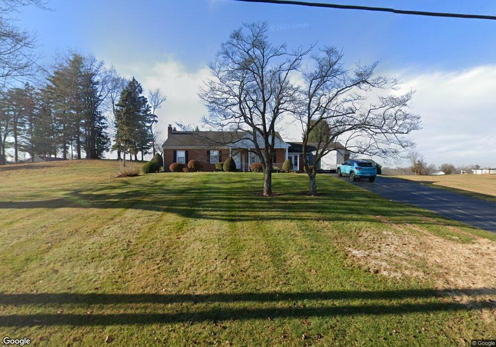
52 Moulstown Rd Abbottstown, PA 17301
Estimated Value: $221,000 - $291,000
3
Beds
1
Bath
1,472
Sq Ft
$171/Sq Ft
Est. Value
About This Home
This home is located at 52 Moulstown Rd, Abbottstown, PA 17301 and is currently estimated at $251,453, approximately $170 per square foot. 52 Moulstown Rd is a home located in York County with nearby schools including Spring Grove Area Middle School, Spring Grove Area High School, and Paradise School.
Ownership History
Date
Name
Owned For
Owner Type
Purchase Details
Closed on
Nov 1, 2023
Sold by
Baker Carman Elvin
Bought by
Seilhamer Kathy E
Current Estimated Value
Purchase Details
Closed on
Jan 29, 2016
Sold by
Tg Meadows Lp
Bought by
Baker Carmen E
Purchase Details
Closed on
Mar 13, 2006
Sold by
Baker Carman E and Baker Doris V
Bought by
Tg Meadows Lp
Purchase Details
Closed on
Jun 30, 1958
Sold by
Baker Carman and Baker Doris
Bought by
Baker Carman and Baker Doris
Create a Home Valuation Report for This Property
The Home Valuation Report is an in-depth analysis detailing your home's value as well as a comparison with similar homes in the area
Home Values in the Area
Average Home Value in this Area
Purchase History
| Date | Buyer | Sale Price | Title Company |
|---|---|---|---|
| Seilhamer Kathy E | $240,000 | None Listed On Document | |
| Baker Carmen E | -- | None Available | |
| Tg Meadows Lp | $100,000 | None Available | |
| Baker Carman | $700 | -- |
Source: Public Records
Tax History Compared to Growth
Tax History
| Year | Tax Paid | Tax Assessment Tax Assessment Total Assessment is a certain percentage of the fair market value that is determined by local assessors to be the total taxable value of land and additions on the property. | Land | Improvement |
|---|---|---|---|---|
| 2025 | $4,246 | $127,310 | $33,110 | $94,200 |
| 2024 | $4,200 | $127,310 | $33,110 | $94,200 |
| 2023 | $4,200 | $127,310 | $33,110 | $94,200 |
| 2022 | $4,200 | $127,310 | $33,110 | $94,200 |
| 2021 | $4,019 | $127,310 | $33,110 | $94,200 |
| 2020 | $4,006 | $127,310 | $33,110 | $94,200 |
| 2019 | $3,920 | $127,310 | $33,110 | $94,200 |
| 2018 | $3,867 | $127,310 | $33,110 | $94,200 |
| 2017 | $3,778 | $127,310 | $33,110 | $94,200 |
| 2016 | $0 | $127,310 | $33,110 | $94,200 |
| 2015 | -- | $127,310 | $33,110 | $94,200 |
| 2014 | -- | $127,310 | $33,110 | $94,200 |
Source: Public Records
Map
Nearby Homes
- 7452 Lincoln Hwy
- 7461 Saint Patrick Ct
- 7463 Saint Patrick Ct
- 7459 Saint Patrick Ct
- 7457 Saint Patrick Ct
- 7455 Saint Patrick Ct Unit 28
- 7435 Saint Patrick Ct Unit 6
- 28 Town Cir Unit 12A
- 224 W King St
- 507 Bullet Way
- 484 Brough Rd
- 486 W King St
- 7962 Woodland Dr
- 1209 Jackson Square Rd
- 334 Rolling Ln Unit 2
- 7877 Gnatstown Rd
- 0 Woods Rd
- 60 Hunters Cir Unit 19
- 201 Kinneman Rd Unit 25
- 221 Kinneman Rd Unit 28
- 12 Clover Ct
- 12 Clover Ct Unit 22
- 42 Moulstown Rd
- 8 Clover Ct Unit 23
- 8 Clover Ct
- 16 Clover Ct Unit 21
- 16 Clover Ct Unit 21
- 117 Clover Run Unit 26
- 117 Clover Run
- 51 Moulstown Rd
- 115 Clover Run
- 115 Clover Run Unit 25
- 47 Moulstown Rd
- 55 Moulstown Rd
- 7491 Meadowlark Ln
- 4 Clover Ct Unit 24
- 41 Moulstown Rd
- 112 Clover Run Unit 1
- 112 Clover Run
- 0 Clover Run Unit 1004226189