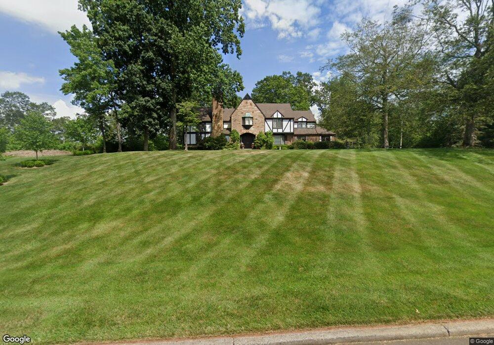
52 Mountain Brook Rd North Haven, CT 06473
Estimated Value: $818,546 - $1,099,000
5
Beds
5
Baths
4,568
Sq Ft
$209/Sq Ft
Est. Value
About This Home
This home is located at 52 Mountain Brook Rd, North Haven, CT 06473 and is currently estimated at $956,887, approximately $209 per square foot. 52 Mountain Brook Rd is a home located in New Haven County with nearby schools including North Haven Middle School, North Haven High School, and Laurel Oaks Adventist School.
Ownership History
Date
Name
Owned For
Owner Type
Purchase Details
Closed on
Nov 7, 2013
Sold by
Cook 4Th Ralph W
Bought by
Cook Lynda N
Current Estimated Value
Purchase Details
Closed on
Aug 17, 2001
Sold by
Petrucci Tr Stephen J
Bought by
Naclerio Louis E and Cook Ralph W
Purchase Details
Closed on
Feb 15, 1994
Sold by
Pace Arlene A
Bought by
Petrucci Stephen J and Petrucci Marylyn S
Create a Home Valuation Report for This Property
The Home Valuation Report is an in-depth analysis detailing your home's value as well as a comparison with similar homes in the area
Home Values in the Area
Average Home Value in this Area
Purchase History
| Date | Buyer | Sale Price | Title Company |
|---|---|---|---|
| Cook Lynda N | -- | -- | |
| Naclerio Louis E | $575,000 | -- | |
| Petrucci Stephen J | $575,000 | -- |
Source: Public Records
Mortgage History
| Date | Status | Borrower | Loan Amount |
|---|---|---|---|
| Previous Owner | Petrucci Stephen J | $600,000 | |
| Previous Owner | Petrucci Stephen J | $350,000 | |
| Previous Owner | Petrucci Stephen J | $220,000 |
Source: Public Records
Tax History
| Year | Tax Paid | Tax Assessment Tax Assessment Total Assessment is a certain percentage of the fair market value that is determined by local assessors to be the total taxable value of land and additions on the property. | Land | Improvement |
|---|---|---|---|---|
| 2025 | $16,566 | $562,310 | $88,200 | $474,110 |
| 2024 | $15,277 | $441,020 | $88,220 | $352,800 |
| 2023 | $14,399 | $441,020 | $88,220 | $352,800 |
| 2022 | $13,544 | $441,020 | $88,220 | $352,800 |
| 2021 | $13,544 | $441,020 | $88,220 | $352,800 |
| 2020 | $13,548 | $441,020 | $88,220 | $352,800 |
| 2019 | $16,708 | $535,850 | $107,940 | $427,910 |
| 2018 | $8,526 | $535,850 | $107,940 | $427,910 |
| 2017 | $5,782 | $535,850 | $107,940 | $427,910 |
| 2016 | $16,360 | $535,850 | $107,940 | $427,910 |
| 2015 | $15,765 | $535,850 | $107,940 | $427,910 |
| 2014 | $14,821 | $527,450 | $107,520 | $419,930 |
Source: Public Records
Map
Nearby Homes
- 10 Canterbury Way
- 78 Blue Hills Rd
- 1866 Hartford Turnpike
- 1986 Hartford Turnpike
- 1350 Mount Carmel Ave
- 1 Pond Hollow Unit 1
- 3409 Whitney Ave Unit 1
- 4183 Whitney Ave
- 100-150 Dodge Ave
- 180 River Rd
- 35 Todd St Unit 103
- 68 Todd St
- 2974 Whitney Ave
- 36R Nod Brook Rd
- 161 Sleeping Giant Dr
- 110 Dickerman St
- 15 Don Mar Ct
- 129 Brentwood Dr
- 2838 Whitney Ave Unit 2
- 51 Charlton Hill Rd
- 40 Mountain Brook Rd
- 49 Mountain Brook Rd
- 32 Mountain Brook Rd
- 55 Mountain Brook Rd
- 64 Mountain Brook Rd
- 68 Mountain Brook Rd
- 39 Mountain Brook Rd
- 60 Mountain Brook Rd
- 63 Mountain Brook Rd
- 30 N Hill Rd
- 48 Mountain Brook Rd
- 44 Mountain Brook Rd
- 27 Mountain Brook Rd
- 35 Mountain Brook Rd
- 22 Mountain Brook Rd
- 23 Mountain Brook Rd
- 31 Mountain Brook Rd
- 180 Blue Hills Rd
- 14 Mountain Brook Rd
- 19 Mountain Brook Rd
Your Personal Tour Guide
Ask me questions while you tour the home.