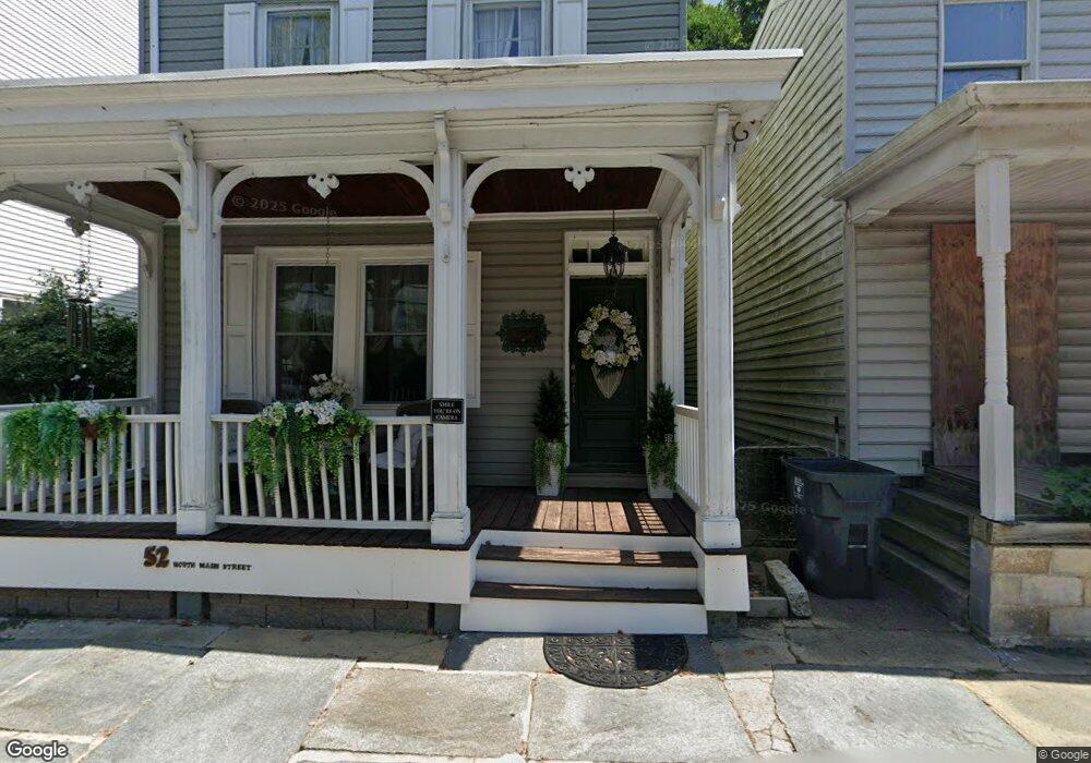
52 N Main St Port Deposit, MD 21904
Estimated Value: $203,000 - $254,000
3
Beds
2
Baths
1,648
Sq Ft
$137/Sq Ft
Est. Value
About This Home
This home is located at 52 N Main St, Port Deposit, MD 21904 and is currently estimated at $226,424, approximately $137 per square foot. 52 N Main St is a home located in Cecil County with nearby schools including Bainbridge Elementary School, Perryville Middle School, and Perryville High School.
Ownership History
Date
Name
Owned For
Owner Type
Purchase Details
Closed on
Jul 26, 2018
Sold by
Palmeri Deborah D
Bought by
Salyer Shannon Lee and Palmeri Jordan Duncan
Current Estimated Value
Purchase Details
Closed on
Jun 5, 2003
Sold by
The Bank Of New York
Bought by
Palmeri Guy V and Palmeri Deborah D
Purchase Details
Closed on
Apr 25, 2001
Sold by
Becht Mark and Ewing Ruthann
Bought by
Stutelberg Ii Warren and Stutelberg Karen Elizabeth
Purchase Details
Closed on
Nov 1, 1993
Sold by
Bloom
Bought by
Becht Mark
Home Financials for this Owner
Home Financials are based on the most recent Mortgage that was taken out on this home.
Original Mortgage
$49,500
Interest Rate
6.86%
Create a Home Valuation Report for This Property
The Home Valuation Report is an in-depth analysis detailing your home's value as well as a comparison with similar homes in the area
Home Values in the Area
Average Home Value in this Area
Purchase History
| Date | Buyer | Sale Price | Title Company |
|---|---|---|---|
| Salyer Shannon Lee | -- | None Available | |
| Palmeri Guy V | $61,000 | -- | |
| The Bank Of New York | $56,106 | -- | |
| Stutelberg Ii Warren | $71,000 | -- | |
| Becht Mark | $55,000 | -- |
Source: Public Records
Mortgage History
| Date | Status | Borrower | Loan Amount |
|---|---|---|---|
| Previous Owner | Becht Mark | $49,500 | |
| Closed | Stutelberg Ii Warren | -- |
Source: Public Records
Tax History Compared to Growth
Tax History
| Year | Tax Paid | Tax Assessment Tax Assessment Total Assessment is a certain percentage of the fair market value that is determined by local assessors to be the total taxable value of land and additions on the property. | Land | Improvement |
|---|---|---|---|---|
| 2025 | $2,761 | $161,800 | $0 | $0 |
| 2024 | $2,312 | $150,900 | $0 | $0 |
| 2023 | $1,880 | $140,000 | $43,700 | $96,300 |
| 2022 | $2,565 | $137,633 | $0 | $0 |
| 2021 | $2,513 | $135,267 | $0 | $0 |
| 2020 | $1,778 | $132,900 | $43,700 | $89,200 |
| 2019 | $2,259 | $132,900 | $43,700 | $89,200 |
| 2018 | $1,610 | $132,900 | $43,700 | $89,200 |
| 2017 | $2,247 | $132,900 | $0 | $0 |
| 2016 | $2,375 | $131,167 | $0 | $0 |
| 2015 | $2,375 | $129,433 | $0 | $0 |
| 2014 | $2,427 | $127,700 | $0 | $0 |
Source: Public Records
Map
Nearby Homes
- 317 Rowland Dr
- 118 Rowland Dr
- 18 S Main St
- 111 N Main St
- 21 High St
- 236 N Main St
- 120 Beechwood Dr
- 176 Rowland Rd
- 4 Brenda St
- 91 Honeysuckle Dr
- 419 Cokesbury Rd
- 8 Sandybrook Dr
- 1 Wildwood Ln
- 1080 Bainbridge Rd
- 1103 Bainbridge Rd
- 1001 Morrison Blvd
- TBD Rowland Dr
- 55 Marian Dr
- 39 N Friendship Ct
- 903 Eugene Dr