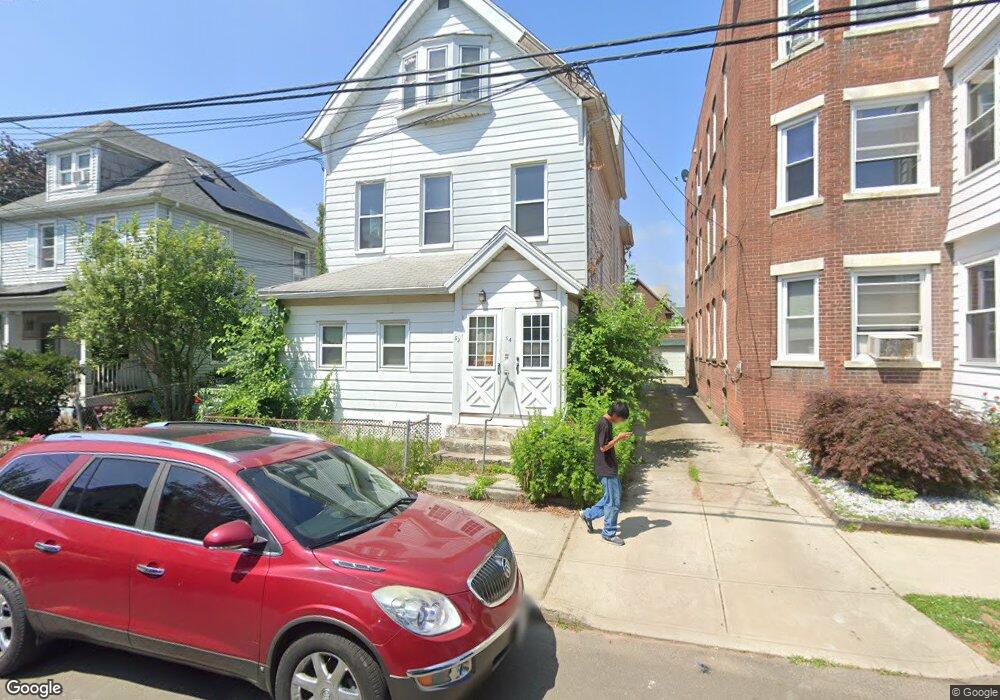
52 Perkins St New Haven, CT 06513
Fair Haven NeighborhoodEstimated Value: $342,964 - $443,000
6
Beds
3
Baths
3,123
Sq Ft
$125/Sq Ft
Est. Value
About This Home
This home is located at 52 Perkins St, New Haven, CT 06513 and is currently estimated at $389,741, approximately $124 per square foot. 52 Perkins St is a home located in New Haven County with nearby schools including Fair Haven School, Elm City College Preparatory School, and St Francis & St Rose Of Lima School.
Ownership History
Date
Name
Owned For
Owner Type
Purchase Details
Closed on
Jan 21, 2025
Sold by
Secy Of Hsng & Urban Dev
Bought by
Secy Of Hsng & Urban Dev
Current Estimated Value
Purchase Details
Closed on
Feb 24, 1976
Bought by
Grillo Anthony and Grillo Josephine
Create a Home Valuation Report for This Property
The Home Valuation Report is an in-depth analysis detailing your home's value as well as a comparison with similar homes in the area
Home Values in the Area
Average Home Value in this Area
Purchase History
| Date | Buyer | Sale Price | Title Company |
|---|---|---|---|
| Secy Of Hsng & Urban Dev | $327,644 | None Available | |
| Secy Of Hsng & Urban Dev | $327,644 | None Available | |
| Grillo Anthony | $38,000 | -- |
Source: Public Records
Mortgage History
| Date | Status | Borrower | Loan Amount |
|---|---|---|---|
| Previous Owner | Grillo Anthony | $15,000 |
Source: Public Records
Tax History Compared to Growth
Tax History
| Year | Tax Paid | Tax Assessment Tax Assessment Total Assessment is a certain percentage of the fair market value that is determined by local assessors to be the total taxable value of land and additions on the property. | Land | Improvement |
|---|---|---|---|---|
| 2025 | $8,040 | $204,050 | $44,380 | $159,670 |
| 2024 | $7,856 | $204,050 | $44,380 | $159,670 |
| 2023 | $7,591 | $204,050 | $44,380 | $159,670 |
| 2022 | $8,111 | $204,050 | $44,380 | $159,670 |
| 2021 | $5,526 | $125,930 | $31,220 | $94,710 |
| 2020 | $5,526 | $125,930 | $31,220 | $94,710 |
| 2019 | $5,412 | $125,930 | $31,220 | $94,710 |
| 2018 | $5,412 | $125,930 | $31,220 | $94,710 |
| 2017 | $4,871 | $125,930 | $31,220 | $94,710 |
| 2016 | $4,273 | $102,830 | $26,950 | $75,880 |
| 2015 | $4,273 | $102,830 | $26,950 | $75,880 |
| 2014 | $4,273 | $102,830 | $26,950 | $75,880 |
Source: Public Records
Map
Nearby Homes
- 25 Pine St
- 22 Downing St
- 54 Lombard St
- 147 Lombard St
- 181 Lombard St
- 714 Quinnipiac Ave
- 728 Quinnipiac Ave
- 100 Front St Unit 100
- 674 Quinnipiac Ave
- 76 Front St Unit 76
- 409 Poplar St
- 308 Poplar St
- 72 Pierpont St
- 314 Lenox St
- 71 Houston St
- 85 Pierpont St
- 121 Fillmore St
- 74 Fillmore St
- 916 Quinnipiac Ave Unit 2
- 373 Blatchley Ave
- 56 Perkins St
- 60 Perkins St
- 50 Perkins St
- 62 Perkins St
- 48 Perkins St
- 75 Clinton Ave
- 79 Clinton Ave
- 71 Clinton Ave
- 71 Clinton Ave Unit 71+73
- 81 Clinton Ave
- 51 Perkins St
- 53 Perkins St
- 64 Perkins St
- 67 Clinton Ave
- 67 Clinton Ave Unit 2
- 49 Perkins St
- 55 Perkins St
- 47 Perkins St
- 66 Perkins St
- 61 Clinton Ave