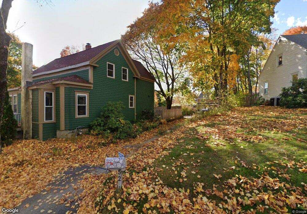
52 Powow St Amesbury, MA 01913
Estimated Value: $674,358 - $760,000
3
Beds
2
Baths
2,016
Sq Ft
$352/Sq Ft
Est. Value
About This Home
This home is located at 52 Powow St, Amesbury, MA 01913 and is currently estimated at $709,840, approximately $352 per square foot. 52 Powow St is a home located in Essex County with nearby schools including Amesbury High School and Amesbury Seventh-Day Adventist School.
Ownership History
Date
Name
Owned For
Owner Type
Purchase Details
Closed on
Dec 20, 2010
Sold by
Dellea Bernard G and Dellea Valerie L
Bought by
Hayden-Heimlich Whitney and Dellea Ian Kyle
Current Estimated Value
Home Financials for this Owner
Home Financials are based on the most recent Mortgage that was taken out on this home.
Original Mortgage
$160,788
Outstanding Balance
$106,284
Interest Rate
4.23%
Mortgage Type
Purchase Money Mortgage
Estimated Equity
$603,556
Purchase Details
Closed on
Dec 27, 1999
Sold by
Dellea Ellen S
Bought by
Dellea Bernard G and Dellea Valerie L
Home Financials for this Owner
Home Financials are based on the most recent Mortgage that was taken out on this home.
Original Mortgage
$53,000
Interest Rate
7.61%
Mortgage Type
Purchase Money Mortgage
Create a Home Valuation Report for This Property
The Home Valuation Report is an in-depth analysis detailing your home's value as well as a comparison with similar homes in the area
Home Values in the Area
Average Home Value in this Area
Purchase History
| Date | Buyer | Sale Price | Title Company |
|---|---|---|---|
| Hayden-Heimlich Whitney | $185,000 | -- | |
| Dellea Bernard G | $66,250 | -- |
Source: Public Records
Mortgage History
| Date | Status | Borrower | Loan Amount |
|---|---|---|---|
| Open | Dellea Bernard G | $160,788 | |
| Previous Owner | Dellea Bernard G | $65,000 | |
| Previous Owner | Dellea Bernard G | $53,000 | |
| Previous Owner | Dellea Bernard G | $10,000 |
Source: Public Records
Tax History Compared to Growth
Tax History
| Year | Tax Paid | Tax Assessment Tax Assessment Total Assessment is a certain percentage of the fair market value that is determined by local assessors to be the total taxable value of land and additions on the property. | Land | Improvement |
|---|---|---|---|---|
| 2025 | $8,025 | $524,500 | $183,300 | $341,200 |
| 2024 | $7,653 | $489,300 | $172,900 | $316,400 |
| 2023 | $7,358 | $450,300 | $150,400 | $299,900 |
| 2022 | $7,180 | $405,900 | $130,800 | $275,100 |
| 2021 | $7,107 | $389,400 | $101,000 | $288,400 |
| 2020 | $6,590 | $383,600 | $97,100 | $286,500 |
| 2019 | $5,153 | $280,500 | $97,100 | $183,400 |
| 2018 | $5,180 | $272,800 | $92,500 | $180,300 |
| 2017 | $4,950 | $248,100 | $92,500 | $155,600 |
| 2016 | $4,855 | $239,400 | $92,500 | $146,900 |
| 2015 | $4,424 | $215,400 | $92,500 | $122,900 |
| 2014 | $4,316 | $205,800 | $92,500 | $113,300 |
Source: Public Records
Map
Nearby Homes
- 48 Orchard St
- 81 High St Unit 27
- 37 Millyard Unit 204
- 101 Market St Unit B
- 101 Market St Unit A
- 103 Market St Unit A
- 103 Market St Unit B
- 17 Linwood Place
- 105 Market St Unit B
- 53 Market St
- 25 Cedar St Unit 4
- 25 Cedar St Unit 7
- 5 Richs Ct Unit 3
- 97 Elm St
- 19 Perkins St
- 3 Glenwood St
- 24 Aubin St Unit 2
- 129 Friend St
- 4 Lincoln Ct
- 2 Locke Hill Ln
- 54 Powow St
- 50 Powow St
- 5 Tremont Ave
- 7 Tremont Ave
- 33 Lake St
- 1 Tremont Ave Unit 1
- 48 Powow St
- 3 Tremont Ave Unit B
- 3 Tremont Ave Unit A
- 3 Tremont Ave Unit 3,1
- 3 Tremont Ave Unit 2
- 3 Tremont Ave Unit 1
- 27 Lake St
- 27 Lake St Unit A
- 29 Lake St Unit 29
- 6 Tremont Ave
- 53 Powow St
- 51 Powow St
- 8 Tremont Ave
- 32 Lake St