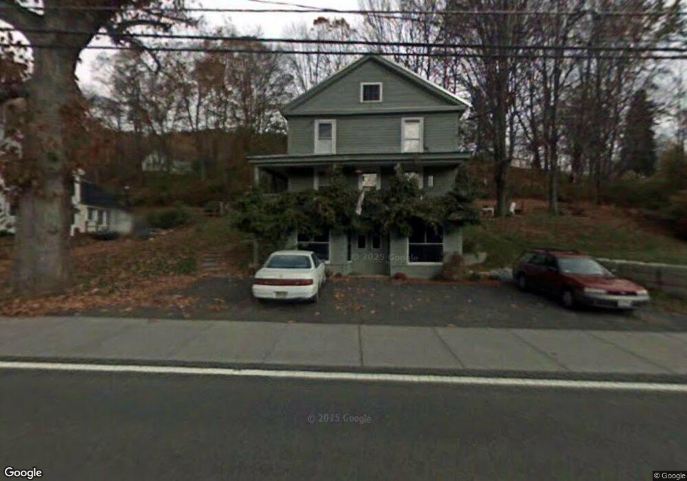
52 River St Conway, MA 01341
Estimated Value: $177,000 - $558,000
4
Beds
2
Baths
1,310
Sq Ft
$229/Sq Ft
Est. Value
About This Home
This home is located at 52 River St, Conway, MA 01341 and is currently estimated at $299,595, approximately $228 per square foot. 52 River St is a home located in Franklin County with nearby schools including Frontier Regional School.
Ownership History
Date
Name
Owned For
Owner Type
Purchase Details
Closed on
Jul 27, 2023
Sold by
Raphael Gwenn R
Bought by
Raphael Int and Raphael R
Current Estimated Value
Purchase Details
Closed on
Apr 3, 1986
Bought by
Raphael Gwenn R and Verrochi Frances
Create a Home Valuation Report for This Property
The Home Valuation Report is an in-depth analysis detailing your home's value as well as a comparison with similar homes in the area
Home Values in the Area
Average Home Value in this Area
Purchase History
| Date | Buyer | Sale Price | Title Company |
|---|---|---|---|
| Raphael Int | -- | None Available | |
| Raphael Gwenn R | $56,600 | -- |
Source: Public Records
Mortgage History
| Date | Status | Borrower | Loan Amount |
|---|---|---|---|
| Previous Owner | Raphael Gwenn R | $34,000 | |
| Previous Owner | Raphael Gwenn R | $25,000 |
Source: Public Records
Tax History
| Year | Tax Paid | Tax Assessment Tax Assessment Total Assessment is a certain percentage of the fair market value that is determined by local assessors to be the total taxable value of land and additions on the property. | Land | Improvement |
|---|---|---|---|---|
| 2025 | $2,589 | $179,300 | $73,500 | $105,800 |
| 2024 | $3,024 | $184,400 | $66,800 | $117,600 |
| 2023 | $3,162 | $184,400 | $66,800 | $117,600 |
| 2022 | $3,066 | $170,800 | $61,900 | $108,900 |
| 2021 | $52 | $161,500 | $59,100 | $102,400 |
| 2020 | $2,968 | $158,200 | $58,900 | $99,300 |
| 2019 | $52 | $158,200 | $58,900 | $99,300 |
| 2018 | $2,927 | $158,200 | $58,900 | $99,300 |
| 2017 | $49 | $158,300 | $59,000 | $99,300 |
| 2016 | $2,427 | $145,500 | $51,600 | $93,900 |
| 2015 | $2,353 | $145,500 | $51,600 | $93,900 |
Source: Public Records
Map
Nearby Homes
- lot 1 Shelburne Falls Rd
- 85 Dacey Rd
- 71 Mathews Rd
- 3 Adams Ct Unit A
- 240 Beldingville Rd
- 527 Main St
- 355 Greenfield Rd
- 208 Greenfield Rd
- 24 Elm St
- 0 Greenfield Rd Unit 73472322
- 26 S Main St
- 59 N Hillside Rd
- 40 Suburban Dr
- 0 North St Unit 73407299
- 7 Christian Ln
- 15 Crestview Dr
- 18 Stage Rd
- 102 Elm St
- 143 E Buckland Rd
- 0 Sears Rd Unit 73373850
- 62 River St
- 85 Upper Baptist Hill Rd
- 70 River St
- 112 River St
- 79 Upper Baptist Hill Rd
- 34 River St
- 78 River St
- 86 River St
- 96 Upper Baptist Hill Rd
- 21 River St
- 67 Upper Baptist Hill Rd
- Lot Z Shelburne Falls Rd
- 98 River St
- 11 River St
- 45 Upper Baptist Hill Rd
- 12 River St
- 106 Upper Baptist Hill Rd
- 21 Baptist Hill Rd
- 0 Bond St Unit 30363024
- 101 River St
Your Personal Tour Guide
Ask me questions while you tour the home.