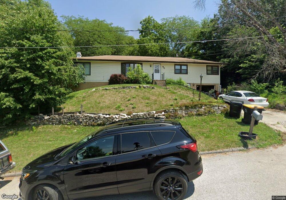
52 S Elm St Colfax, IA 50054
Estimated Value: $192,000 - $223,000
3
Beds
1
Bath
1,526
Sq Ft
$136/Sq Ft
Est. Value
About This Home
This home is located at 52 S Elm St, Colfax, IA 50054 and is currently estimated at $207,020, approximately $135 per square foot. 52 S Elm St is a home located in Jasper County with nearby schools including Colfax-Mingo Elementary School and Colfax-Mingo High School.
Ownership History
Date
Name
Owned For
Owner Type
Purchase Details
Closed on
Apr 15, 2010
Sold by
Federal National Mortgage Association
Bought by
Bentley Edmond S
Current Estimated Value
Home Financials for this Owner
Home Financials are based on the most recent Mortgage that was taken out on this home.
Original Mortgage
$61,122
Outstanding Balance
$40,750
Interest Rate
5.02%
Mortgage Type
New Conventional
Estimated Equity
$166,270
Create a Home Valuation Report for This Property
The Home Valuation Report is an in-depth analysis detailing your home's value as well as a comparison with similar homes in the area
Home Values in the Area
Average Home Value in this Area
Purchase History
| Date | Buyer | Sale Price | Title Company |
|---|---|---|---|
| Bentley Edmond S | -- | None Available |
Source: Public Records
Mortgage History
| Date | Status | Borrower | Loan Amount |
|---|---|---|---|
| Open | Bentley Edmond S | $61,122 |
Source: Public Records
Tax History Compared to Growth
Tax History
| Year | Tax Paid | Tax Assessment Tax Assessment Total Assessment is a certain percentage of the fair market value that is determined by local assessors to be the total taxable value of land and additions on the property. | Land | Improvement |
|---|---|---|---|---|
| 2025 | $2,970 | $186,380 | $18,210 | $168,170 |
| 2024 | $2,970 | $166,250 | $18,210 | $148,040 |
| 2023 | $2,986 | $166,250 | $18,210 | $148,040 |
| 2022 | $2,594 | $134,630 | $18,210 | $116,420 |
| 2021 | $2,404 | $124,480 | $18,210 | $106,270 |
| 2020 | $2,404 | $109,350 | $12,740 | $96,610 |
| 2019 | $2,292 | $99,420 | $0 | $0 |
| 2018 | $2,292 | $99,420 | $0 | $0 |
| 2017 | $2,262 | $99,420 | $0 | $0 |
| 2016 | $2,262 | $99,420 | $0 | $0 |
| 2015 | $2,242 | $99,420 | $0 | $0 |
| 2014 | $2,136 | $99,420 | $0 | $0 |
Source: Public Records
Map
Nearby Homes
- 34 E Broadway St
- 108 S Walnut St
- 222 E Broadway St
- 200 Jefferson St
- 0000 Lincoln St
- 226 S Iowa St
- 119 W Washington St
- 108 N West St
- 300 E Front St
- 20 S Oak Park Ave
- 223 W Broadway St
- 215 W Spring St
- 400 S Goodrich St
- 655 E Division St
- 501 W Broadway St
- 520 S Oak Park Ave
- 624 S Goodrich St
- 1161 S Goodrich St
- 11213 Orchard Ave
- HWY 117 at Intersection of Fleet Ave
- 104 E Washington St
- 103 E Division St
- 106 S Elm St
- 130 E Washington St
- 105 S Elm St
- 24 E Division St
- 11 E Division St
- 8 N Elm St
- 122 E Division St
- 11 N Elm St
- 10 N Elm St
- 129 E Washington St
- 12 E Division St
- 205 E Division St
- 2 N Maple St
- 15 E Washington St
- 15 N Maple St
- 12 E Washington St
- 23 E Washington St
- 0 E Washington St Unit 655597