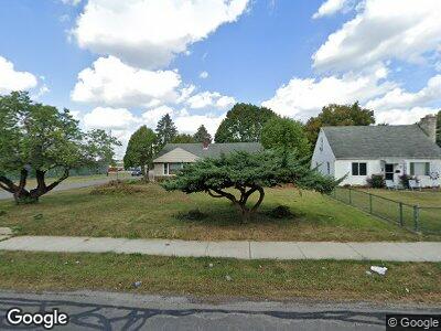
52 Southgate Dr Columbus, OH 43207
Far South NeighborhoodEstimated Value: $188,629 - $206,000
3
Beds
1
Bath
1,008
Sq Ft
$196/Sq Ft
Est. Value
About This Home
This home is located at 52 Southgate Dr, Columbus, OH 43207 and is currently estimated at $197,157, approximately $195 per square foot. 52 Southgate Dr is a home located in Franklin County with nearby schools including Parsons Elementary School, Buckeye Middle School, and Marion-Franklin High School.
Ownership History
Date
Name
Owned For
Owner Type
Purchase Details
Closed on
Oct 14, 2022
Sold by
County Treasurer
Bought by
Nar Ohio Llc
Current Estimated Value
Purchase Details
Closed on
Mar 2, 2017
Sold by
Dye Bruse O and The Ke Saon Lavelle Trust
Bought by
Dye Bruce O
Purchase Details
Closed on
Oct 24, 2003
Sold by
Sonn Lavelle Ke and Lavelle Martin J
Bought by
Lavelle Ke Soon and The Ke Soon Lavelle Revocable
Purchase Details
Closed on
Nov 9, 1989
Bought by
Dye Ke Soon
Create a Home Valuation Report for This Property
The Home Valuation Report is an in-depth analysis detailing your home's value as well as a comparison with similar homes in the area
Home Values in the Area
Average Home Value in this Area
Purchase History
| Date | Buyer | Sale Price | Title Company |
|---|---|---|---|
| Nar Ohio Llc | -- | -- | |
| Dye Bruce O | -- | None Available | |
| Lavelle Ke Soon | -- | -- | |
| Dye Ke Soon | -- | -- |
Source: Public Records
Mortgage History
| Date | Status | Borrower | Loan Amount |
|---|---|---|---|
| Open | Holt Chrles | $106,379 | |
| Closed | Lavelle Martin | $15,050 |
Source: Public Records
Tax History Compared to Growth
Tax History
| Year | Tax Paid | Tax Assessment Tax Assessment Total Assessment is a certain percentage of the fair market value that is determined by local assessors to be the total taxable value of land and additions on the property. | Land | Improvement |
|---|---|---|---|---|
| 2024 | $5,486 | $57,690 | $18,380 | $39,310 |
| 2023 | $2,611 | $57,680 | $18,375 | $39,305 |
| 2022 | $6,390 | $36,260 | $13,230 | $23,030 |
| 2021 | $2,106 | $36,260 | $13,230 | $23,030 |
| 2020 | $2,083 | $36,260 | $13,230 | $23,030 |
| 2019 | $2,210 | $31,780 | $11,480 | $20,300 |
| 2018 | $1,919 | $31,780 | $11,480 | $20,300 |
| 2017 | $1,976 | $31,780 | $11,480 | $20,300 |
| 2016 | $1,884 | $27,730 | $7,740 | $19,990 |
| 2015 | $1,715 | $27,730 | $7,740 | $19,990 |
| 2014 | $1,719 | $27,730 | $7,740 | $19,990 |
| 2013 | $893 | $29,190 | $8,155 | $21,035 |
Source: Public Records
Map
Nearby Homes
- 82 Schryver Rd
- 78 Phelps Rd
- 0 Thorndale Ave
- 2811 Dolby Dr
- 2806 Claude Dr
- 273 E Alcott Rd
- 3128 Parsons Ave
- 115 W Castle Rd
- 3161 Lewis Rd
- 215 Stockbridge Rd
- 125 Betz Rd
- 167 Betz Rd
- 3197 E Ave
- 82 Delray Rd
- 1633-1635 E Greenway Ave
- 0 F Ave Unit 224036459
- 109 Williams Rd
- 245 Marilla Rd
- 623 Colton Rd
- 780 Basswood Rd
- 52 Southgate Dr
- 62 Southgate Dr
- 70 Southgate Dr
- 2930 Thorndale Ave
- 59 Amsterdam Ave
- 69 Amsterdam Ave
- 78 Southgate Dr
- 2930 S High St
- 2920 S High St
- 77 Amsterdam Ave
- 86 Southgate Dr
- 87 Amsterdam Ave
- 94 Southgate Dr
- 2912 S High St
- 52 Amsterdam Ave
- 62 Amsterdam Ave
- 95 Amsterdam Ave
- 70 Amsterdam Ave
- 78 Amsterdam Ave
- 102 Southgate Dr