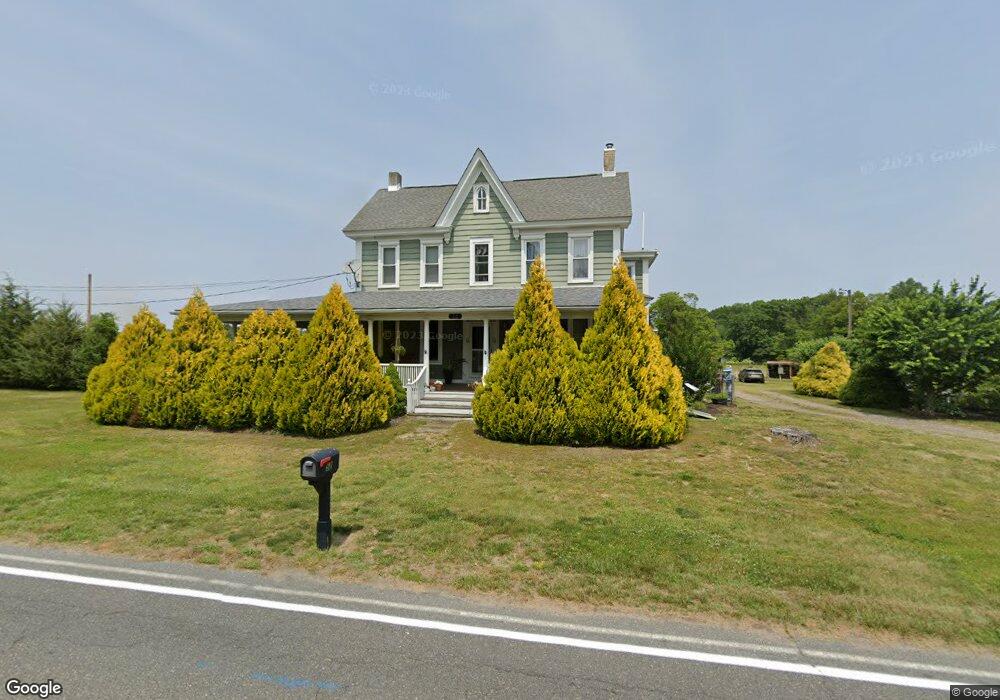
52 W Wolfert Station Rd Mickleton, NJ 08056
Estimated Value: $587,000 - $762,000
Studio
--
Bath
3,048
Sq Ft
$220/Sq Ft
Est. Value
About This Home
This home is located at 52 W Wolfert Station Rd, Mickleton, NJ 08056 and is currently estimated at $671,363, approximately $220 per square foot. 52 W Wolfert Station Rd is a home located in Gloucester County with nearby schools including Jeffrey Clark School, Samuel Mickle School, and Kingsway Regional Middle School.
Ownership History
Date
Name
Owned For
Owner Type
Purchase Details
Closed on
Apr 11, 2003
Sold by
Newcomb Robert L and Newcomb Cynthia J
Bought by
Baker Brent A and Baker Theresa L
Current Estimated Value
Home Financials for this Owner
Home Financials are based on the most recent Mortgage that was taken out on this home.
Original Mortgage
$232,000
Outstanding Balance
$99,666
Interest Rate
5.75%
Mortgage Type
Purchase Money Mortgage
Estimated Equity
$571,697
Purchase Details
Closed on
Aug 20, 1997
Sold by
Falciani Angelo J and Pennell Anna
Bought by
Newcomb Robert L and Newcomb Cynthia J
Create a Home Valuation Report for This Property
The Home Valuation Report is an in-depth analysis detailing your home's value as well as a comparison with similar homes in the area
Home Values in the Area
Average Home Value in this Area
Purchase History
| Date | Buyer | Sale Price | Title Company |
|---|---|---|---|
| Baker Brent A | $325,000 | Independence Abstract & Titl | |
| Newcomb Robert L | $105,000 | Continental Title Abstract C |
Source: Public Records
Mortgage History
| Date | Status | Borrower | Loan Amount |
|---|---|---|---|
| Open | Baker Brent A | $232,000 |
Source: Public Records
Tax History
| Year | Tax Paid | Tax Assessment Tax Assessment Total Assessment is a certain percentage of the fair market value that is determined by local assessors to be the total taxable value of land and additions on the property. | Land | Improvement |
|---|---|---|---|---|
| 2025 | $10,322 | $324,700 | $101,200 | $223,500 |
| 2024 | $9,994 | $324,700 | $101,200 | $223,500 |
| 2023 | $9,994 | $324,700 | $101,200 | $223,500 |
| 2022 | $9,712 | $324,700 | $101,200 | $223,500 |
| 2021 | $9,777 | $324,700 | $101,200 | $223,500 |
| 2020 | $9,822 | $324,700 | $101,200 | $223,500 |
| 2019 | $9,722 | $324,700 | $101,200 | $223,500 |
| 2018 | $10,138 | $307,500 | $76,700 | $230,800 |
| 2017 | $10,006 | $307,500 | $76,700 | $230,800 |
| 2016 | $9,889 | $307,500 | $76,700 | $230,800 |
| 2015 | $9,477 | $307,500 | $76,700 | $230,800 |
| 2014 | $8,893 | $307,500 | $76,700 | $230,800 |
Source: Public Records
Map
Nearby Homes
- 71 W Tomlin Station Rd
- 0 Tomlin Station Rd Unit NJGL2061600
- 67 E Rattling Run Rd
- 241 Gaunt Dr
- 18 Millwood Dr
- 50 Mill Rd
- 424 Country Way
- 415 Country Way
- 253 Jennings Way
- 200 David Mills Ln
- 10 & 26 Garwin Rd
- 120 Jubilee Dr
- 118 Timberlane Rd
- 209 Charles Corliss Blvd
- 355 Friendship Rd
- 792 Paulsboro Rd
- 788 Paulsboro Rd
- 155 Rulon Rd
- 6 Burton Ln
- 43 45 Repaupo Station Rd
- 49 W Wolfert Station Rd
- 50 W Wolfert Station Rd
- 139 Quaker Rd
- 43 W Wolfert Station Rd
- 62 W Wolfert Station Rd
- 61 W Wolfert Station Rd
- 39 W Wolfert Station Rd
- 201 Bartlett Dr
- 200 Smallwood Dr
- 202 Smallwood Dr
- 68 W Wolfert Station Rd
- 203 Bartlett Dr
- 37 W Wolfert Station Rd
- 48 W Wolfert Station Rd
- W Wolfert Station Rd
- 204 Smallwood Dr
- 205 Bartlett Dr
- 7 Campbell Ct
- 201 Smallwood Dr
- 201 Smallwood Dr Unit 92
Your Personal Tour Guide
Ask me questions while you tour the home.