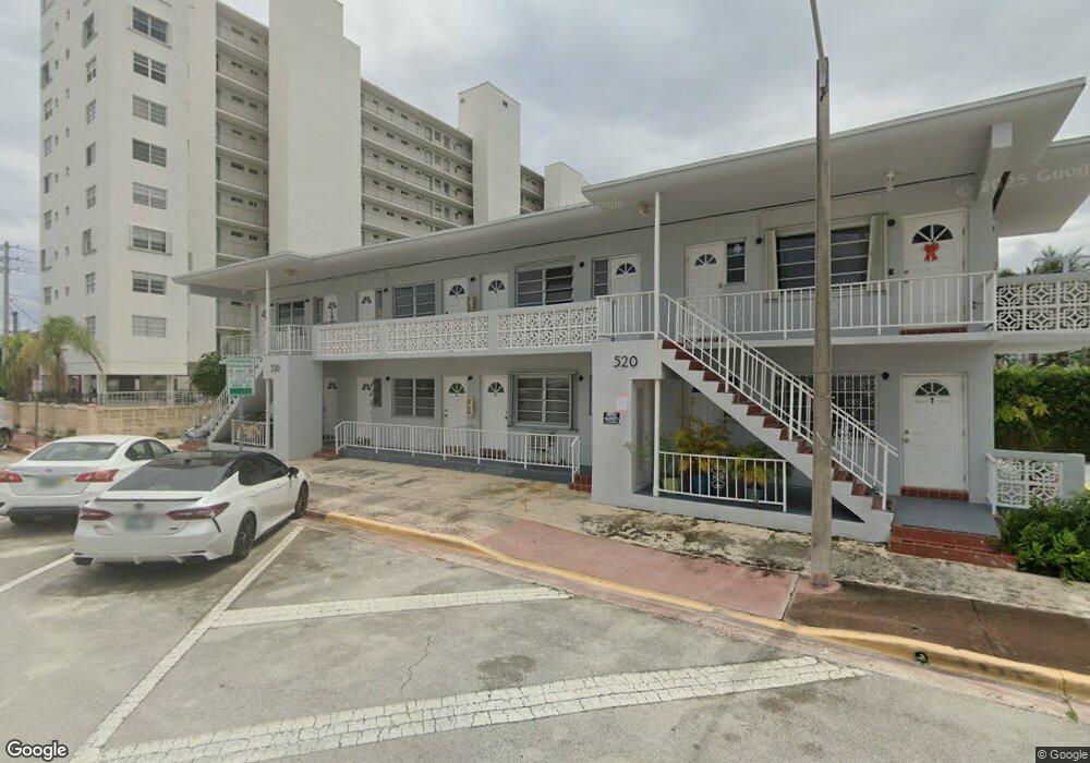
520 79th St Unit 4 Miami Beach, FL 33141
North Shore NeighborhoodEstimated Value: $209,000 - $266,000
1
Bed
1
Bath
687
Sq Ft
$348/Sq Ft
Est. Value
About This Home
This home is located at 520 79th St Unit 4, Miami Beach, FL 33141 and is currently estimated at $238,767, approximately $347 per square foot. 520 79th St Unit 4 is a home located in Miami-Dade County with nearby schools including Biscayne Beach Elementary School, Nautilus Middle School, and Miami Beach Senior High School.
Ownership History
Date
Name
Owned For
Owner Type
Purchase Details
Closed on
Sep 16, 1998
Sold by
Zylberberg Jack
Bought by
Naseer Mohamed
Current Estimated Value
Home Financials for this Owner
Home Financials are based on the most recent Mortgage that was taken out on this home.
Original Mortgage
$39,250
Interest Rate
6.95%
Mortgage Type
New Conventional
Create a Home Valuation Report for This Property
The Home Valuation Report is an in-depth analysis detailing your home's value as well as a comparison with similar homes in the area
Home Values in the Area
Average Home Value in this Area
Purchase History
| Date | Buyer | Sale Price | Title Company |
|---|---|---|---|
| Naseer Mohamed | $40,500 | -- |
Source: Public Records
Mortgage History
| Date | Status | Borrower | Loan Amount |
|---|---|---|---|
| Open | Naseer Mohamed | $38,000 | |
| Closed | Naseer Mohamed | $39,250 |
Source: Public Records
Tax History Compared to Growth
Tax History
| Year | Tax Paid | Tax Assessment Tax Assessment Total Assessment is a certain percentage of the fair market value that is determined by local assessors to be the total taxable value of land and additions on the property. | Land | Improvement |
|---|---|---|---|---|
| 2025 | $3,033 | $163,779 | -- | -- |
| 2024 | $2,888 | $148,890 | -- | -- |
| 2023 | $2,888 | $135,355 | $0 | $0 |
| 2022 | $2,312 | $123,050 | $0 | $0 |
| 2021 | $2,197 | $113,113 | $0 | $0 |
| 2020 | $2,078 | $115,000 | $0 | $0 |
| 2019 | $1,965 | $115,000 | $0 | $0 |
| 2018 | $1,800 | $115,000 | $0 | $0 |
| 2017 | $1,655 | $77,259 | $0 | $0 |
| 2016 | $1,608 | $70,236 | $0 | $0 |
| 2015 | $1,464 | $63,851 | $0 | $0 |
| 2014 | $1,179 | $58,047 | $0 | $0 |
Source: Public Records
Map
Nearby Homes
- 7850 Byron Ave Unit 1004
- 7850 Byron Ave Unit 307
- 7734 Abbott Ave Unit 101
- 7734 Abbott Ave Unit 201
- 7921 Byron Ave Unit 407
- 7725 Carlyle Ave Unit 4
- 7801 Abbott Ave Unit 504
- 7801 Abbott Ave Unit 307
- 7712 Byron Ave Unit 3
- 7712 Byron Ave Unit 2
- 7711 Carlyle Ave
- 7710 Carlyle Ave
- 7830 Dickens Ave Unit 203
- 7830 Dickens Ave Unit 202
- 605 77th St
- 7900 Tatum Waterway Dr Unit 413
- 7900 Tatum Waterway Dr Unit 502
- 7920 Harding Ave Unit 7
- 8000 Tatum Waterway Dr Unit 1
- 7928 Harding Ave Unit 1
- 520 79th St Unit 8
- 520 79th St Unit 7
- 520 79th St Unit 2
- 520 79th St Unit 5
- 520 79th St Unit 6
- 520 79th St Unit 3
- 7835 Carlyle Ave
- 7829 Carlyle Ave Unit 5
- 7829 Carlyle Ave Unit 1
- 7829 Carlyle Ave Unit 4
- 7829 Carlyle Ave Unit 2
- 7829 Carlyle Ave Unit 3
- 7829 Carlyle Ave Unit 6
- 525 79 St
- 525 79th St Unit 10
- 525 79th St Unit 1
- 525 79th St Unit 6
- 525 79th St Unit 3
- 525 79th St Unit 8