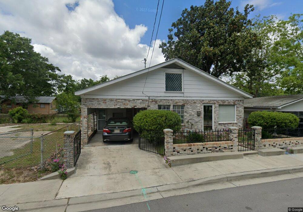
520 Austin St Biloxi, MS 39530
Estimated Value: $149,000 - $193,000
5
Beds
--
Bath
2,473
Sq Ft
$69/Sq Ft
Est. Value
About This Home
This home is located at 520 Austin St, Biloxi, MS 39530 and is currently estimated at $169,993, approximately $68 per square foot. 520 Austin St is a home located in Harrison County with nearby schools including Gorenflo Elementary School, Biloxi Junior High School, and Biloxi High School.
Ownership History
Date
Name
Owned For
Owner Type
Purchase Details
Closed on
Aug 15, 2017
Bought by
Travis Larry
Current Estimated Value
Home Financials for this Owner
Home Financials are based on the most recent Mortgage that was taken out on this home.
Original Mortgage
$148,000
Outstanding Balance
$124,767
Interest Rate
3.9%
Estimated Equity
$52,368
Purchase Details
Closed on
Mar 21, 2016
Bought by
Travis Larry
Home Financials for this Owner
Home Financials are based on the most recent Mortgage that was taken out on this home.
Original Mortgage
$75,000
Interest Rate
3.73%
Create a Home Valuation Report for This Property
The Home Valuation Report is an in-depth analysis detailing your home's value as well as a comparison with similar homes in the area
Home Values in the Area
Average Home Value in this Area
Purchase History
| Date | Buyer | Sale Price | Title Company |
|---|---|---|---|
| Travis Larry | -- | -- | |
| Travis Larry | -- | -- |
Source: Public Records
Mortgage History
| Date | Status | Borrower | Loan Amount |
|---|---|---|---|
| Open | Travis Larry | $148,000 | |
| Closed | Travis Larry | -- | |
| Previous Owner | Travis Larry | $75,000 | |
| Previous Owner | Travis Larry | -- |
Source: Public Records
Tax History Compared to Growth
Tax History
| Year | Tax Paid | Tax Assessment Tax Assessment Total Assessment is a certain percentage of the fair market value that is determined by local assessors to be the total taxable value of land and additions on the property. | Land | Improvement |
|---|---|---|---|---|
| 2024 | $573 | $13,791 | $0 | $0 |
| 2023 | $568 | $13,791 | $0 | $0 |
| 2022 | $568 | $13,791 | $0 | $0 |
| 2021 | $568 | $13,791 | $0 | $0 |
| 2020 | $572 | $12,701 | $0 | $0 |
| 2019 | $549 | $12,493 | $0 | $0 |
| 2018 | $549 | $12,493 | $0 | $0 |
| 2017 | $549 | $12,493 | $0 | $0 |
| 2015 | $545 | $12,464 | $0 | $0 |
| 2014 | -- | $7,500 | $0 | $0 |
| 2013 | -- | $12,544 | $706 | $11,838 |
Source: Public Records
Map
Nearby Homes
- 269 Holley St
- 235 Holley St
- 208 Keller Ave
- 281 Dorries St
- 215 Strangi Ave
- 512 Peyton Dr
- 277 Nichols Dr
- 345 Bowen St
- 185 Claiborne St
- 329 Heidenheim Ave
- 326 Strangi Ave
- 532 Jefferson St
- 241 Spanner Ln
- 264 Kuhn St
- 636 Murray St
- 294 Kuhn St
- 546 Howard Ave Unit 2
- 249 Laurel Ct
- 259 Laurel Ct
- 263 Laurel Ct