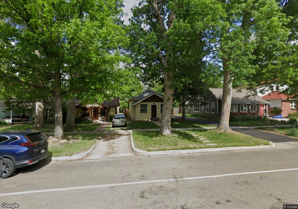
520 Bross St Longmont, CO 80501
Sunset NeighborhoodEstimated Value: $523,932 - $608,000
2
Beds
2
Baths
1,349
Sq Ft
$425/Sq Ft
Est. Value
About This Home
This home is located at 520 Bross St, Longmont, CO 80501 and is currently estimated at $573,733, approximately $425 per square foot. 520 Bross St is a home located in Boulder County with nearby schools including Central Elementary School, Westview Middle School, and Longmont High School.
Ownership History
Date
Name
Owned For
Owner Type
Purchase Details
Closed on
Apr 28, 2006
Sold by
Brown Michael B and Brown Jenny B
Bought by
Shrimpton Cathy
Current Estimated Value
Home Financials for this Owner
Home Financials are based on the most recent Mortgage that was taken out on this home.
Original Mortgage
$179,900
Outstanding Balance
$103,713
Interest Rate
6.32%
Mortgage Type
Fannie Mae Freddie Mac
Estimated Equity
$470,020
Purchase Details
Closed on
Nov 9, 2001
Sold by
Armstrong Violet H
Bought by
Brown Michael B
Home Financials for this Owner
Home Financials are based on the most recent Mortgage that was taken out on this home.
Original Mortgage
$197,115
Interest Rate
6.59%
Purchase Details
Closed on
Jan 28, 1993
Bought by
Shrimpton Cathy
Purchase Details
Closed on
Mar 29, 1976
Bought by
Shrimpton Cathy
Create a Home Valuation Report for This Property
The Home Valuation Report is an in-depth analysis detailing your home's value as well as a comparison with similar homes in the area
Home Values in the Area
Average Home Value in this Area
Purchase History
| Date | Buyer | Sale Price | Title Company |
|---|---|---|---|
| Shrimpton Cathy | $259,900 | Utc Colorado | |
| Brown Michael B | $199,900 | First American Heritage Titl | |
| Shrimpton Cathy | -- | -- | |
| Shrimpton Cathy | $22,500 | -- |
Source: Public Records
Mortgage History
| Date | Status | Borrower | Loan Amount |
|---|---|---|---|
| Open | Shrimpton Cathy | $179,900 | |
| Previous Owner | Brown Michael B | $197,115 |
Source: Public Records
Tax History
| Year | Tax Paid | Tax Assessment Tax Assessment Total Assessment is a certain percentage of the fair market value that is determined by local assessors to be the total taxable value of land and additions on the property. | Land | Improvement |
|---|---|---|---|---|
| 2025 | $2,556 | $32,619 | $10,713 | $21,906 |
| 2024 | $2,556 | $32,619 | $10,713 | $21,906 |
| 2023 | $2,521 | $33,420 | $11,986 | $25,118 |
| 2022 | $1,959 | $26,744 | $8,827 | $17,917 |
| 2021 | $1,984 | $27,514 | $9,081 | $18,433 |
| 2020 | $1,814 | $25,826 | $7,079 | $18,747 |
| 2019 | $1,786 | $25,826 | $7,079 | $18,747 |
| 2018 | $1,468 | $22,651 | $8,136 | $14,515 |
| 2017 | $1,448 | $25,042 | $8,995 | $16,047 |
| 2016 | $1,869 | $19,558 | $10,348 | $9,210 |
| 2015 | $1,781 | $16,987 | $5,970 | $11,017 |
| 2014 | $1,587 | $16,987 | $5,970 | $11,017 |
Source: Public Records
Map
Nearby Homes
- 409 Terry St Unit B
- 831 4th Ave
- 331 Main St
- 402 Sherman St
- 1301 Spruce Ave
- 1260 Longs Peak Ave
- 832 Gay St
- 1129 2nd Ave
- 106 Lincoln St
- 400 Emery St Unit 202
- 344 Judson St
- 1401 3rd Ave
- 824 Kimbark St
- 150 Francis St
- 348 Collyer St Unit 105
- 140 Judson St
- 531 Atwood St
- 306 Collyer St
- 422 Atwood St
- 1618 Donovan Place
Your Personal Tour Guide
Ask me questions while you tour the home.