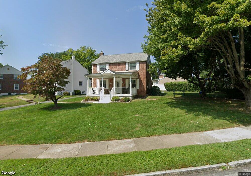
520 Evans Rd Springfield, PA 19064
Estimated Value: $465,000 - $507,000
3
Beds
2
Baths
1,665
Sq Ft
$291/Sq Ft
Est. Value
About This Home
This home is located at 520 Evans Rd, Springfield, PA 19064 and is currently estimated at $484,103, approximately $290 per square foot. 520 Evans Rd is a home located in Delaware County with nearby schools including Springfield High School, St Francis Of Assisi School, and Holy Cross School.
Ownership History
Date
Name
Owned For
Owner Type
Purchase Details
Closed on
Nov 28, 1997
Sold by
Cattafesta James Joseph and Cattafesta Anna M
Bought by
Acchione John B and Acchione Deborah F
Current Estimated Value
Home Financials for this Owner
Home Financials are based on the most recent Mortgage that was taken out on this home.
Original Mortgage
$120,000
Outstanding Balance
$20,391
Interest Rate
7.28%
Estimated Equity
$463,712
Create a Home Valuation Report for This Property
The Home Valuation Report is an in-depth analysis detailing your home's value as well as a comparison with similar homes in the area
Home Values in the Area
Average Home Value in this Area
Purchase History
| Date | Buyer | Sale Price | Title Company |
|---|---|---|---|
| Acchione John B | $152,000 | -- |
Source: Public Records
Mortgage History
| Date | Status | Borrower | Loan Amount |
|---|---|---|---|
| Open | Acchione John B | $120,000 |
Source: Public Records
Tax History
| Year | Tax Paid | Tax Assessment Tax Assessment Total Assessment is a certain percentage of the fair market value that is determined by local assessors to be the total taxable value of land and additions on the property. | Land | Improvement |
|---|---|---|---|---|
| 2025 | $7,536 | $268,120 | $96,920 | $171,200 |
| 2024 | $7,536 | $268,120 | $96,920 | $171,200 |
| 2023 | $7,256 | $268,120 | $96,920 | $171,200 |
| 2022 | $7,099 | $268,120 | $96,920 | $171,200 |
| 2021 | $10,995 | $268,120 | $96,920 | $171,200 |
| 2020 | $7,048 | $155,540 | $46,600 | $108,940 |
| 2019 | $6,883 | $155,540 | $46,600 | $108,940 |
| 2018 | $6,784 | $155,540 | $0 | $0 |
| 2017 | $6,627 | $155,540 | $0 | $0 |
| 2016 | $854 | $155,540 | $0 | $0 |
| 2015 | $854 | $155,540 | $0 | $0 |
| 2014 | $854 | $155,540 | $0 | $0 |
Source: Public Records
Map
Nearby Homes
- 332 Franklin Ave
- 173 Rambling Way
- 211 S Norwinden Dr
- 226 Lynbrooke Rd
- 227 E Leamy Ave
- 978 Westfield Rd
- 514 Springview Ln
- 34 Schuyler Rd
- 31 Wayfield Rd
- 364 S Rolling Rd
- 507 School St
- 29 School Ln
- 120 W Springfield Rd
- 111 Broad St
- 19 Wayne Ave
- 246 Pennington Ave
- 0 N Bishop Ave
- 624 E Springfield Rd
- 5358 Delmar Dr
- 493 Wheatsheaf Rd
Your Personal Tour Guide
Ask me questions while you tour the home.