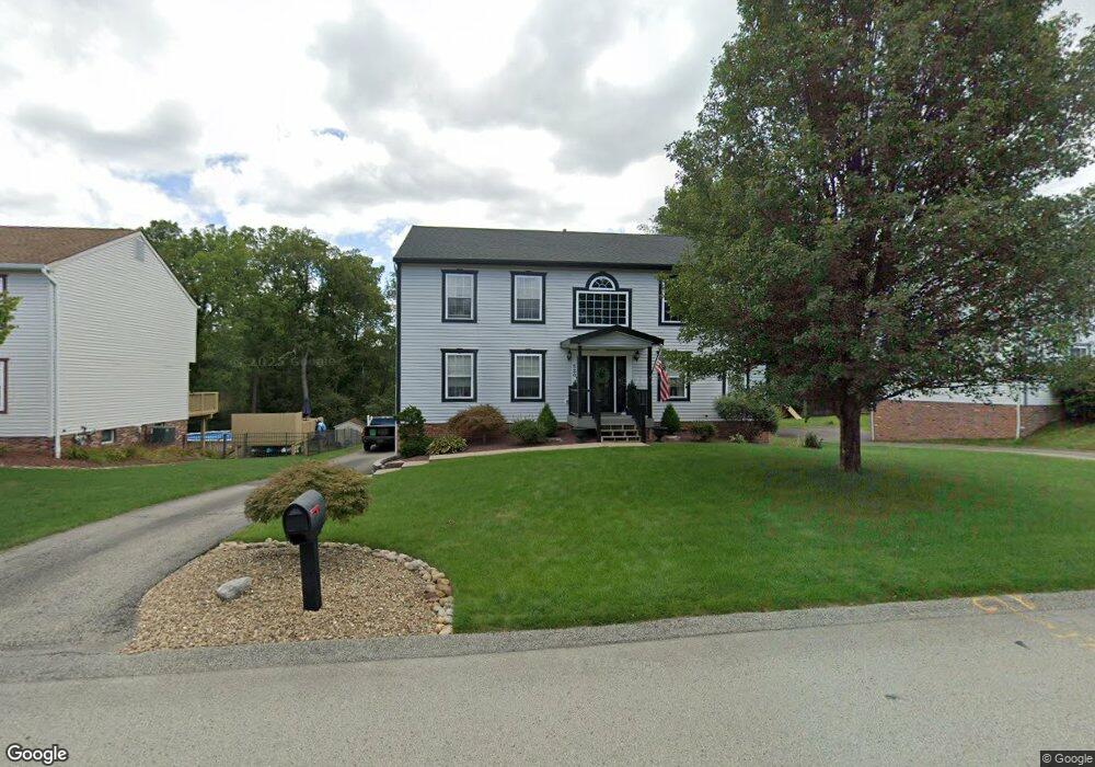
520 Jackson Dr Apollo, PA 15613
Estimated Value: $395,000 - $429,119
Studio
--
Bath
2,640
Sq Ft
$157/Sq Ft
Est. Value
About This Home
This home is located at 520 Jackson Dr, Apollo, PA 15613 and is currently estimated at $414,530, approximately $157 per square foot. 520 Jackson Dr is a home located in Westmoreland County with nearby schools including Kiski Area High School.
Ownership History
Date
Name
Owned For
Owner Type
Purchase Details
Closed on
Jul 15, 2014
Sold by
Drenning James C and Drenning Bree E
Bought by
Jackson Jeffrey and Jackson Nicole
Current Estimated Value
Home Financials for this Owner
Home Financials are based on the most recent Mortgage that was taken out on this home.
Original Mortgage
$183,200
Outstanding Balance
$137,598
Interest Rate
4.18%
Mortgage Type
New Conventional
Estimated Equity
$276,932
Purchase Details
Closed on
Sep 19, 2006
Sold by
Cochrane Jeffrey N and Cochrane Nancy C
Bought by
Drenning James C and Denning Bree E
Home Financials for this Owner
Home Financials are based on the most recent Mortgage that was taken out on this home.
Original Mortgage
$198,500
Interest Rate
6.52%
Mortgage Type
Purchase Money Mortgage
Create a Home Valuation Report for This Property
The Home Valuation Report is an in-depth analysis detailing your home's value as well as a comparison with similar homes in the area
Home Values in the Area
Average Home Value in this Area
Purchase History
| Date | Buyer | Sale Price | Title Company |
|---|---|---|---|
| Jackson Jeffrey | $229,000 | None Available | |
| Drenning James C | $191,500 | None Available |
Source: Public Records
Mortgage History
| Date | Status | Borrower | Loan Amount |
|---|---|---|---|
| Open | Jackson Jeffrey | $183,200 | |
| Previous Owner | Drenning James C | $198,500 |
Source: Public Records
Tax History
| Year | Tax Paid | Tax Assessment Tax Assessment Total Assessment is a certain percentage of the fair market value that is determined by local assessors to be the total taxable value of land and additions on the property. | Land | Improvement |
|---|---|---|---|---|
| 2026 | $5,429 | $35,430 | $4,150 | $31,280 |
| 2025 | $5,285 | $35,430 | $4,150 | $31,280 |
| 2024 | $5,010 | $35,430 | $4,150 | $31,280 |
| 2023 | $4,573 | $35,430 | $4,150 | $31,280 |
| 2022 | $4,432 | $35,430 | $4,150 | $31,280 |
| 2021 | $4,432 | $35,430 | $4,150 | $31,280 |
| 2020 | $4,420 | $35,430 | $4,150 | $31,280 |
| 2019 | $4,367 | $35,430 | $4,150 | $31,280 |
| 2018 | $4,296 | $35,430 | $4,150 | $31,280 |
| 2017 | $4,191 | $35,430 | $4,150 | $31,280 |
| 2016 | $4,125 | $35,430 | $4,150 | $31,280 |
| 2015 | $4,125 | $35,430 | $4,150 | $31,280 |
| 2014 | $4,104 | $35,430 | $4,150 | $31,280 |
Source: Public Records
Map
Nearby Homes
- 537 Jackson Dr
- 1824 Washington Rd
- Parcel A Beighley Rd
- 126 Jefferson Dr
- 474 Exton Lake Rd
- 00 Saltsburg Rd
- 4930 Ashbaugh Rd
- 4302 Michel Ct
- 4306 Michel Ct
- 3424 Lashan Dr
- 5879 Steele Rd
- Lot 1-4 Cole Rd
- 5005 Mamont Rd
- 4830 Dargate Ln
- 440 Chapeldale Dr
- 126 Bakers Ln
- 5 Acres Ct
- 280 Kistler Dr
- 4941 Bulltown Rd
- Lot 4 Shag Bark Grove
- 518 Jackson Dr
- 524 Jackson Dr
- 516 Jackson Dr
- 523 Jackson Dr
- 526 Jackson Dr
- 529 Jackson Dr
- 517 Jackson Dr
- 512 Jackson Dr
- 530 Jackson Dr
- 537 Jackson Dr Unit 501
- 515 Jackson Dr
- 543 Jackson Dr
- 511 Jackson Dr
- 532 Jackson Dr
- 2 N Washington Rd
- 526 Hoover Dr
- 528 Hoover Dr
- 532 Hoover Dr
- 506 Jackson Dr
- 518 Hoover Dr
Your Personal Tour Guide
Ask me questions while you tour the home.