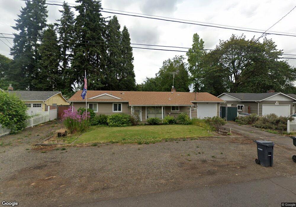
520 Larry Ave N Keizer, OR 97303
Estimated Value: $340,000 - $409,000
2
Beds
1
Bath
1,056
Sq Ft
$355/Sq Ft
Est. Value
About This Home
This home is located at 520 Larry Ave N, Keizer, OR 97303 and is currently estimated at $374,670, approximately $354 per square foot. 520 Larry Ave N is a home located in Marion County with nearby schools including Cummings Elementary School, Claggett Creek Middle School, and McNary High School.
Ownership History
Date
Name
Owned For
Owner Type
Purchase Details
Closed on
Jul 1, 2025
Sold by
Koski Eleanor M and Koski Robert Allen
Bought by
Koski Robert Allen
Current Estimated Value
Purchase Details
Closed on
Nov 17, 2006
Sold by
Anderson Jodi Lynn
Bought by
Koski Robert Allen and Koski Eleanor M
Home Financials for this Owner
Home Financials are based on the most recent Mortgage that was taken out on this home.
Original Mortgage
$151,200
Interest Rate
6.36%
Mortgage Type
Purchase Money Mortgage
Purchase Details
Closed on
Sep 9, 2003
Sold by
Anderson Eric J and Anderson Jodi L
Bought by
Anderson Eric J and Anderson Jodi L
Home Financials for this Owner
Home Financials are based on the most recent Mortgage that was taken out on this home.
Original Mortgage
$75,563
Interest Rate
6.3%
Mortgage Type
Purchase Money Mortgage
Create a Home Valuation Report for This Property
The Home Valuation Report is an in-depth analysis detailing your home's value as well as a comparison with similar homes in the area
Home Values in the Area
Average Home Value in this Area
Purchase History
| Date | Buyer | Sale Price | Title Company |
|---|---|---|---|
| Koski Robert Allen | -- | Stewart Title | |
| Koski Robert Allen | $168,000 | Ticor Title | |
| Anderson Eric J | -- | Fidelity National Title |
Source: Public Records
Mortgage History
| Date | Status | Borrower | Loan Amount |
|---|---|---|---|
| Previous Owner | Koski Robert Allen | $151,200 | |
| Previous Owner | Anderson Eric J | $75,563 |
Source: Public Records
Tax History Compared to Growth
Tax History
| Year | Tax Paid | Tax Assessment Tax Assessment Total Assessment is a certain percentage of the fair market value that is determined by local assessors to be the total taxable value of land and additions on the property. | Land | Improvement |
|---|---|---|---|---|
| 2025 | $3,136 | $187,610 | -- | -- |
| 2024 | $3,136 | $182,150 | -- | -- |
| 2023 | $2,983 | $176,850 | $0 | $0 |
| 2022 | $2,811 | $171,700 | $0 | $0 |
| 2021 | $2,722 | $166,700 | $0 | $0 |
| 2020 | $2,651 | $161,850 | $0 | $0 |
| 2019 | $2,549 | $157,140 | $0 | $0 |
| 2018 | $2,593 | $0 | $0 | $0 |
| 2017 | $2,331 | $0 | $0 | $0 |
| 2016 | $2,234 | $0 | $0 | $0 |
| 2015 | $1,955 | $0 | $0 | $0 |
| 2014 | $1,891 | $0 | $0 | $0 |
Source: Public Records
Map
Nearby Homes
- 530 Larry Ave N
- 211 Sunset Ave N
- 132 Sunset Ave N Unit 168
- 4407 Toni Ave N
- 3796 Hart Dr N
- 382 Cummings Ln N
- 500 Bever Dr NE
- 1001 Ring St NE Unit 1007
- 870 Rafael Ave N
- 1202 Leo St NE
- 1009 Ring St NE Unit 1015
- 4575 Clark Ave NE
- 359 Apple Blossom Ave N
- 550 Churchdale Ave N Unit 570
- 459 Churchdale Ave N
- 3774 Homestead Ct NE
- 3515 Brooks Ave NE
- 4670 Thorman Ave NE
- 724 Lost Ln N
- 797 Dearborn Ave NE
- 510 Larry Ave N
- 470 Larry Ave N
- 560 Larry Ave N
- 503 Sunset Ave N
- 541 Sunset Ave N
- 505 Larry Ave N
- 400 Larry Ave N Unit BLK
- 525 Larry Ave N
- 535 Larry Ave N
- 460 Larry Ave N
- 561 Sunset Ave N
- 570 Larry Ave N
- 481 Sunset Ave N
- 565 Larry Ave N
- 4155 Rowan Ave N
- 4001 12th (5) St
- 451 Larry Ave N
- 591 Sunset Ave N
- 595 Larry Ave N
- 450 Larry Ave N