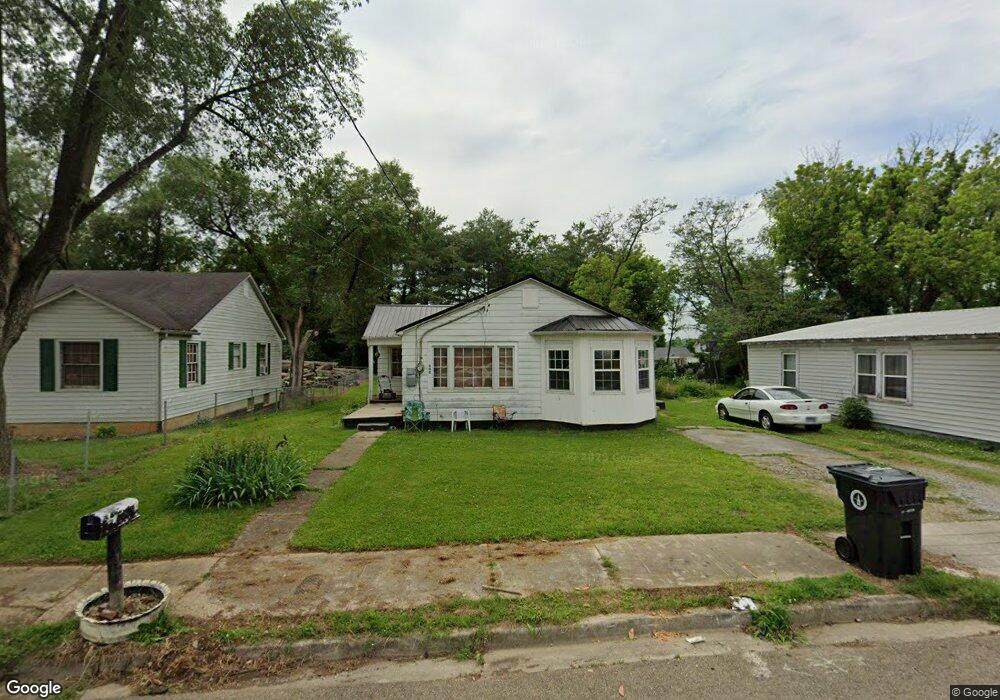
520 Montvue Ave Morristown, TN 37813
Estimated Value: $123,000 - $162,000
--
Bed
1
Bath
1,092
Sq Ft
$130/Sq Ft
Est. Value
About This Home
This home is located at 520 Montvue Ave, Morristown, TN 37813 and is currently estimated at $142,267, approximately $130 per square foot. 520 Montvue Ave is a home located in Hamblen County with nearby schools including Hillcrest Elementary School, Meadowview Middle School, and Morristown East High School.
Ownership History
Date
Name
Owned For
Owner Type
Purchase Details
Closed on
Dec 1, 2017
Sold by
Jefferson Federal Bank
Bought by
Mccracken Winnie
Current Estimated Value
Purchase Details
Closed on
Dec 18, 1998
Bought by
Solomon Kenneth
Purchase Details
Closed on
Jan 21, 1948
Bought by
Carpenter Vernon and Carpenter Barbara
Create a Home Valuation Report for This Property
The Home Valuation Report is an in-depth analysis detailing your home's value as well as a comparison with similar homes in the area
Home Values in the Area
Average Home Value in this Area
Purchase History
| Date | Buyer | Sale Price | Title Company |
|---|---|---|---|
| Mccracken Winnie | $39,600 | None Available | |
| Solomon Kenneth | $22,000 | -- | |
| Carpenter Vernon | -- | -- |
Source: Public Records
Tax History Compared to Growth
Tax History
| Year | Tax Paid | Tax Assessment Tax Assessment Total Assessment is a certain percentage of the fair market value that is determined by local assessors to be the total taxable value of land and additions on the property. | Land | Improvement |
|---|---|---|---|---|
| 2024 | $295 | $16,775 | $3,450 | $13,325 |
| 2023 | $295 | $16,775 | $0 | $0 |
| 2022 | $530 | $16,775 | $3,450 | $13,325 |
| 2021 | $530 | $16,775 | $3,450 | $13,325 |
| 2020 | $529 | $16,775 | $3,450 | $13,325 |
| 2019 | $453 | $13,300 | $3,125 | $10,175 |
| 2018 | $419 | $13,300 | $3,125 | $10,175 |
| 2017 | $413 | $13,300 | $3,125 | $10,175 |
| 2016 | $394 | $13,300 | $3,125 | $10,175 |
| 2015 | $366 | $13,300 | $3,125 | $10,175 |
| 2014 | -- | $13,300 | $3,125 | $10,175 |
| 2013 | -- | $15,200 | $0 | $0 |
Source: Public Records
Map
Nearby Homes
- 417 Cain Ave
- 712 Williams St
- 219 Inman St
- 915 Forgey Ave
- 831 Cave St
- 435 S Hill St
- 0 S Liberty Hill Rd Unit 703697
- 525 S Liberty Hill Rd
- 926 E Main St
- 819 Choctaw St
- 0 Joe Hall Rd Unit 703714
- 518 W Hillcrest Dr
- 816 Choctaw St
- 721 E 1st St N
- 721 E 1st North St
- 1200 Liberty Hall Dr
- 207 E 2nd St N
- 0 Russell Cir
- 323 Pauline Ave
- 1205 Ledford Ave
- 526 Montvue Ave
- 514 Montvue Ave
- 510 Montvue Ave
- 534 Montvue Ave
- 602 Inman St
- 612 Inman St
- 540 Inman St
- 521 Montvue Ave
- 515 Montvue Ave
- 525 Montvue Ave
- 532 Inman St
- 609 E Louise Ave
- 535 Montvue Ave
- 501 Montvue Ave
- 541 Montvue Ave
- 526 Inman St
- 607 Inman St
- 533 E Louise Ave
- 437 Montvue Ave
- 547 Montvue Ave