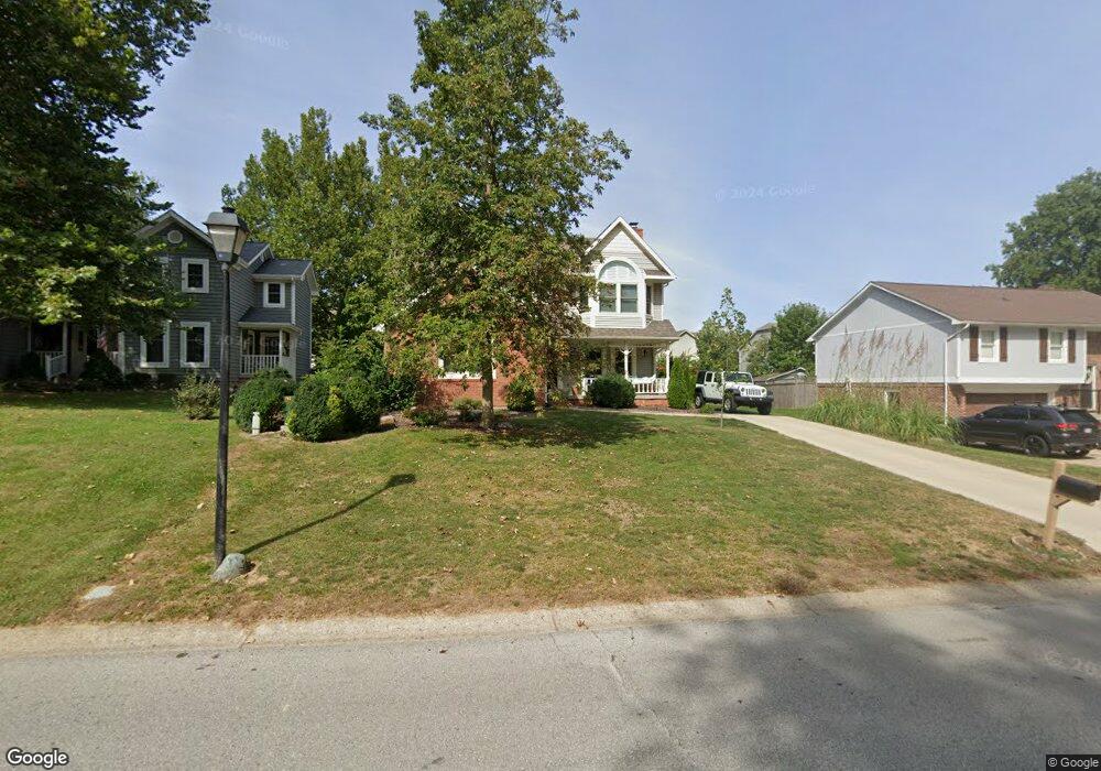
520 Morse Landing Dr Cicero, IN 46034
Estimated Value: $385,000 - $406,000
3
Beds
3
Baths
2,261
Sq Ft
$177/Sq Ft
Est. Value
About This Home
This home is located at 520 Morse Landing Dr, Cicero, IN 46034 and is currently estimated at $399,184, approximately $176 per square foot. 520 Morse Landing Dr is a home located in Hamilton County with nearby schools including Hamilton Heights Primary School, Hamilton Heights Elementary School, and Hamilton Heights Middle School.
Ownership History
Date
Name
Owned For
Owner Type
Purchase Details
Closed on
Aug 21, 2020
Sold by
Jackson Kenneth W and Jackson Christina A
Bought by
Bonge Amy L
Current Estimated Value
Purchase Details
Closed on
Nov 7, 2008
Sold by
Jackson Kenneth W
Bought by
Jackson Ii Kenneth W and Jackson Christina A
Home Financials for this Owner
Home Financials are based on the most recent Mortgage that was taken out on this home.
Original Mortgage
$179,080
Interest Rate
5.95%
Mortgage Type
FHA
Purchase Details
Closed on
Oct 31, 2006
Sold by
Hightower Charles A and Hightower Cathy L
Bought by
Jackson Ii Kenneth W
Home Financials for this Owner
Home Financials are based on the most recent Mortgage that was taken out on this home.
Original Mortgage
$191,000
Interest Rate
6.36%
Mortgage Type
Purchase Money Mortgage
Create a Home Valuation Report for This Property
The Home Valuation Report is an in-depth analysis detailing your home's value as well as a comparison with similar homes in the area
Home Values in the Area
Average Home Value in this Area
Purchase History
| Date | Buyer | Sale Price | Title Company |
|---|---|---|---|
| Bonge Amy L | -- | None Listed On Document | |
| Jackson Ii Kenneth W | -- | None Available | |
| Jackson Ii Kenneth W | -- | Pinnacle Land Title Co Inc |
Source: Public Records
Mortgage History
| Date | Status | Borrower | Loan Amount |
|---|---|---|---|
| Previous Owner | Jackson Ii Kenneth W | $179,080 | |
| Previous Owner | Jackson Ii Kenneth W | $191,000 |
Source: Public Records
Tax History Compared to Growth
Tax History
| Year | Tax Paid | Tax Assessment Tax Assessment Total Assessment is a certain percentage of the fair market value that is determined by local assessors to be the total taxable value of land and additions on the property. | Land | Improvement |
|---|---|---|---|---|
| 2024 | $2,640 | $325,800 | $100,000 | $225,800 |
| 2023 | $2,640 | $277,900 | $100,000 | $177,900 |
| 2022 | $2,673 | $267,300 | $51,300 | $216,000 |
| 2021 | $2,344 | $234,400 | $51,300 | $183,100 |
| 2020 | $2,317 | $236,100 | $51,300 | $184,800 |
| 2019 | $2,123 | $207,800 | $33,500 | $174,300 |
| 2018 | $1,975 | $192,800 | $33,500 | $159,300 |
| 2017 | $1,967 | $191,800 | $33,500 | $158,300 |
| 2016 | $2,027 | $197,800 | $33,500 | $164,300 |
| 2014 | $1,859 | $181,000 | $31,000 | $150,000 |
| 2013 | $1,859 | $175,100 | $31,200 | $143,900 |
Source: Public Records
Map
Nearby Homes
- 1055 Spinner Ct
- 826 N Lanyard Dr
- 34 Hovden Dr
- 130 Overston Ct
- 815 Morse Landing Dr
- 131 Batteese Dr
- 100 Confidential Dr
- 221 Common Loon Blvd
- 14 Morse Ct
- 104 Perlican Dr
- 15 Morse Ct
- 31 Bluewater Dr
- 1180 Shoreline Cir
- 949 Nantucket Dr
- 1306 N Catamaran Cir
- 18 Point Ln
- 47 Lively Place
- 1940 Stringtown Pike
- 24 Karner Blue Ct
- 47 Karner Blue Ct
- 500 Morse Landing Dr
- 540 Morse Landing Dr
- 3005 W Morse Dr
- 490 Morse Landing Dr
- 2095 W Morse Dr
- 3015 W Morse Dr
- 480 Morse Landing Dr
- 3025 W Morse Dr
- 2090 W Morse Dr
- 525 Morse Landing Dr
- 460 Morse Landing Dr
- 545 Morse Landing Dr
- 515 Morse Landing Dr
- 580 Morse Landing Dr
- 3035 W Morse Dr
- 495 Morse Landing Dr
- 2080 W Morse Dr
- 475 Morse Landing Dr
- LOT 36 Morse Landing Dr
- LOT 37 Morse Landing Dr