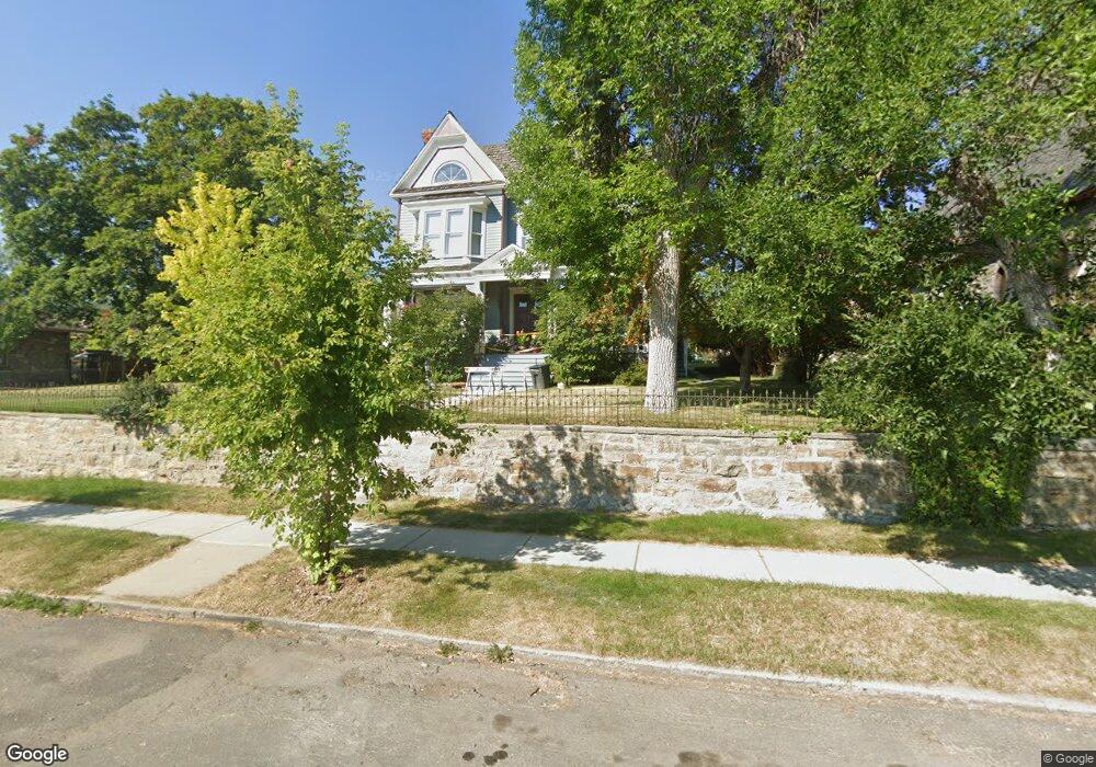
520 N Benton Ave Helena, MT 59601
Upper West Side NeighborhoodEstimated Value: $589,000 - $1,250,349
5
Beds
3
Baths
3,744
Sq Ft
$261/Sq Ft
Est. Value
About This Home
This home is located at 520 N Benton Ave, Helena, MT 59601 and is currently estimated at $975,450, approximately $260 per square foot. 520 N Benton Ave is a home located in Lewis and Clark County with nearby schools including Hawthorne Elementary School, C.R. Anderson Middle School, and Helena Christian Academy.
Ownership History
Date
Name
Owned For
Owner Type
Purchase Details
Closed on
Feb 1, 2011
Sold by
Flink John W
Bought by
Flink John W and Bramer Kathryn M
Current Estimated Value
Purchase Details
Closed on
May 27, 2005
Sold by
Foutch Shawn L and Foutch Meg E
Bought by
Flink John W
Create a Home Valuation Report for This Property
The Home Valuation Report is an in-depth analysis detailing your home's value as well as a comparison with similar homes in the area
Home Values in the Area
Average Home Value in this Area
Purchase History
| Date | Buyer | Sale Price | Title Company |
|---|---|---|---|
| Flink John W | -- | First Montana Title | |
| Flink John W | -- | First Montana Title Company |
Source: Public Records
Tax History
| Year | Tax Paid | Tax Assessment Tax Assessment Total Assessment is a certain percentage of the fair market value that is determined by local assessors to be the total taxable value of land and additions on the property. | Land | Improvement |
|---|---|---|---|---|
| 2025 | $7,440 | $1,092,143 | $0 | $0 |
| 2024 | $8,869 | $926,528 | $0 | $0 |
| 2023 | $10,451 | $926,528 | $0 | $0 |
| 2022 | $8,359 | $610,445 | $0 | $0 |
| 2021 | $6,772 | $610,445 | $0 | $0 |
| 2020 | $7,916 | $562,204 | $0 | $0 |
| 2019 | $7,926 | $562,204 | $0 | $0 |
| 2018 | $7,230 | $504,868 | $0 | $0 |
| 2017 | $5,035 | $504,868 | $0 | $0 |
| 2016 | $6,266 | $472,980 | $0 | $0 |
| 2015 | $4,812 | $472,980 | $0 | $0 |
| 2014 | $4,287 | $233,306 | $0 | $0 |
Source: Public Records
Map
Nearby Homes
- 342 Clarke St
- 21 N Last Chance Gulch Unit 3H
- 21 N Last Chance Gulch Unit 5M
- 21 N Last Chance Gulch Unit 4M
- 21 N Last Chance Gulch Unit 4H
- 816 Flowerree St
- 804 Logan St
- 315 8th Ave
- 316 9th Ave
- 33 Carriage Ln
- 316 S Park Ave
- 1001 Hauser Blvd
- 290 S Harrison Ave
- 524 E Broadway St
- 442 S Park Ave
- 715 N Davis St
- 719 N Davis St
- 421 E 15th St
- 1051 N Warren St
- 824 N Hoback St
- 508 N Benton Ave
- 319 Power St
- 312 Holter St
- 500 N Benton Ave
- 314 Holter St
- 527 Dearborn Ave
- 521 Dearborn Ave
- 531 Dearborn Ave
- 501 N Benton Ave
- 320 Holter St
- 301 Holter St
- 612 N Benton Ave
- 320 Power St
- 320 Power St Unit 615 Dearborn
- 320 Power St Unit 615 Dearborn Ave.
- 320 Power St Unit 615 Dearborn Avenue
- 560 N Park Ave Unit 3rd Floor Southwest
- 560 N Park Ave
- 320 Power 615 Dearborn Ave
- 200 W Placer Ave Unit 200 p
Your Personal Tour Guide
Ask me questions while you tour the home.