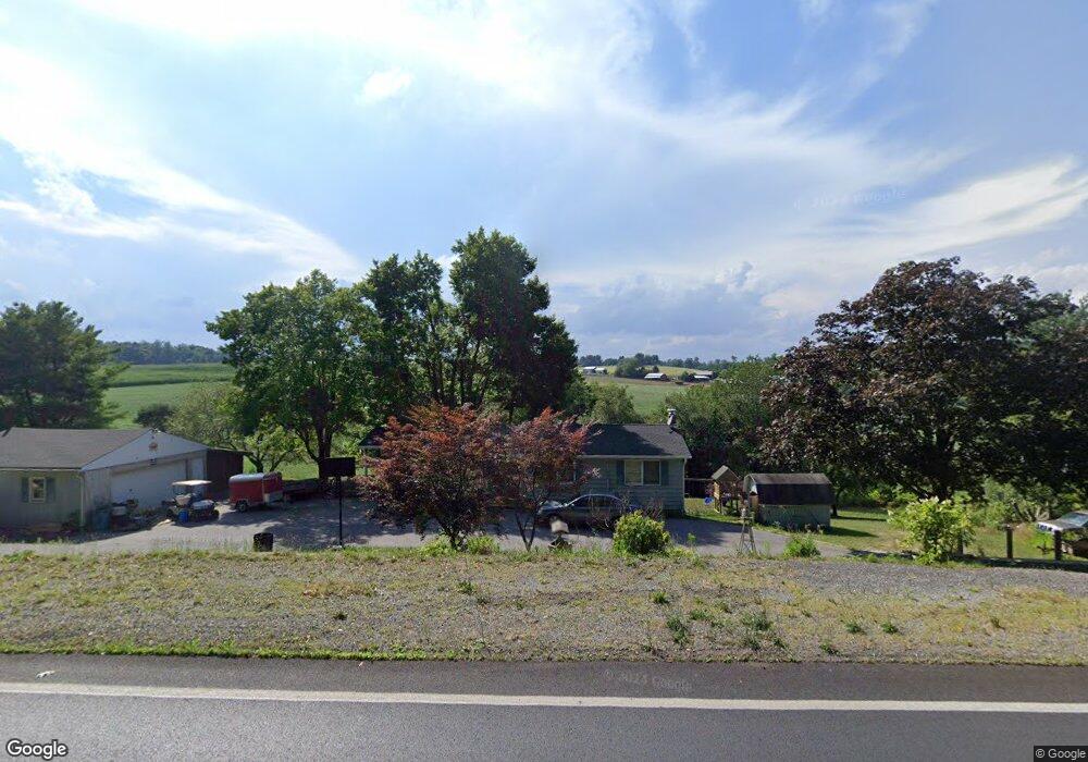
520 N Gorsuch Rd Westminster, MD 21157
Estimated Value: $375,426 - $383,000
--
Bed
2
Baths
1,008
Sq Ft
$377/Sq Ft
Est. Value
About This Home
This home is located at 520 N Gorsuch Rd, Westminster, MD 21157 and is currently estimated at $379,857, approximately $376 per square foot. 520 N Gorsuch Rd is a home located in Carroll County with nearby schools including Cranberry Station Elementary School, Westminster East Middle School, and Winters Mill High School.
Ownership History
Date
Name
Owned For
Owner Type
Purchase Details
Closed on
Oct 17, 2005
Sold by
Manger Tom
Bought by
Hudson Steven L and Hudson Sue
Current Estimated Value
Purchase Details
Closed on
Jun 11, 2003
Sold by
Federal National Mortgage Association
Bought by
Manger Tom and Manger Marilyn J
Purchase Details
Closed on
Jul 29, 2002
Sold by
Chase Ian N
Bought by
Federal National Mortgage Association
Purchase Details
Closed on
Jul 3, 1996
Sold by
Schubert Albert J
Bought by
Chase Ian N
Create a Home Valuation Report for This Property
The Home Valuation Report is an in-depth analysis detailing your home's value as well as a comparison with similar homes in the area
Home Values in the Area
Average Home Value in this Area
Purchase History
| Date | Buyer | Sale Price | Title Company |
|---|---|---|---|
| Hudson Steven L | $180,000 | -- | |
| Manger Tom | $134,000 | -- | |
| Federal National Mortgage Association | $144,900 | -- | |
| Chase Ian N | $124,900 | -- |
Source: Public Records
Tax History Compared to Growth
Tax History
| Year | Tax Paid | Tax Assessment Tax Assessment Total Assessment is a certain percentage of the fair market value that is determined by local assessors to be the total taxable value of land and additions on the property. | Land | Improvement |
|---|---|---|---|---|
| 2025 | $3,282 | $323,600 | $141,100 | $182,500 |
| 2024 | $3,282 | $302,233 | $0 | $0 |
| 2023 | $3,121 | $280,867 | $0 | $0 |
| 2022 | $2,966 | $259,500 | $141,100 | $118,400 |
| 2021 | $6,094 | $259,033 | $0 | $0 |
| 2020 | $2,982 | $258,567 | $0 | $0 |
| 2019 | $2,977 | $258,100 | $141,100 | $117,000 |
| 2018 | $2,914 | $254,833 | $0 | $0 |
| 2017 | $2,877 | $251,567 | $0 | $0 |
| 2016 | -- | $248,300 | $0 | $0 |
| 2015 | -- | $240,867 | $0 | $0 |
| 2014 | -- | $233,433 | $0 | $0 |
Source: Public Records
Map
Nearby Homes
- 0 Hampstead Mexico Rd Unit MDCR2026312
- 885 Paxser Dr
- 2611 Hoffman Mill Rd
- 1763 Gablehammer Rd
- 1520 Carriage Hill Dr
- 2424 Shiloh Rd
- 1212 Random Ridge Rd
- 1217 Random Ridge Rd
- 1526 Manchester Rd
- 0 Martin Dr
- 1345 Brehm Rd
- 2810 Hoffman Mill Rd
- 1281 Guadelupe Dr
- 2612 Neudecker Rd
- 334 N Tannery Rd
- 0 Hampstead Mexico Unit MDCR2018980
- N/A Tannery Rd
- 932 Old Manchester Rd
- 213 Blue Heron Dr
- 1815 Manchester Rd
- 518 N Gorsuch Rd
- 516 N Gorsuch Rd
- 514 N Gorsuch Rd
- 647 N Gorsuch Rd
- 512 N Gorsuch Rd
- 517 N Gorsuch Rd
- 510 N Gorsuch Rd
- 508 N Gorsuch Rd
- 515 N Gorsuch Rd
- 506 N Gorsuch Rd
- 1820 Coon Club Rd
- 669 N Gorsuch Rd
- 504 N Gorsuch Rd
- 2016 Coon Club Rd
- 2020 Coon Club Rd
- 502 N Gorsuch Rd
- 500 N Gorsuch Rd
- Coon Club Rd
- 1828 Coon Club Rd
- 2010 Coon Club Rd