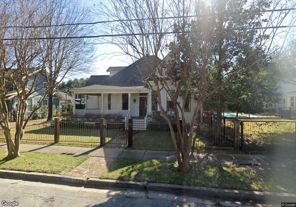
520 Omar St Unit A Houston, TX 77009
Greater Heights NeighborhoodEstimated Value: $1,424,925 - $1,592,000
4
Beds
4
Baths
3,016
Sq Ft
$490/Sq Ft
Est. Value
About This Home
This home is located at 520 Omar St Unit A, Houston, TX 77009 and is currently estimated at $1,477,731, approximately $489 per square foot. 520 Omar St Unit A is a home located in Harris County with nearby schools including Travis Elementary School, Hogg Middle, and Heights High School.
Ownership History
Date
Name
Owned For
Owner Type
Purchase Details
Closed on
May 23, 2025
Sold by
Marom Daniel N and Krumholz Lauren J
Bought by
Mallon Darragh and Mallon Ellie
Current Estimated Value
Purchase Details
Closed on
Aug 26, 2020
Sold by
Shorter Jonathan E and Shorter Jenna H
Bought by
Marom Daniel N and Krumholz Lauren J
Purchase Details
Closed on
Apr 14, 2014
Sold by
Rennell Lawrence M and Rennell Betty C
Bought by
Shorter Jonathan E and Shorter Jenna H
Home Financials for this Owner
Home Financials are based on the most recent Mortgage that was taken out on this home.
Original Mortgage
$654,375
Interest Rate
2%
Mortgage Type
Adjustable Rate Mortgage/ARM
Create a Home Valuation Report for This Property
The Home Valuation Report is an in-depth analysis detailing your home's value as well as a comparison with similar homes in the area
Home Values in the Area
Average Home Value in this Area
Purchase History
| Date | Buyer | Sale Price | Title Company |
|---|---|---|---|
| Mallon Darragh | -- | Old Republic Title | |
| Marom Daniel N | -- | Old Republic Title Ins Co | |
| Shorter Jonathan E | -- | None Available | |
| Shorter Jonathan E | -- | None Available |
Source: Public Records
Mortgage History
| Date | Status | Borrower | Loan Amount |
|---|---|---|---|
| Previous Owner | Shorter Jonathan E | $654,375 |
Source: Public Records
Tax History Compared to Growth
Tax History
| Year | Tax Paid | Tax Assessment Tax Assessment Total Assessment is a certain percentage of the fair market value that is determined by local assessors to be the total taxable value of land and additions on the property. | Land | Improvement |
|---|---|---|---|---|
| 2025 | $19,172 | $1,187,181 | $750,000 | $437,181 |
| 2024 | $19,172 | $1,195,155 | $750,000 | $445,155 |
| 2023 | $19,172 | $1,136,503 | $675,000 | $461,503 |
| 2022 | $23,399 | $1,062,680 | $622,500 | $440,180 |
| 2021 | $23,248 | $997,493 | $600,000 | $397,493 |
| 2020 | $23,490 | $970,044 | $600,000 | $370,044 |
| 2019 | $25,063 | $990,455 | $600,000 | $390,455 |
| 2018 | $18,399 | $919,216 | $480,000 | $439,216 |
| 2017 | $21,894 | $919,216 | $480,000 | $439,216 |
| 2016 | $19,903 | $787,137 | $400,000 | $387,137 |
| 2015 | $10,351 | $763,259 | $375,000 | $388,259 |
| 2014 | $10,351 | $663,027 | $337,500 | $325,527 |
Source: Public Records
Map
Nearby Homes
- 412 Merrill St
- 424 Redan St
- 3211 Beauchamp St
- 304 Bayland Ave
- 729 Merrill St
- 215 Bayland Ave
- 423 Pecore St
- 416 Euclid St
- 405 Pecore St
- 3711 Reagan St
- 418 Byrne St
- 525 Teetshorn St
- 3000 Morrison St
- 4110 N Main St
- 2715 Beauchamp St
- 931 Merrill St
- 825 Key St
- 2817 Houston Ave
- 615 Wendel St
- 1860 White Oak Dr Unit 321