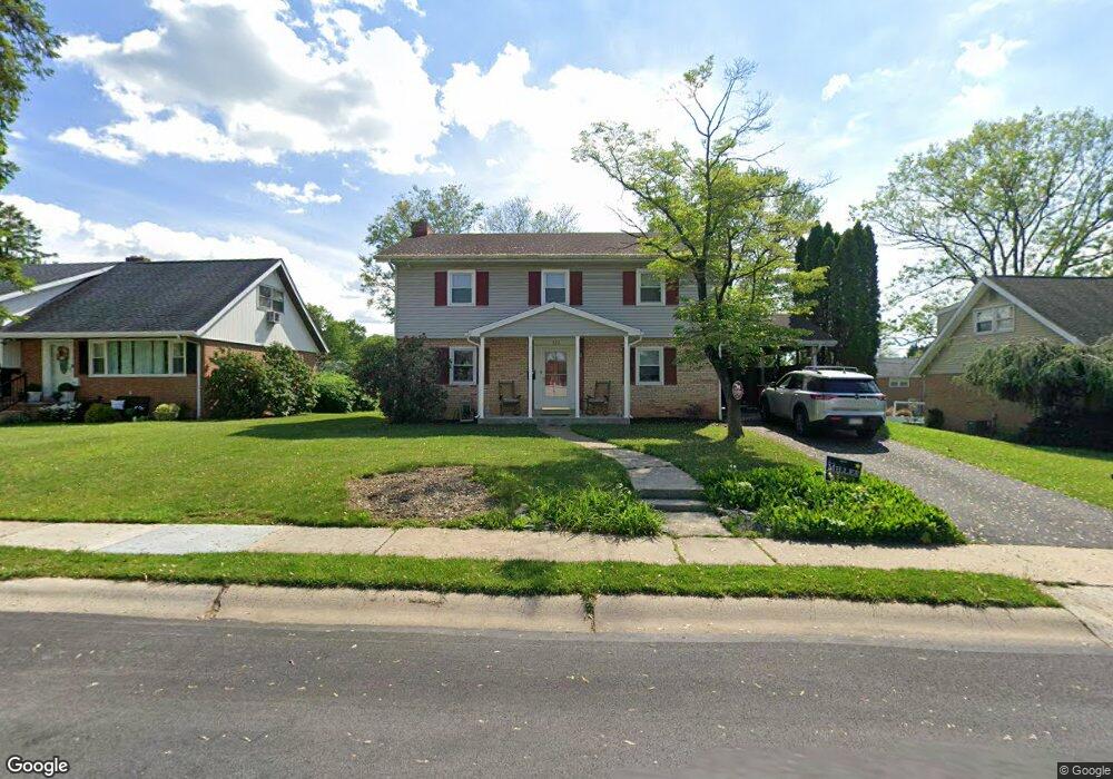
520 Snyder Rd Reading, PA 19609
Whitfield NeighborhoodEstimated Value: $338,000 - $372,000
4
Beds
3
Baths
1,890
Sq Ft
$189/Sq Ft
Est. Value
About This Home
This home is located at 520 Snyder Rd, Reading, PA 19609 and is currently estimated at $357,497, approximately $189 per square foot. 520 Snyder Rd is a home located in Berks County with nearby schools including Whitfield Elementary School, Wilson West Middle School, and Wilson High School.
Ownership History
Date
Name
Owned For
Owner Type
Purchase Details
Closed on
Jun 22, 2010
Sold by
Marks Donald E and Marks Jennifer L
Bought by
Marks Donald E and Marks Jennifer L
Current Estimated Value
Home Financials for this Owner
Home Financials are based on the most recent Mortgage that was taken out on this home.
Original Mortgage
$184,500
Outstanding Balance
$123,713
Interest Rate
4.98%
Mortgage Type
New Conventional
Estimated Equity
$233,784
Purchase Details
Closed on
Apr 29, 2008
Sold by
Woodring Donald M and Woodring Anne M
Bought by
Marks Donald E and Hiester Jennifer L
Home Financials for this Owner
Home Financials are based on the most recent Mortgage that was taken out on this home.
Original Mortgage
$182,400
Interest Rate
5.99%
Mortgage Type
Purchase Money Mortgage
Create a Home Valuation Report for This Property
The Home Valuation Report is an in-depth analysis detailing your home's value as well as a comparison with similar homes in the area
Home Values in the Area
Average Home Value in this Area
Purchase History
| Date | Buyer | Sale Price | Title Company |
|---|---|---|---|
| Marks Donald E | -- | None Available | |
| Marks Donald E | $192,000 | None Available |
Source: Public Records
Mortgage History
| Date | Status | Borrower | Loan Amount |
|---|---|---|---|
| Open | Marks Donald E | $184,500 | |
| Closed | Marks Donald E | $182,400 |
Source: Public Records
Tax History
| Year | Tax Paid | Tax Assessment Tax Assessment Total Assessment is a certain percentage of the fair market value that is determined by local assessors to be the total taxable value of land and additions on the property. | Land | Improvement |
|---|---|---|---|---|
| 2025 | $2,297 | $125,400 | $36,600 | $88,800 |
| 2024 | $5,365 | $125,400 | $36,600 | $88,800 |
| 2023 | $5,112 | $125,400 | $36,600 | $88,800 |
| 2022 | $4,987 | $125,400 | $36,600 | $88,800 |
| 2021 | $4,811 | $125,400 | $36,600 | $88,800 |
| 2020 | $4,811 | $125,400 | $36,600 | $88,800 |
| 2019 | $4,675 | $125,400 | $36,600 | $88,800 |
| 2018 | $4,634 | $125,400 | $36,600 | $88,800 |
| 2017 | $4,556 | $125,400 | $36,600 | $88,800 |
| 2016 | $1,605 | $125,400 | $36,600 | $88,800 |
| 2015 | $1,605 | $125,400 | $36,600 | $88,800 |
| 2014 | $1,605 | $125,400 | $36,600 | $88,800 |
Source: Public Records
Map
Nearby Homes
- 2405 Garden Ln
- 112 Grandview Blvd
- 2300 Gring Dr
- 101 Robert Rd
- 2133 Fairview St
- 12 Kevin Ct
- 37 Dorchester Dr
- 119 Woodside Ave
- 65 Wyomissing Hills Blvd
- 2121 Bressler Dr
- 118 Laurel Ct Unit 118B
- 162 Hawthorne Ct
- 130 Laurel Ct Unit 130B
- 14 Laird St
- 132 Laurel Ct Unit 132A
- 103 Hawthorne Ct
- 105 Hawthorne Ct
- 450 Warwick Dr
- 41 Park Rd
- 1812 Portland Ave
- 522 Snyder Rd
- 518 Snyder Rd
- 524 Snyder Rd
- 516 Snyder Rd
- 521 Lenore Place
- 517 Lenore Ct
- 523 Lenore Place
- 702 Evergreen Ct
- 515 Lenore Ct
- 704 Evergreen Ct
- 525 Lenore Place
- 514 Snyder Rd
- 526 Snyder Rd
- 519 Lenore Place
- 2204 Wellington Blvd
- 700 Evergreen Ct
- 706 Evergreen Ct
- 513 Lenore Ct
- 512 Snyder Rd
- 2202 Wellington Blvd
Your Personal Tour Guide
Ask me questions while you tour the home.