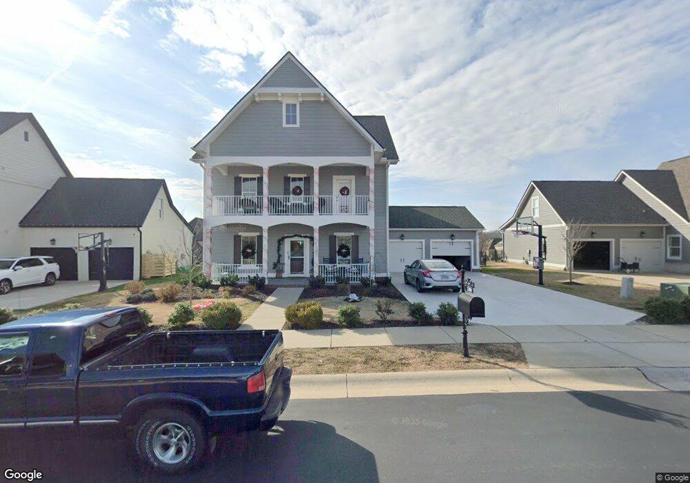
520 Stable St Unit 384 Mount Juliet, TN 37122
Estimated Value: $678,733 - $779,000
4
Beds
3
Baths
2,611
Sq Ft
$282/Sq Ft
Est. Value
About This Home
This home is located at 520 Stable St Unit 384, Mount Juliet, TN 37122 and is currently estimated at $736,933, approximately $282 per square foot. 520 Stable St Unit 384 is a home located in Wilson County with nearby schools including Stoner Creek Elementary School, West Wilson Middle School, and Mt. Juliet High School.
Ownership History
Date
Name
Owned For
Owner Type
Purchase Details
Closed on
Jan 25, 2019
Sold by
Jackson Hills Partners Llc
Bought by
Wilson Daniel and Daschner Leslie
Current Estimated Value
Home Financials for this Owner
Home Financials are based on the most recent Mortgage that was taken out on this home.
Original Mortgage
$366,592
Outstanding Balance
$236,056
Interest Rate
4.6%
Mortgage Type
New Conventional
Estimated Equity
$500,877
Purchase Details
Closed on
Jun 19, 2018
Sold by
Propst Realty Nashville Llc
Bought by
Kackson Hills Partners Llc
Create a Home Valuation Report for This Property
The Home Valuation Report is an in-depth analysis detailing your home's value as well as a comparison with similar homes in the area
Home Values in the Area
Average Home Value in this Area
Purchase History
| Date | Buyer | Sale Price | Title Company |
|---|---|---|---|
| Wilson Daniel | $431,285 | Indmill Title Llc | |
| Kackson Hills Partners Llc | $513,000 | Windmill Title Llc |
Source: Public Records
Mortgage History
| Date | Status | Borrower | Loan Amount |
|---|---|---|---|
| Open | Wilson Daniel | $366,592 |
Source: Public Records
Tax History Compared to Growth
Tax History
| Year | Tax Paid | Tax Assessment Tax Assessment Total Assessment is a certain percentage of the fair market value that is determined by local assessors to be the total taxable value of land and additions on the property. | Land | Improvement |
|---|---|---|---|---|
| 2024 | $2,206 | $115,550 | $20,000 | $95,550 |
| 2022 | $2,197 | $115,100 | $20,000 | $95,100 |
| 2021 | $2,324 | $115,100 | $20,000 | $95,100 |
| 2020 | $2,464 | $115,100 | $20,000 | $95,100 |
| 2019 | $409 | $91,750 | $16,250 | $75,500 |
| 2018 | $409 | $16,250 | $16,250 | $0 |
Source: Public Records
Map
Nearby Homes
- 27 Yearling Way
- 243 Croft Way
- 247 Croft Way
- 270 Croft Way
- 309 Croft Way
- 1012 Zane Dr
- 1010 Zane Dr
- 1019 Zane Dr
- Weston Plan at Bradshaw Farms - Estates
- Ansley Plan at Bradshaw Farms - Estates
- Buchanan Plan at Bradshaw Farms - Estates
- Kingston Plan at Bradshaw Farms - Estates
- Ashford Plan at Bradshaw Farms - Estates
- 701 Plowson Rd
- 1015 Zane Dr
- 1014 Zane Dr
- 1018 Zane Dr
- 1022 Zane Dr
- 1101 Codah Dr
- 2011 Stonebrook Cir
- 520 Stable St
- 520 Stable St
- 520 Stable St
- 522 Stable St Unit 385
- 522 Stable St
- 518 Stable St Unit 383
- 518 Stable St
- 522 Stable St
- 522 Stable St
- 518 Stable St
- 225 Croft Way #334
- 115 Vanner Rd Unit 160
- 115 Vanner Rd
- 523 Stable St
- 524 Stable St Unit 386
- 226 Croft Way Unit 378
- 226 Croft Way
- 113 Vanner Rd Unit 159
- 113 Vanner Rd
- 115 Vanner Rd