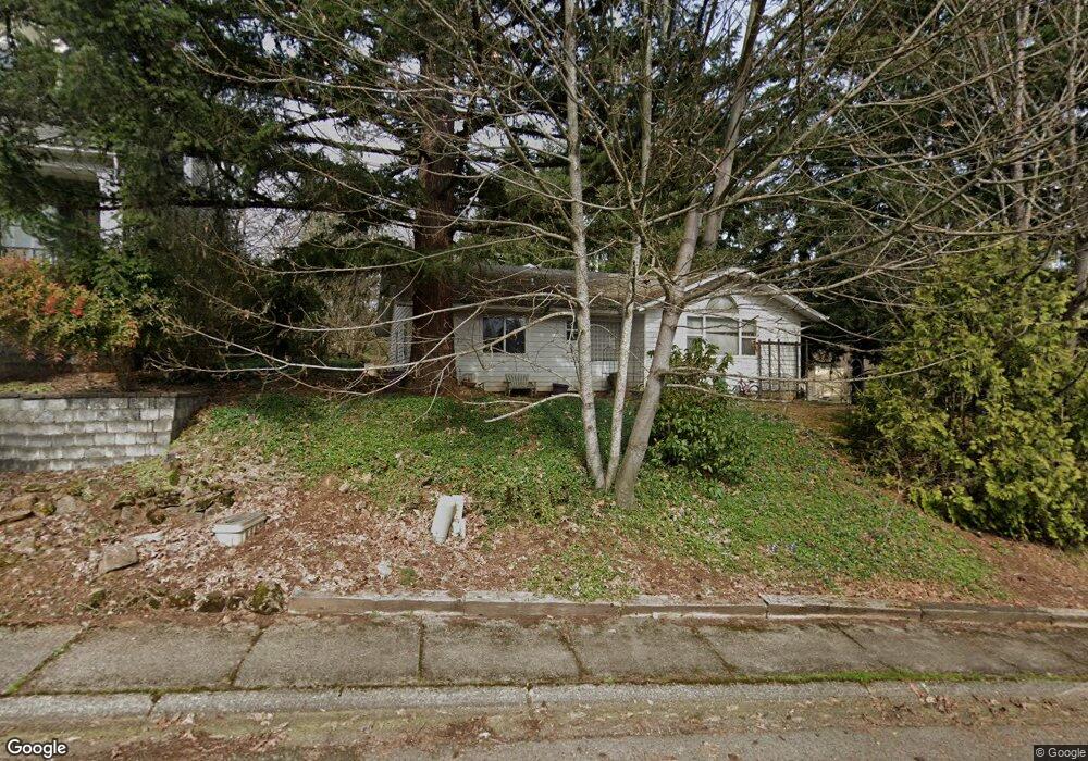
520 Strawberry Loop Sweet Home, OR 97386
Estimated Value: $483,442 - $720,000
4
Beds
3
Baths
2,412
Sq Ft
$249/Sq Ft
Est. Value
About This Home
This home is located at 520 Strawberry Loop, Sweet Home, OR 97386 and is currently estimated at $601,721, approximately $249 per square foot. 520 Strawberry Loop is a home located in Linn County with nearby schools including Sweet Home High School, Sweet Home Charter School, and Little Promises Children's Program.
Ownership History
Date
Name
Owned For
Owner Type
Purchase Details
Closed on
May 12, 2016
Sold by
Austin Verna L
Bought by
Robinson Dale W and Robinson Kelly D
Current Estimated Value
Purchase Details
Closed on
Mar 2, 2011
Sold by
Keen Walter D and Keen Marilyn S
Bought by
Robinson Dale and Robinson Kelly
Home Financials for this Owner
Home Financials are based on the most recent Mortgage that was taken out on this home.
Original Mortgage
$227,461
Interest Rate
4.71%
Mortgage Type
New Conventional
Purchase Details
Closed on
Dec 21, 2005
Sold by
Woody Barbara A
Bought by
Keen Walter D and Keen Marilyn S
Create a Home Valuation Report for This Property
The Home Valuation Report is an in-depth analysis detailing your home's value as well as a comparison with similar homes in the area
Home Values in the Area
Average Home Value in this Area
Purchase History
| Date | Buyer | Sale Price | Title Company |
|---|---|---|---|
| Robinson Dale W | -- | None Available | |
| Robinson Dale | $219,500 | Fidelity Natl Title Co Of Or | |
| Keen Walter D | $224,000 | Amerititle |
Source: Public Records
Mortgage History
| Date | Status | Borrower | Loan Amount |
|---|---|---|---|
| Previous Owner | Robinson Dale | $227,461 |
Source: Public Records
Tax History
| Year | Tax Paid | Tax Assessment Tax Assessment Total Assessment is a certain percentage of the fair market value that is determined by local assessors to be the total taxable value of land and additions on the property. | Land | Improvement |
|---|---|---|---|---|
| 2025 | $7,559 | $305,810 | -- | -- |
| 2024 | $7,348 | $296,910 | -- | -- |
| 2023 | $6,580 | $288,270 | $0 | $0 |
| 2022 | $6,442 | $279,880 | $0 | $0 |
| 2021 | $6,305 | $271,730 | $0 | $0 |
| 2020 | $6,020 | $263,820 | $0 | $0 |
| 2019 | $5,641 | $256,140 | $0 | $0 |
| 2018 | $5,214 | $248,680 | $0 | $0 |
| 2017 | $5,038 | $241,440 | $0 | $0 |
| 2016 | $4,723 | $234,410 | $0 | $0 |
Source: Public Records
Map
Nearby Homes
- 1360 Sunset Ln
- 1421 Sunset Ln
- 1454 Westwood Ln
- 21 Nandina St
- 1248 1st Ave
- 1335 1st Ave
- 1247 1st Ave
- 27329 Rowell Hill Rd
- 1132 2nd Ave
- 1453 45th Ave
- 320 Juniper St
- 451 Oak Terrace
- 805 4th Ave
- 0 Oregon 228 Unit Lot 3 24082871
- 0 Oregon 228 Unit 24446007
- 1720 9th Ave
- 678 5th Ave
- 960 7th Ave
- 1606 11th Ave
- Parcel 2 - 1400 Nandina St
- 546 Strawberry Loop
- 1443 Fern Ln
- 555 Strawberry Loop
- 525 Strawberry Loop
- 580 Strawberry Loop
- 1493 Strawberry Ridge (Lot #7) Dr
- 1483 Fern Ln
- 1492 Fern Ln
- 577 Strawberry Loop
- 577 Strawberry (Next To) Lp
- 497 Strawberry Loop
- 1497 Fern Ln
- 1459 Strawberry Ridge
- 0 Strawberry Crest Unit 6
- 528 Nandina St
- 526 Nandina St
- 546 Nandina St
- TL#4300 Strawberry Loop
- Next To 4300 Strawberry Loop
- Lot 2 Strawberry Loop
Your Personal Tour Guide
Ask me questions while you tour the home.