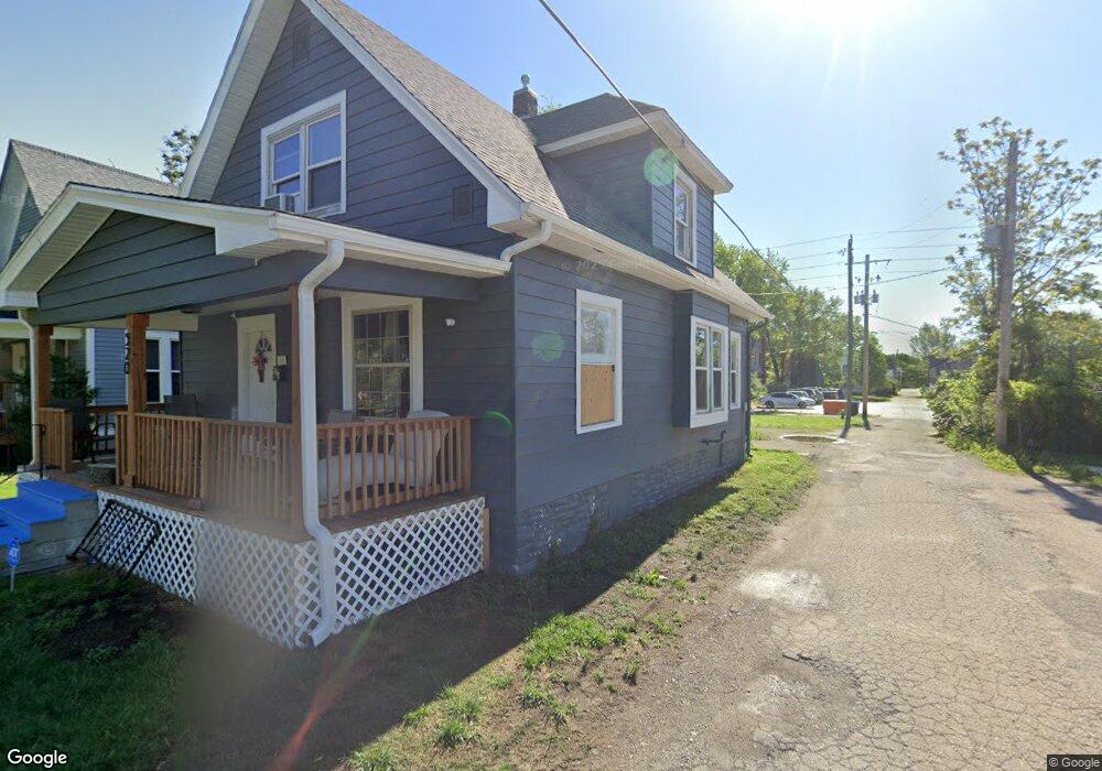
520 SW Lane St Topeka, KS 66606
Estimated Value: $81,000 - $126,000
--
Bed
2
Baths
1,617
Sq Ft
$65/Sq Ft
Est. Value
About This Home
This home is located at 520 SW Lane St, Topeka, KS 66606 and is currently estimated at $105,893, approximately $65 per square foot. 520 SW Lane St is a home located in Shawnee County with nearby schools including Meadows Elementary School, Robinson Middle School, and Topeka High School.
Ownership History
Date
Name
Owned For
Owner Type
Purchase Details
Closed on
Mar 14, 2022
Sold by
Area Robert E & Henrietta
Bought by
Guinn Group Llc
Current Estimated Value
Home Financials for this Owner
Home Financials are based on the most recent Mortgage that was taken out on this home.
Original Mortgage
$159,200
Outstanding Balance
$148,626
Interest Rate
3.85%
Mortgage Type
New Conventional
Estimated Equity
-$42,733
Purchase Details
Closed on
Apr 17, 2008
Sold by
Bullock Dorian L and Bullock Carolynn E
Bought by
Area Robert E and Area William C
Home Financials for this Owner
Home Financials are based on the most recent Mortgage that was taken out on this home.
Original Mortgage
$35,000
Interest Rate
6%
Mortgage Type
Future Advance Clause Open End Mortgage
Create a Home Valuation Report for This Property
The Home Valuation Report is an in-depth analysis detailing your home's value as well as a comparison with similar homes in the area
Home Values in the Area
Average Home Value in this Area
Purchase History
| Date | Buyer | Sale Price | Title Company |
|---|---|---|---|
| Guinn Group Llc | -- | Kansas Secured Title | |
| Area Robert E | -- | Lawyers Title Of Topeka Inc |
Source: Public Records
Mortgage History
| Date | Status | Borrower | Loan Amount |
|---|---|---|---|
| Open | Guinn Group Llc | $159,200 | |
| Previous Owner | Area Robert E | $35,000 |
Source: Public Records
Tax History Compared to Growth
Tax History
| Year | Tax Paid | Tax Assessment Tax Assessment Total Assessment is a certain percentage of the fair market value that is determined by local assessors to be the total taxable value of land and additions on the property. | Land | Improvement |
|---|---|---|---|---|
| 2025 | $1,047 | $8,525 | -- | -- |
| 2023 | $1,047 | $7,659 | $0 | $0 |
| 2022 | $943 | $6,692 | $0 | $0 |
| 2021 | $928 | $6,083 | $0 | $0 |
| 2020 | $717 | $4,821 | $0 | $0 |
| 2019 | $707 | $4,726 | $0 | $0 |
| 2018 | $685 | $4,588 | $0 | $0 |
| 2017 | $687 | $4,588 | $0 | $0 |
| 2014 | $757 | $4,978 | $0 | $0 |
Source: Public Records
Map
Nearby Homes
- 433 SW Lincoln St
- 511 SW Buchanan St
- 634 SW Lincoln St
- 505 SW Clay St
- 711 SW Buchanan St
- 731 SW Lincoln St
- 215 SW Courtland Ave
- 306 SW Clay St
- 435 SW Western Ave
- 312 SW Elmwood Ave
- 223 SW Fillmore St
- 1830 SW Willow Ave
- 0000 SW Elmwood Ave Unit Lots 5,6 Laurel Park
- 131 SW Clay St
- 509 SW Taylor St
- 425 SW Taylor St
- 216 SW Fillmore St
- 348 SW Jewell Ave
- 719 SW Jewell Ave
- 705 SW 6th Ave
- 518 SW Lane St
- 516 SW Lane St
- 1320 SW 6th Ave
- 512 SW Lane St
- 1314 SW 6th Ave
- 510 SW Lane St
- 523 SW Lincoln St
- 1300 SW 6th Ave
- 1400 SW 6th Ave
- 511 SW Lincoln St
- 515 SW Lincoln St
- 1319 SW 5th St
- 1315 SW 5th St
- 521 SW Lane St
- 519 SW Lane St
- 517 SW Lane St
- 509 SW Lincoln St
- 1311 SW 5th St
- 513 SW Lane St
- 1404 SW 6th Ave