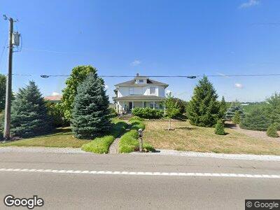
5200 W State Route 41 Covington, OH 45318
Estimated Value: $325,000 - $407,000
3
Beds
3
Baths
3,107
Sq Ft
$117/Sq Ft
Est. Value
About This Home
This home is located at 5200 W State Route 41, Covington, OH 45318 and is currently estimated at $362,265, approximately $116 per square foot. 5200 W State Route 41 is a home located in Miami County with nearby schools including Newton Elementary School, Newton High School, and The Miami Montessori School.
Ownership History
Date
Name
Owned For
Owner Type
Purchase Details
Closed on
Mar 27, 2012
Sold by
Melvin L & Virginia M Fisher Trust
Bought by
Fisher Roland L
Current Estimated Value
Home Financials for this Owner
Home Financials are based on the most recent Mortgage that was taken out on this home.
Original Mortgage
$164,000
Outstanding Balance
$115,890
Interest Rate
3.95%
Mortgage Type
Unknown
Estimated Equity
$252,215
Purchase Details
Closed on
Mar 21, 2012
Sold by
Melvin L & Virginia M Fisher Trust
Bought by
Fisher Roland L
Home Financials for this Owner
Home Financials are based on the most recent Mortgage that was taken out on this home.
Original Mortgage
$164,000
Outstanding Balance
$115,890
Interest Rate
3.95%
Mortgage Type
Unknown
Estimated Equity
$252,215
Purchase Details
Closed on
May 17, 2000
Sold by
Fisher Melvin L and Fisher Virginia M
Bought by
Fisher Melvin L and Fisher Virginia M
Create a Home Valuation Report for This Property
The Home Valuation Report is an in-depth analysis detailing your home's value as well as a comparison with similar homes in the area
Home Values in the Area
Average Home Value in this Area
Purchase History
| Date | Buyer | Sale Price | Title Company |
|---|---|---|---|
| Fisher Roland L | -- | -- | |
| Fisher Roland L | -- | -- | |
| Fisher Melvin L | -- | -- |
Source: Public Records
Mortgage History
| Date | Status | Borrower | Loan Amount |
|---|---|---|---|
| Open | Fisher Melvin L | $164,000 | |
| Closed | Fisher Roland L | $164,000 |
Source: Public Records
Tax History Compared to Growth
Tax History
| Year | Tax Paid | Tax Assessment Tax Assessment Total Assessment is a certain percentage of the fair market value that is determined by local assessors to be the total taxable value of land and additions on the property. | Land | Improvement |
|---|---|---|---|---|
| 2024 | $3,012 | $82,290 | $9,030 | $73,260 |
| 2023 | $3,012 | $82,290 | $9,030 | $73,260 |
| 2022 | $3,060 | $82,290 | $9,030 | $73,260 |
| 2021 | $2,724 | $68,570 | $7,530 | $61,040 |
| 2020 | $2,732 | $68,570 | $7,530 | $61,040 |
| 2019 | $2,554 | $68,570 | $7,530 | $61,040 |
| 2018 | $1,918 | $51,530 | $7,460 | $44,070 |
| 2017 | $1,936 | $51,530 | $7,460 | $44,070 |
| 2016 | $1,912 | $51,530 | $7,460 | $44,070 |
| 2015 | $2,022 | $49,570 | $7,180 | $42,390 |
| 2014 | $2,022 | $49,570 | $7,180 | $42,390 |
| 2013 | $2,042 | $49,570 | $7,180 | $42,390 |
Source: Public Records
Map
Nearby Homes
- 4613 W State Route 41
- 244 Chapel Ct
- 2755 Douglas Dr
- 61 Edward Cir
- 120 Fox Harbor Dr
- 131 S Ludlow St
- 13 N Long St
- 1708 Dover Ave
- 2695 Executive Dr
- 698 E Broadway St
- 109 S Long St
- 1604 Haverhill Dr
- 1800 New Haven Rd
- 1505 Arrowhead Dr
- 2 N Main St
- 1516 Amesbury Ct
- 1503 Amesbury Ct
- 1313 Arrowhead
- 1320 Arrowhead
- 5225 N Front St