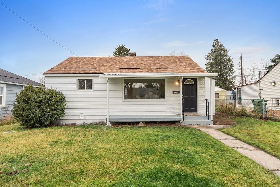
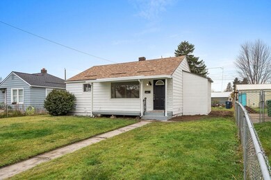
5203 N Cannon St Spokane, WA 99205
Northwest Spokane NeighborhoodEstimated payment $1,932/month
Highlights
- Workshop
- 1-Story Property
- Level Lot
- Fenced Yard
- Forced Air Heating and Cooling System
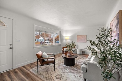
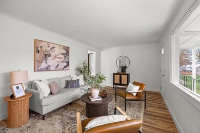
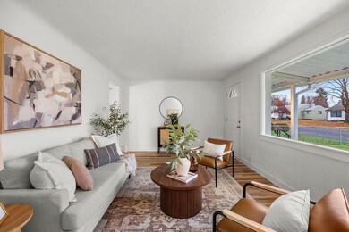
About This Home
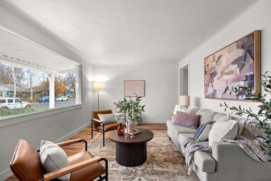
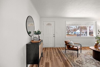
Beautifully updated North Side home in the heart of Shadle! This 3 bed, 2 bath, 1,594 sq ft charmer features all-new flooring, trim, interior/exterior paint, and fully refreshed kitchen and bathrooms. Enjoy peace of mind with a brand-new furnace, newer roof, Hardi siding, double-pane windows, and gas forced air with A/C. The layout offers room to grow with a partially finished basement ready for your vision. Outside, the large level yard is fully fenced front and back, complete with a sprinkler system and convenient alley access with off-street parking options. Located close to shopping, schools, bus routes, and all the amenities that make Shadle such a desirable neighborhood. Move-in ready and beautifully updated—don’t miss this one!
Home Details
Home Type
- Single Family
Est. Annual Taxes
- $2,327
Year Built
- Built in 1943
Lot Details
- 6,534 Sq Ft Lot
- Fenced Yard
- Level Lot
- Sprinkler System
Interior Spaces
- 1,548 Sq Ft Home
- 1-Story Property
Kitchen
- Free-Standing Range
- Microwave
- Dishwasher
Bedrooms and Bathrooms
- 3 Bedrooms
- 2 Bathrooms
Basement
- Basement Fills Entire Space Under The House
- Workshop
Parking
- Alley Access
- Off-Site Parking
Schools
- Flett Middle School
- Shadle Park High School
Utilities
- Forced Air Heating and Cooling System
Listing and Financial Details
- Assessor Parcel Number 26364.2206
Map
Home Values in the Area
Average Home Value in this Area
Tax History
| Year | Tax Paid | Tax Assessment Tax Assessment Total Assessment is a certain percentage of the fair market value that is determined by local assessors to be the total taxable value of land and additions on the property. | Land | Improvement |
|---|---|---|---|---|
| 2025 | $2,327 | $234,200 | $70,000 | $164,200 |
| 2024 | $2,327 | $234,000 | $60,000 | $174,000 |
| 2023 | $2,325 | $231,900 | $60,000 | $171,900 |
| 2022 | $2,125 | $237,200 | $60,000 | $177,200 |
| 2021 | $1,791 | $150,100 | $38,000 | $112,100 |
| 2020 | $1,594 | $128,600 | $32,000 | $96,600 |
| 2019 | $1,361 | $113,500 | $25,000 | $88,500 |
| 2018 | $1,455 | $104,300 | $25,000 | $79,300 |
| 2017 | $1,283 | $93,600 | $25,000 | $68,600 |
| 2016 | $1,208 | $86,200 | $25,000 | $61,200 |
| 2015 | $1,166 | $81,400 | $25,000 | $56,400 |
| 2014 | -- | $86,250 | $23,050 | $63,200 |
| 2013 | -- | $0 | $0 | $0 |
Property History
| Date | Event | Price | List to Sale | Price per Sq Ft |
|---|---|---|---|---|
| 11/18/2025 11/18/25 | For Sale | $329,900 | -- | $213 / Sq Ft |
Purchase History
| Date | Type | Sale Price | Title Company |
|---|---|---|---|
| Warranty Deed | $160,000 | Wfg National Title | |
| Warranty Deed | $105,280 | Stewart Title Of Spokane |
Mortgage History
| Date | Status | Loan Amount | Loan Type |
|---|---|---|---|
| Previous Owner | $78,750 | New Conventional |
Source: Spokane Association of REALTORS®
MLS Number: 202526903
APN: 26364.2206
Disclaimer: Certain information contained herein is derived from information provided by parties other than Homes.com. All information provided is deemed reliable, but is not guaranteed to be accurate and should be independently verified.
![]() IDX information is provided exclusively for personal, non-commercial use, and may not be used for any purpose other than to identify prospective properties consumers may be interested in purchasing.
IDX information is provided exclusively for personal, non-commercial use, and may not be used for any purpose other than to identify prospective properties consumers may be interested in purchasing.
Information is deemed reliable but not guaranteed.
- 5223 N Cannon St
- 5111 N Elgin St
- 2212 W Crown Ave
- 2212 W Queen Ave
- 5027 N Belt St
- 2211 W Rowan Ave
- 2217 W Rowan Ave
- 5522 N Cannon St
- 5516 N Elm St
- 5111 N Maple St
- 5007 N Maple St
- 5403 N Walnut St
- 5708 N Elm St
- 5318 N Walnut St
- 5727 N Cannon St
- 5812 N Elm St
- 4722 N Walnut St
- 2624 W Wabash Ave
- 5804 N Maple St
- 2603 W Broad Ave
- 5709 N C St
- 1829 W Northridge Ct
- 1020 W Lacrosse Ave
- 6614 N Cedar Rd
- 951 W Walton Ave
- 3909 N Wall St
- 6109 N Lidgerwood St
- 4403 W Winston Ct
- 121 E Wedgewood Ave
- 43 E Weile Ave
- 7002 N Colton St
- 6603 N Standard St
- 603-721 E Houston Ave
- 2865 W Elliott Dr
- 2002 N Monroe St
- 910 E Holyoke Ave
- 210 E Lincoln Rd
- 911 E Beacon Ave
- 519 E North Foothills Dr
- 7007 N Nevada St
