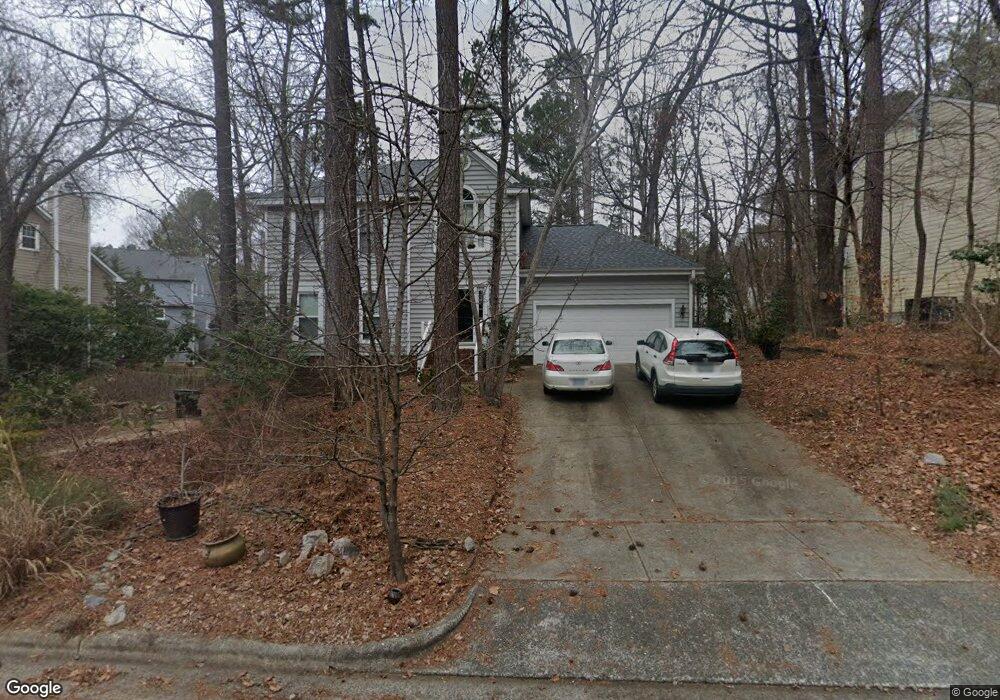
5204 Brookstone Dr Durham, NC 27713
Woodcroft NeighborhoodEstimated Value: $444,000 - $523,000
3
Beds
3
Baths
1,883
Sq Ft
$259/Sq Ft
Est. Value
About This Home
This home is located at 5204 Brookstone Dr, Durham, NC 27713 and is currently estimated at $487,493, approximately $258 per square foot. 5204 Brookstone Dr is a home located in Durham County with nearby schools including Southwest Elementary School, Morehead Montessori, and Sherwood Githens Middle.
Ownership History
Date
Name
Owned For
Owner Type
Purchase Details
Closed on
Jul 26, 2007
Sold by
Shannon Lynwood P and Slickers Jennifer E
Bought by
Kane Judith
Current Estimated Value
Home Financials for this Owner
Home Financials are based on the most recent Mortgage that was taken out on this home.
Original Mortgage
$197,550
Outstanding Balance
$119,140
Interest Rate
5.75%
Mortgage Type
Purchase Money Mortgage
Estimated Equity
$368,353
Purchase Details
Closed on
Aug 2, 2004
Sold by
Calisto Amy Harvey and Calisto Thomas J
Bought by
Shannon Lynwood P and Slickers Jennifer E
Home Financials for this Owner
Home Financials are based on the most recent Mortgage that was taken out on this home.
Original Mortgage
$154,800
Interest Rate
4.87%
Mortgage Type
Purchase Money Mortgage
Create a Home Valuation Report for This Property
The Home Valuation Report is an in-depth analysis detailing your home's value as well as a comparison with similar homes in the area
Home Values in the Area
Average Home Value in this Area
Purchase History
| Date | Buyer | Sale Price | Title Company |
|---|---|---|---|
| Kane Judith | $219,500 | None Available | |
| Shannon Lynwood P | $193,500 | -- |
Source: Public Records
Mortgage History
| Date | Status | Borrower | Loan Amount |
|---|---|---|---|
| Open | Kane Judith | $197,550 | |
| Previous Owner | Shannon Lynwood P | $154,800 |
Source: Public Records
Tax History
| Year | Tax Paid | Tax Assessment Tax Assessment Total Assessment is a certain percentage of the fair market value that is determined by local assessors to be the total taxable value of land and additions on the property. | Land | Improvement |
|---|---|---|---|---|
| 2025 | $4,465 | $450,374 | $135,300 | $315,074 |
| 2024 | $3,638 | $260,825 | $55,305 | $205,520 |
| 2023 | $3,417 | $260,825 | $55,305 | $205,520 |
| 2022 | $3,338 | $260,825 | $55,305 | $205,520 |
| 2021 | $3,323 | $260,825 | $55,305 | $205,520 |
| 2020 | $3,244 | $260,825 | $55,305 | $205,520 |
| 2019 | $3,244 | $260,825 | $55,305 | $205,520 |
| 2018 | $3,174 | $233,996 | $43,015 | $190,981 |
| 2017 | $3,151 | $233,996 | $43,015 | $190,981 |
| 2016 | $3,045 | $233,996 | $43,015 | $190,981 |
| 2015 | $3,105 | $224,271 | $43,851 | $180,420 |
| 2014 | $3,105 | $224,271 | $43,851 | $180,420 |
Source: Public Records
Map
Nearby Homes
- 5219 Oakbrook Dr
- 5315 Oakbrook Dr
- 135 Long Shadow Place
- 3702 Chimney Ridge Place Unit 8
- 118 Old Maple Ln
- 3805 Chimney Ridge Place Unit 104
- 3706 Chimney Ridge Place Unit 8
- 3908 Blakeford Dr
- 609 Windsong Ln
- 4908 Victoria Dr
- 708 Sleepy Creek Dr
- 527 Woodwinds Dr
- 4904 Victoria Dr
- 12 Citation Dr
- 18 W Bridlewood Trail
- 4 Barkridge Ct
- 3908 Sturbridge Dr
- 64 Citation Dr
- 3514 Shady Creek Dr
- 5500 Fortunes Ridge Dr Unit 89B
- 5202 Brookstone Dr
- 5210 Brookstone Dr
- 5211 Longwood Dr
- 5112 Brookstone Dr
- 5213 Longwood Dr
- 5207 Longwood Dr
- 5205 Brookstone Dr
- 5203 Brookstone Dr
- 5207 Brookstone Dr
- 5215 Longwood Dr
- 5201 Brookstone Dr
- 5110 Brookstone Dr
- 5209 Brookstone Dr
- 5113 Brookstone Dr
- 5211 Brookstone Dr
- 5108 Brookstone Dr
- 5222 Oakbrook Dr
- 5224 Oakbrook Dr
- 5111 Brookstone Dr
- 5220 Oakbrook Dr
Your Personal Tour Guide
Ask me questions while you tour the home.