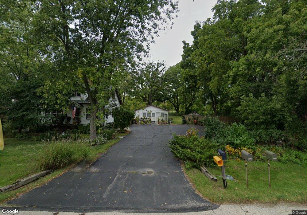
5208 Springbrook Rd Pleasant Prairie, WI 53158
Village of Pleasant Prairie NeighborhoodEstimated Value: $251,000 - $354,000
3
Beds
1
Bath
972
Sq Ft
$301/Sq Ft
Est. Value
About This Home
This home is located at 5208 Springbrook Rd, Pleasant Prairie, WI 53158 and is currently estimated at $292,764, approximately $301 per square foot. 5208 Springbrook Rd is a home located in Kenosha County with nearby schools including Prairie Lane Elementary School, Mahone Middle School, and Indian Trail High School And Academy.
Ownership History
Date
Name
Owned For
Owner Type
Purchase Details
Closed on
Sep 29, 2006
Sold by
Hastings James F
Bought by
Schilf Julie E
Current Estimated Value
Home Financials for this Owner
Home Financials are based on the most recent Mortgage that was taken out on this home.
Original Mortgage
$142,000
Interest Rate
6.25%
Mortgage Type
Adjustable Rate Mortgage/ARM
Create a Home Valuation Report for This Property
The Home Valuation Report is an in-depth analysis detailing your home's value as well as a comparison with similar homes in the area
Home Values in the Area
Average Home Value in this Area
Purchase History
| Date | Buyer | Sale Price | Title Company |
|---|---|---|---|
| Schilf Julie E | $177,500 | None Available |
Source: Public Records
Mortgage History
| Date | Status | Borrower | Loan Amount |
|---|---|---|---|
| Closed | Schilf Julie E | $142,000 |
Source: Public Records
Tax History Compared to Growth
Tax History
| Year | Tax Paid | Tax Assessment Tax Assessment Total Assessment is a certain percentage of the fair market value that is determined by local assessors to be the total taxable value of land and additions on the property. | Land | Improvement |
|---|---|---|---|---|
| 2024 | $2,493 | $227,100 | $95,700 | $131,400 |
| 2023 | $2,431 | $195,400 | $87,000 | $108,400 |
| 2022 | $2,484 | $195,400 | $87,000 | $108,400 |
| 2021 | $2,778 | $154,400 | $74,000 | $80,400 |
| 2020 | $2,778 | $154,400 | $74,000 | $80,400 |
| 2019 | $2,534 | $154,400 | $74,000 | $80,400 |
| 2018 | $3,038 | $154,400 | $74,000 | $80,400 |
| 2017 | $2,598 | $139,700 | $69,600 | $70,100 |
| 2016 | $2,977 | $139,700 | $69,600 | $70,100 |
| 2015 | $2,561 | $132,100 | $65,300 | $66,800 |
| 2014 | $2,745 | $132,100 | $65,300 | $66,800 |
Source: Public Records
Map
Nearby Homes
- Lt30 Cedar Ridge Ct
- Lt32 Cedar Ridge Ct
- Lt17 Cedar Ridge Ct
- Lt24 Cedar Ridge Ct
- Lt18 Cedar Ridge Ct
- Lt34 Cedar Ridge Ct
- Lt25 Cedar Ridge Ct
- Lt23 Cedar Ridge Ct
- Lt12 113th St
- Lt15 113th St
- Lt35 113th St
- Lt19 Cedar Ridge Ct
- Lt6 113th St
- Lt14 113th St
- Lt2 113th St
- Lt10 113th St
- Lt7 113th St
- Lt3 113th St
- Lt5 113th St
- Deerfield Plan at Cedar Ridge
- 5222 Springbrook Rd
- 5117 Springbrook Rd
- 5304 Springbrook Rd
- 5107 Springbrook Rd
- 5313 Springbrook Rd
- 5101 Springbrook Rd
- 5100 Springbrook Rd
- 5045 Springbrook Rd
- 5037 Springbrook Rd
- 5327 Springbrook Rd
- 5031 Springbrook Rd
- 5004 Springbrook Rd
- 5029 Springbrook Rd
- 5401 Springbrook Rd
- 5015 Springbrook Rd
- 4988 Springbrook Rd
- 5005 Springbrook Rd
- 4941 Springbrook Rd
- 5500 Springbrook Rd
- 5427 Springbrook Rd