Estimated Value: $158,000 - $245,000
Studio
--
Bath
2,644
Sq Ft
$70/Sq Ft
Est. Value
About This Home
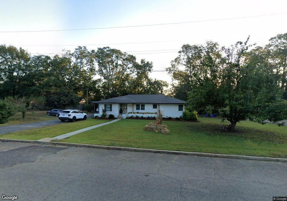
This home is located at 521 2nd Ave SW, Magee, MS 39111 and is currently estimated at $183,853, approximately $69 per square foot. 521 2nd Ave SW is a home with nearby schools including Magee Elementary School, Magee Middle School, and Magee High School.
Ownership History
Date
Name
Owned For
Owner Type
Purchase Details
Closed on
Aug 4, 2021
Sold by
Gail Mayhall Eva
Bought by
Cheramie Tyler and Cheramie Nicole M
Current Estimated Value
Home Financials for this Owner
Home Financials are based on the most recent Mortgage that was taken out on this home.
Original Mortgage
$153,195
Outstanding Balance
$138,016
Interest Rate
3%
Mortgage Type
New Conventional
Estimated Equity
$45,837
Purchase Details
Closed on
Jan 14, 2009
Sold by
Mayhall David N and Mayhall Eva Gail
Bought by
Mayhall Eva Gail
Create a Home Valuation Report for This Property
The Home Valuation Report is an in-depth analysis detailing your home's value as well as a comparison with similar homes in the area
Home Values in the Area
Average Home Value in this Area
Purchase History
| Date | Buyer | Sale Price | Title Company |
|---|---|---|---|
| Cheramie Tyler | -- | None Listed On Document | |
| Mayhall Eva Gail | -- | -- |
Source: Public Records
Mortgage History
| Date | Status | Borrower | Loan Amount |
|---|---|---|---|
| Open | Cheramie Tyler | $153,195 |
Source: Public Records
Tax History
| Year | Tax Paid | Tax Assessment Tax Assessment Total Assessment is a certain percentage of the fair market value that is determined by local assessors to be the total taxable value of land and additions on the property. | Land | Improvement |
|---|---|---|---|---|
| 2025 | $1,102 | $10,173 | $0 | $0 |
| 2024 | $1,102 | $9,430 | $0 | $0 |
| 2023 | $994 | $9,309 | $0 | $0 |
| 2022 | $944 | $9,309 | $0 | $0 |
| 2021 | $924 | $9,309 | $0 | $0 |
| 2020 | $816 | $8,486 | $0 | $0 |
| 2019 | $1,003 | $8,486 | $0 | $0 |
| 2018 | $1,003 | $8,486 | $0 | $0 |
| 2017 | $1,003 | $8,486 | $0 | $0 |
| 2016 | $958 | $8,402 | $0 | $0 |
| 2015 | $929 | $8,402 | $0 | $0 |
| 2014 | $1,506 | $12,604 | $0 | $0 |
Source: Public Records
Map
Nearby Homes
- 212 2nd Ave SW
- 227 1st St SW
- 00 Hwy 49 N @13th St Se and 149 N
- 00 8th Ave
- 0 Eighth Ave Unit 1261667
- 612 Laurel Dr SE
- 520 Choctaw St E
- 211 3rd St NE
- 305 3rd Ave NW
- 702 2nd St SE
- 600 Goodwater Rd NW
- 429 1st Ave NE
- 510 Kennedy Dr NW
- 225 7th Ave SE
- 605 1st St NE
- 0 8th Ave Unit 4132915
- 522 Kennedy Dr NW
- 632 2nd Ave NW
- 621 Magnolia Ave NW
- 602 Simpson Highway 149