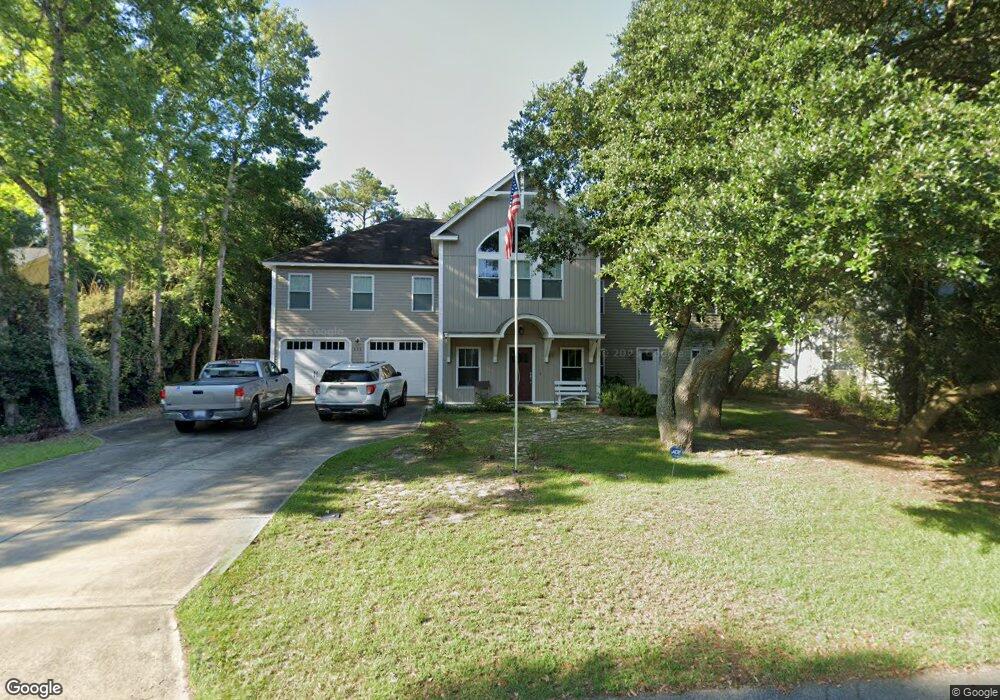
521 Canal Dr Unit 34 Kill Devil Hills, NC 27948
Estimated Value: $602,000 - $929,000
4
Beds
4
Baths
3,460
Sq Ft
$231/Sq Ft
Est. Value
About This Home
This home is located at 521 Canal Dr Unit 34, Kill Devil Hills, NC 27948 and is currently estimated at $797,666, approximately $230 per square foot. 521 Canal Dr Unit 34 is a home located in Dare County with nearby schools including Nags Head Elementary School, First Flight Middle School, and First Flight High School.
Ownership History
Date
Name
Owned For
Owner Type
Purchase Details
Closed on
Dec 10, 2009
Sold by
Church Dawn R
Bought by
Aidoock Clifton W and Aidoock Ellen Loy
Current Estimated Value
Purchase Details
Closed on
Jul 9, 2008
Sold by
Lamp Patricia L
Bought by
Church Dawn R
Home Financials for this Owner
Home Financials are based on the most recent Mortgage that was taken out on this home.
Original Mortgage
$298,860
Interest Rate
6.03%
Mortgage Type
Purchase Money Mortgage
Create a Home Valuation Report for This Property
The Home Valuation Report is an in-depth analysis detailing your home's value as well as a comparison with similar homes in the area
Home Values in the Area
Average Home Value in this Area
Purchase History
| Date | Buyer | Sale Price | Title Company |
|---|---|---|---|
| Aidoock Clifton W | $390,000 | None Available | |
| Church Dawn R | $120,000 | None Available |
Source: Public Records
Mortgage History
| Date | Status | Borrower | Loan Amount |
|---|---|---|---|
| Previous Owner | Church Dawn R | $298,860 |
Source: Public Records
Tax History Compared to Growth
Tax History
| Year | Tax Paid | Tax Assessment Tax Assessment Total Assessment is a certain percentage of the fair market value that is determined by local assessors to be the total taxable value of land and additions on the property. | Land | Improvement |
|---|---|---|---|---|
| 2025 | $2,381 | $876,800 | $178,800 | $698,000 |
| 2024 | $1,846 | $488,700 | $84,900 | $403,800 |
| 2023 | $3,692 | $488,700 | $84,900 | $403,800 |
| 2022 | $3,521 | $488,700 | $84,900 | $403,800 |
| 2021 | $3,521 | $488,700 | $84,900 | $403,800 |
| 2020 | $3,521 | $488,700 | $84,900 | $403,800 |
| 2019 | $3,486 | $400,700 | $85,000 | $315,700 |
| 2018 | $3,410 | $400,700 | $85,000 | $315,700 |
| 2017 | $3,410 | $400,700 | $85,000 | $315,700 |
| 2016 | $3,249 | $400,700 | $85,000 | $315,700 |
| 2014 | $3,129 | $400,700 | $85,000 | $315,700 |
Source: Public Records
Map
Nearby Homes
- 1402 Harpoon Dr Unit Lot 88
- 524 Anika Way Unit Lot 30
- 603 W Landing Dr Unit Lot 93
- 330 Canal Dr Unit 170
- 708 Harmony Ln Unit Lot 15
- 701 Zen Ln Unit Lot 57
- 703 Zen Ln Unit Lot 58
- 705 Zen Ln Unit Lot 59
- 509 Telegraph Ct Unit Lot 17
- 700 W First St Unit E-11
- 1320 Water Oak Dr Unit Lot 4
- 1204 Indian Dr Unit Lot 29
- 1304 Water Oak Dr Unit Lot 12
- 1705 Sea Swept Rd Unit Lot 26
- 403 Indian Dr Unit Lot 7
- 1308 Water Oak Dr Unit Lot 10
- 1716 Upper Dune Rd Unit Lot 13
- 102 E Landing Dr Unit Lot 2
- 105 Camellia Dr Unit Lot 7
- 1613 N Croatan Hwy Unit 23
- 521 Canal Dr
- 519 Canal Dr
- 525 Canal Dr
- 516 Canal Dr
- 518 Canal Dr Unit 137
- 518 Canal Dr
- 512 Canal Dr
- 514 Canal Dr Unit 134-35
- 601 Canal Dr
- 515 Canal Dr Unit 31 & p.32
- 515 Canal Dr
- 527 First Flight Ln
- 1503 Ketch Ln
- 510 Canal Dr
- 600 Canal Dr
- 525 First Flight Ln
- 1501 Ketch Ln
- 517 Mccabe Ct
- 514 First Flight Ln Unit 75
- 514 First Flight Ln