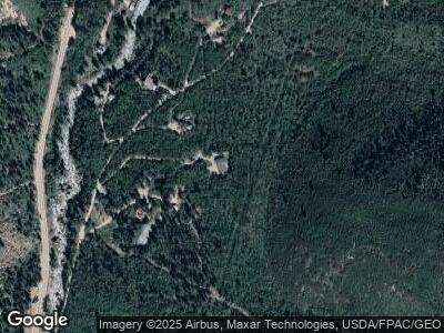
521 Dorais Way Redstone, CO 81623
Estimated Value: $1,360,000 - $2,068,000
4
Beds
4
Baths
3,077
Sq Ft
$578/Sq Ft
Est. Value
About This Home
This home is located at 521 Dorais Way, Redstone, CO 81623 and is currently estimated at $1,777,000, approximately $577 per square foot. 521 Dorais Way is a home located in Pitkin County.
Ownership History
Date
Name
Owned For
Owner Type
Purchase Details
Closed on
Jan 20, 2021
Sold by
Ramge Renee K
Bought by
Renee K Ramge Revocable Trust
Current Estimated Value
Home Financials for this Owner
Home Financials are based on the most recent Mortgage that was taken out on this home.
Original Mortgage
$318,000
Outstanding Balance
$287,689
Interest Rate
2.71%
Mortgage Type
New Conventional
Estimated Equity
$1,656,311
Purchase Details
Closed on
Apr 17, 2017
Sold by
Seevers Mark and Seevers Suzanne
Bought by
Everson Dee Stacy and Mrotek Maciej A
Purchase Details
Closed on
Jun 21, 2016
Sold by
Ramge Renee K
Bought by
Renee K Ramge Revocable Living Trust
Purchase Details
Closed on
Feb 23, 2004
Sold by
Kotwicki Victor I
Bought by
Vmb Llc
Purchase Details
Closed on
Feb 2, 2001
Sold by
Kotwicki Victor L
Bought by
Dorais William J and Dorais Mary C
Create a Home Valuation Report for This Property
The Home Valuation Report is an in-depth analysis detailing your home's value as well as a comparison with similar homes in the area
Home Values in the Area
Average Home Value in this Area
Purchase History
| Date | Buyer | Sale Price | Title Company |
|---|---|---|---|
| Renee K Ramge Revocable Trust | -- | Land Title Guarantee | |
| Ramge Renee K | -- | Land Title Guarantee | |
| Everson Dee Stacy | $147,500 | Land Title Guarantee Company | |
| Renee K Ramge Revocable Living Trust | -- | None Available | |
| Vmb Llc | -- | -- | |
| Dorais William J | -- | -- |
Source: Public Records
Mortgage History
| Date | Status | Borrower | Loan Amount |
|---|---|---|---|
| Open | Ramge Renee K | $318,000 | |
| Previous Owner | The Renee K Ramge Revocable Living Trust | $323,000 |
Source: Public Records
Tax History Compared to Growth
Tax History
| Year | Tax Paid | Tax Assessment Tax Assessment Total Assessment is a certain percentage of the fair market value that is determined by local assessors to be the total taxable value of land and additions on the property. | Land | Improvement |
|---|---|---|---|---|
| 2024 | $8,062 | $115,040 | $14,610 | $100,430 |
| 2023 | $8,062 | $118,850 | $15,090 | $103,760 |
| 2022 | $5,290 | $69,050 | $12,160 | $56,890 |
| 2021 | $5,338 | $71,040 | $12,510 | $58,530 |
| 2020 | $4,216 | $58,920 | $10,730 | $48,190 |
| 2019 | $4,216 | $58,920 | $10,730 | $48,190 |
| 2018 | $4,474 | $59,330 | $10,800 | $48,530 |
| 2017 | $4,104 | $61,880 | $21,600 | $40,280 |
| 2016 | $4,449 | $65,670 | $23,880 | $41,790 |
| 2015 | $4,511 | $65,670 | $23,880 | $41,790 |
| 2014 | $4,637 | $72,850 | $19,900 | $52,950 |
Source: Public Records
Map
Nearby Homes
- 135 Irwin Dr
- TBD Firehouse Rd
- 450 Coal Creek Rd
- TBD Elk Mountain Dr
- 389 Elk Mountain Dr
- TBD County Rd Unit 102
- 189 Ute Trail
- 95 Chair Mountain Dr
- 212 Cherokee Ln
- 283 Cherokee Ln
- 175 Big Horn Ln
- 131 Aspen St
- 6855 Capitol Creek Rd
- 3900 County Road 3
- TBD Serpentine Trail
- 787 Serpentine Trail
- 315 Forest Service Rd
- TBD W Village Dr Unit Lot A-1
- TBD Onyx Ln
- 1468 W Main St
