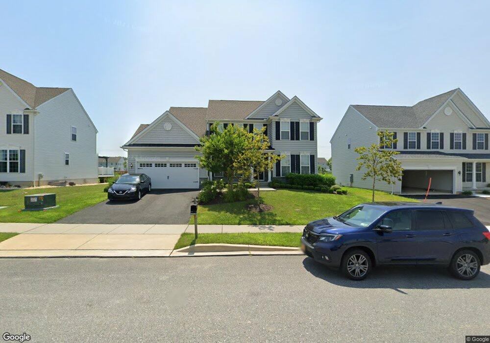
521 Goldsborough Dr Unit 2 Townsend, DE 19734
Estimated Value: $519,000 - $621,000
4
Beds
3
Baths
2,208
Sq Ft
$249/Sq Ft
Est. Value
About This Home
This home is located at 521 Goldsborough Dr Unit 2, Townsend, DE 19734 and is currently estimated at $549,750, approximately $248 per square foot. 521 Goldsborough Dr Unit 2 is a home located in New Castle County with nearby schools including Old State Elementary School, Cantwell's Bridge Middle School, and Odessa High School.
Ownership History
Date
Name
Owned For
Owner Type
Purchase Details
Closed on
Jun 1, 2018
Sold by
Handler Mark L and Handler Ruth M
Bought by
Broward Associates Llc
Current Estimated Value
Purchase Details
Closed on
May 16, 2015
Bought by
Goldsborough Investment Llc
Create a Home Valuation Report for This Property
The Home Valuation Report is an in-depth analysis detailing your home's value as well as a comparison with similar homes in the area
Home Values in the Area
Average Home Value in this Area
Purchase History
| Date | Buyer | Sale Price | Title Company |
|---|---|---|---|
| Broward Associates Llc | -- | None Available | |
| Handler Mark L | -- | None Available | |
| Goldsborough Investment Llc | -- | -- |
Source: Public Records
Tax History Compared to Growth
Tax History
| Year | Tax Paid | Tax Assessment Tax Assessment Total Assessment is a certain percentage of the fair market value that is determined by local assessors to be the total taxable value of land and additions on the property. | Land | Improvement |
|---|---|---|---|---|
| 2024 | $4,593 | $106,300 | $7,500 | $98,800 |
| 2023 | $3,927 | $106,300 | $7,500 | $98,800 |
| 2022 | $3,933 | $106,300 | $7,500 | $98,800 |
| 2021 | $3,883 | $106,300 | $7,500 | $98,800 |
| 2020 | $3,829 | $106,300 | $7,500 | $98,800 |
| 2019 | $3,554 | $106,300 | $7,500 | $98,800 |
| 2018 | $3,437 | $106,300 | $7,500 | $98,800 |
| 2017 | $3,297 | $106,300 | $7,500 | $98,800 |
| 2016 | $105 | $3,700 | $3,700 | $0 |
| 2015 | $102 | $3,700 | $3,700 | $0 |
| 2014 | $102 | $3,700 | $3,700 | $0 |
Source: Public Records
Map
Nearby Homes
- 1068 Robinson Rd Unit DELRAY PLAN
- 1066 Robinson Rd Unit PEMBROOK PLAN
- 1064 Robinson Rd Unit LAKELAND PLAN
- 1062 Robinson Rd Unit WHITFIELD RANCH PLAN
- 1060 Robinson Rd Unit WHITFIELD PLAN
- 119 Abbigail Crossing
- 214 Case Rd
- 212 Case Rd
- 195 Case Rd
- 210 Case Rd
- 208 Case Rd
- 206 Case Rd
- 202 Case Rd
- 1027 Robinson Rd
- 660 Courtly Rd
- 1019 Robinson Rd
- 1143 Kayla Ln
- 1020 Robinson Rd
- 636 Courtly Rd
- 628 Courtly Rd
- 521 Goldsborough Dr
- 521 Goldsborough Dr Unit 1
- 523 Goldsborough Dr
- 519 Goldsborough Dr
- 517 Goldsborough Dr
- 401 Janets Way
- 385 Robinson Rd
- 1019 Fieldsboro Rd
- 402 Janets Way
- 379 Robinson Rd
- 404 Janets Way
- 529 Goldsborough Dr
- 527 Goldsborough Dr
- 525 Goldsborough Dr
- 403 Janets Way
- 405 Janets Way
- 910 Ravenglass Dr
- 377 Robinson Rd
- 910 Robinson Rd
- 407 Janets Way