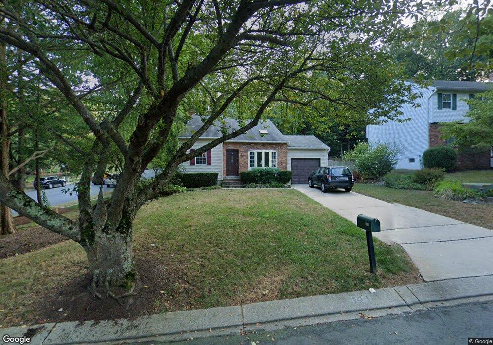
521 Norton Ln Arnold, MD 21012
Estimated Value: $521,853 - $632,000
--
Bed
3
Baths
1,730
Sq Ft
$334/Sq Ft
Est. Value
About This Home
This home is located at 521 Norton Ln, Arnold, MD 21012 and is currently estimated at $576,963, approximately $333 per square foot. 521 Norton Ln is a home located in Anne Arundel County with nearby schools including Broadneck Elementary School, Magothy River Middle School, and Broadneck High School.
Ownership History
Date
Name
Owned For
Owner Type
Purchase Details
Closed on
Oct 25, 2012
Sold by
Preece Charlotte P and Preece Richard M
Bought by
Preece Charlotte P
Current Estimated Value
Home Financials for this Owner
Home Financials are based on the most recent Mortgage that was taken out on this home.
Original Mortgage
$30,000
Outstanding Balance
$17,641
Interest Rate
3.42%
Mortgage Type
Credit Line Revolving
Estimated Equity
$559,322
Purchase Details
Closed on
Nov 22, 1982
Bought by
Preece Richard M
Home Financials for this Owner
Home Financials are based on the most recent Mortgage that was taken out on this home.
Original Mortgage
$99,850
Interest Rate
13.78%
Create a Home Valuation Report for This Property
The Home Valuation Report is an in-depth analysis detailing your home's value as well as a comparison with similar homes in the area
Home Values in the Area
Average Home Value in this Area
Purchase History
| Date | Buyer | Sale Price | Title Company |
|---|---|---|---|
| Preece Charlotte P | -- | Consumer Real Estate Title I | |
| Preece Richard M | $99,600 | -- |
Source: Public Records
Mortgage History
| Date | Status | Borrower | Loan Amount |
|---|---|---|---|
| Open | Preece Charlotte P | $30,000 | |
| Closed | Preece Richard M | $99,850 |
Source: Public Records
Tax History Compared to Growth
Tax History
| Year | Tax Paid | Tax Assessment Tax Assessment Total Assessment is a certain percentage of the fair market value that is determined by local assessors to be the total taxable value of land and additions on the property. | Land | Improvement |
|---|---|---|---|---|
| 2025 | $3,374 | $437,700 | -- | -- |
| 2024 | $3,374 | $415,100 | $255,300 | $159,800 |
| 2023 | $3,288 | $412,800 | $0 | $0 |
| 2022 | $3,085 | $410,500 | $0 | $0 |
| 2021 | $2,941 | $408,200 | $255,300 | $152,900 |
| 2020 | $2,941 | $394,100 | $0 | $0 |
| 2019 | $2,886 | $380,000 | $0 | $0 |
| 2018 | $3,710 | $365,900 | $215,300 | $150,600 |
| 2017 | $2,722 | $362,867 | $0 | $0 |
| 2016 | -- | $359,833 | $0 | $0 |
| 2015 | -- | $356,800 | $0 | $0 |
| 2014 | -- | $356,500 | $0 | $0 |
Source: Public Records
Map
Nearby Homes
- 516 Norton Ln
- 1256 Crowell Ct
- 1215 Driftwood Ct
- 1217 Springwood Ct
- 400 Colonial Ridge Ln
- 249 Overleaf Dr
- 1205 Farley Ct N
- 507 Greenblades Ct
- 303 Ternwing Dr
- 515 Bay Hills Dr
- 493 Colonial Ridge Ln
- 1182 Palmwood Ct
- 1180 Mosswood Ct
- 349 Candle Ridge Ct
- 1078 Brightleaf Ct
- 923 Whitstable Blvd
- 478 Bay Green Dr
- 618 Andrew Hill Rd
- 33 Sheridan Rd
- 633 Andrew Hill Rd
- 519 Norton Ln
- 1246A Doubleday Dr
- 517 Norton Ln
- 1248 Doubleday Dr
- 1247 Doubleday Dr
- 522 Norton Ln
- 524 Norton Ln
- 1249 Doubleday Dr
- 1250 Doubleday Dr
- 520 Norton Ln
- 515 Norton Ln
- 526 Norton Ln
- 527 Norton Ln
- 1251 Doubleday Dr
- 528 Norton Ln
- 1254 Doubleday Dr
- 1252 Doubleday Dr
- 513 Norton Ln
- 1253 Doubleday Dr
- 529 Norton Ln