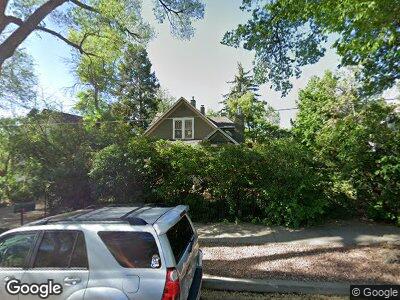
521 W Dale St Colorado Springs, CO 80905
Westside NeighborhoodEstimated Value: $410,233 - $501,000
3
Beds
1
Bath
1,321
Sq Ft
$338/Sq Ft
Est. Value
About This Home
This home is located at 521 W Dale St, Colorado Springs, CO 80905 and is currently estimated at $446,808, approximately $338 per square foot. 521 W Dale St is a home located in El Paso County with nearby schools including Bristol Elementary, School of the Arts and STEM, Holmes Middle School, and Coronado High School.
Ownership History
Date
Name
Owned For
Owner Type
Purchase Details
Closed on
Mar 30, 1999
Sold by
Robert Czajkowski
Bought by
Witherow Sean R and Witherow Leah Davis
Current Estimated Value
Home Financials for this Owner
Home Financials are based on the most recent Mortgage that was taken out on this home.
Original Mortgage
$162,910
Interest Rate
6.82%
Mortgage Type
FHA
Purchase Details
Closed on
Sep 1, 1985
Bought by
Witherow Leah D
Purchase Details
Closed on
Jun 1, 1981
Bought by
Witherow Sean R
Create a Home Valuation Report for This Property
The Home Valuation Report is an in-depth analysis detailing your home's value as well as a comparison with similar homes in the area
Home Values in the Area
Average Home Value in this Area
Purchase History
| Date | Buyer | Sale Price | Title Company |
|---|---|---|---|
| Witherow Sean R | $164,000 | First American | |
| Witherow Leah D | -- | -- | |
| Witherow Sean R | -- | -- |
Source: Public Records
Mortgage History
| Date | Status | Borrower | Loan Amount |
|---|---|---|---|
| Open | Witherow Sean R | $105,600 | |
| Closed | Witherow Sean R | $139,700 | |
| Closed | Witherow Sean R | $159,000 | |
| Closed | Witherow Sean R | $162,910 |
Source: Public Records
Tax History Compared to Growth
Tax History
| Year | Tax Paid | Tax Assessment Tax Assessment Total Assessment is a certain percentage of the fair market value that is determined by local assessors to be the total taxable value of land and additions on the property. | Land | Improvement |
|---|---|---|---|---|
| 2024 | $1,278 | $29,470 | $5,730 | $23,740 |
| 2022 | $1,190 | $21,270 | $3,960 | $17,310 |
| 2021 | $1,292 | $21,890 | $4,080 | $17,810 |
| 2020 | $1,292 | $19,030 | $3,470 | $15,560 |
| 2019 | $1,285 | $19,030 | $3,470 | $15,560 |
| 2018 | $1,119 | $15,250 | $3,200 | $12,050 |
| 2017 | $1,060 | $15,250 | $3,200 | $12,050 |
| 2016 | $860 | $14,840 | $3,530 | $11,310 |
| 2015 | $857 | $14,840 | $3,530 | $11,310 |
| 2014 | $820 | $13,620 | $3,180 | $10,440 |
Source: Public Records
Map
Nearby Homes
- 549 W Dale St Unit 569
- 565 W Dale St
- 735 N Walnut St
- 610 N Tower St
- 738 Harrison Place
- 976 Uintah Bluffs Place
- 314 Nichols Ct
- 522 N Spruce St
- 831 Manitou Blvd
- 505 N Spruce St
- 444 N Spruce St
- 325 W Saint Vrain St
- 427 N Walnut St
- 317 W Saint Vrain St
- 1355 Talley Cir
- 1345 Talley Cir
- 1407 Manitou Blvd
- 660 Pony Ln
- 240 N Limit St
- 426 W Platte Ave
- 521 W Dale St
- 523 W Dale St
- 517 W Dale St
- 529 W Dale St
- 509 W Dale St
- 533 W Dale St
- 520 W Monument St
- 526 W Monument St
- 537 W Dale St
- 518 W Monument St
- 528 W Monument St
- 532 W Monument St
- 526 W Dale St
- 516 W Dale St
- 740 N Walnut St
- 734 N Walnut St
- 746 N Walnut St
- 510 W Monument St
- 530 W Dale St
- 541 W Dale St