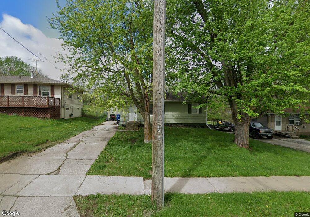
5216 South Union St Des Moines, IA 50315
South Central DSM NeighborhoodEstimated Value: $166,000 - $201,000
3
Beds
1
Bath
840
Sq Ft
$218/Sq Ft
Est. Value
About This Home
This home is located at 5216 South Union St, Des Moines, IA 50315 and is currently estimated at $182,907, approximately $217 per square foot. 5216 South Union St is a home located in Polk County with nearby schools including South Union Elementary School, Brody Middle School, and Lincoln High School.
Ownership History
Date
Name
Owned For
Owner Type
Purchase Details
Closed on
Nov 5, 2010
Sold by
Federal National Mortgage Association
Bought by
Third Llc
Current Estimated Value
Purchase Details
Closed on
Jun 10, 2010
Sold by
Smith Belinda and Northland Mortgage Company
Bought by
Amtrust Bank
Purchase Details
Closed on
Feb 19, 2010
Sold by
Amtrust Bank
Bought by
Federal National Mortgage Association
Create a Home Valuation Report for This Property
The Home Valuation Report is an in-depth analysis detailing your home's value as well as a comparison with similar homes in the area
Home Values in the Area
Average Home Value in this Area
Purchase History
| Date | Buyer | Sale Price | Title Company |
|---|---|---|---|
| Third Llc | -- | None Available | |
| Amtrust Bank | $36,937 | None Available | |
| Federal National Mortgage Association | $36,500 | None Available |
Source: Public Records
Tax History Compared to Growth
Tax History
| Year | Tax Paid | Tax Assessment Tax Assessment Total Assessment is a certain percentage of the fair market value that is determined by local assessors to be the total taxable value of land and additions on the property. | Land | Improvement |
|---|---|---|---|---|
| 2025 | $2,876 | $164,500 | $32,800 | $131,700 |
| 2024 | $2,876 | $146,200 | $28,700 | $117,500 |
| 2023 | $2,786 | $146,200 | $28,700 | $117,500 |
| 2022 | $2,764 | $118,200 | $23,600 | $94,600 |
| 2021 | $2,598 | $118,200 | $23,600 | $94,600 |
| 2020 | $2,698 | $104,100 | $20,700 | $83,400 |
| 2019 | $2,510 | $104,100 | $20,700 | $83,400 |
| 2018 | $2,484 | $93,400 | $18,200 | $75,200 |
| 2017 | $2,308 | $93,400 | $18,200 | $75,200 |
| 2016 | $2,248 | $85,300 | $16,600 | $68,700 |
| 2015 | $2,248 | $85,300 | $16,600 | $68,700 |
| 2014 | $2,108 | $79,300 | $15,400 | $63,900 |
Source: Public Records
Map
Nearby Homes
- 5501 S Union St
- 299 Hackley Ave
- 212 Titus Ave
- 303 Porter Ave
- 520 Hackley Ave
- 304 Herold Ave
- 311 E Emma Ave
- 5814 SW 3rd St
- 5936 SW 2nd St
- 5600 SE 4th St
- 5402 SW 8th St
- 5812 SW 5th St
- 5407 SW 9th St
- 126 E Maxwelton Dr
- 209 E Philip St
- 612 Emma Ave
- 515 Emma Ave
- 217 E Payton Ave
- 401 E Wall Ave
- 108 E Philip St
- 5216 S Union St
- 5220 South Union St
- 5212 South Union St
- 5300 South Union St
- 5300 S Union St
- 5221 S Union St
- 5306 South Union St
- 5211 South Union St
- 5305 S Union St
- 5221 South Union St
- 5312 S Union St
- 5312 South Union St
- 5301 South Union St
- 5301 S Union St
- 5305 South Union St
- 5309 South Union St
- 5316 South Union St
- 5313 South Union St
- 111 Kenyon Ave
- 5201 S Union St