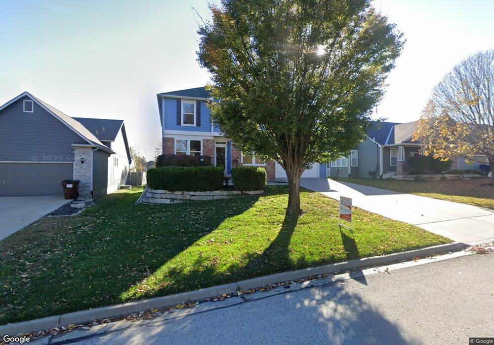
5217 Carson Dr Lawrence, KS 66049
West Lawrence NeighborhoodEstimated Value: $430,589 - $469,000
4
Beds
4
Baths
2,589
Sq Ft
$172/Sq Ft
Est. Value
About This Home
This home is located at 5217 Carson Dr, Lawrence, KS 66049 and is currently estimated at $444,647, approximately $171 per square foot. 5217 Carson Dr is a home located in Douglas County with nearby schools including Quail Run Elementary School, West Middle School, and Lawrence Free State High School.
Ownership History
Date
Name
Owned For
Owner Type
Purchase Details
Closed on
Nov 4, 2024
Sold by
Cole Dean S and Schmitt-Cole Barbara J
Bought by
Kui Thang and Shen Kwee
Current Estimated Value
Home Financials for this Owner
Home Financials are based on the most recent Mortgage that was taken out on this home.
Original Mortgage
$384,750
Outstanding Balance
$379,332
Interest Rate
6.12%
Mortgage Type
New Conventional
Estimated Equity
$65,315
Purchase Details
Closed on
Apr 3, 2008
Sold by
Scott Cole Dean
Bought by
Friesen Judith K
Purchase Details
Closed on
Jan 9, 2008
Sold by
Mallard Properties Lc
Bought by
Cole Dean S and Schmitt Cole Barbara J
Home Financials for this Owner
Home Financials are based on the most recent Mortgage that was taken out on this home.
Original Mortgage
$223,110
Interest Rate
5.67%
Mortgage Type
Purchase Money Mortgage
Create a Home Valuation Report for This Property
The Home Valuation Report is an in-depth analysis detailing your home's value as well as a comparison with similar homes in the area
Home Values in the Area
Average Home Value in this Area
Purchase History
We collect this data history from publicly available records. To have your information removed, we recommend requesting removal directly through your county’s website.
| Date | Buyer | Sale Price | Title Company |
|---|---|---|---|
| Kui Thang | -- | Lawyers Title | |
| Friesen Judith K | -- | Security 1St Title | |
| Cole Dean S | -- | First American Title |
Source: Public Records
Mortgage History
We collect this data history from publicly available records. To have your information removed, we recommend requesting removal directly through your county’s website.
| Date | Status | Borrower | Loan Amount |
|---|---|---|---|
| Open | Kui Thang | $384,750 | |
| Previous Owner | Cole Dean S | $223,110 |
Source: Public Records
Tax History
| Year | Tax Paid | Tax Assessment Tax Assessment Total Assessment is a certain percentage of the fair market value that is determined by local assessors to be the total taxable value of land and additions on the property. | Land | Improvement |
|---|---|---|---|---|
| 2025 | $6,237 | $46,575 | $8,625 | $37,950 |
| 2024 | $6,061 | $48,588 | $7,475 | $41,113 |
| 2023 | $5,710 | $44,287 | $6,900 | $37,387 |
| 2022 | $5,365 | $41,343 | $6,900 | $34,443 |
| 2021 | $4,632 | $34,638 | $5,980 | $28,658 |
| 2020 | $4,496 | $33,799 | $5,980 | $27,819 |
| 2019 | $4,272 | $32,166 | $5,060 | $27,106 |
| 2018 | $4,148 | $31,016 | $4,600 | $26,416 |
| 2017 | $3,953 | $29,245 | $4,600 | $24,645 |
| 2016 | $3,591 | $27,773 | $4,600 | $23,173 |
| 2015 | $3,362 | $26,013 | $4,600 | $21,413 |
| 2014 | $3,763 | $25,783 | $4,600 | $21,183 |
Source: Public Records
Map
Nearby Homes
- 5117 Parker Ct
- 219 Earhart Cir
- 215 Earhart Cir
- 237 Landon Ct
- 5245 Overland Dr Unit C9
- 5245 Overland Dr Unit B22
- 5245 Overland Dr Unit B25
- 5245 Overland Dr Unit B24
- 304 N White Dr
- 323 N Eaton Dr
- 307 N Dole Dr
- 5602 Fort Laramie Ct
- 338 Headwaters Dr
- 5802 Three Forks Ct
- 5200 Congressional Place
- 808 Fox Chase Ct
- 808 Foxchase Ct
- 5204 Fox Chase Dr
- 5204 Foxchase Dr
- 812 Wheaton Dr
- 5221 Carson Dr
- 5225 Carson Dr
- 5229 Carson Dr
- 5222 Carson Place
- 5213 Carson Dr
- 5226 Carson Place
- 5218 Carson Place
- 5230 Carson Place
- 5220 Carson Dr
- 5233 Carson Dr
- 5224 Carson Dr
- 5209 Carson Dr
- 229 Eisenhower Dr
- 5228 Carson Dr
- 5234 Carson Place
- 5210 Carson Place
- 5232 Carson Dr
- 225 Eisenhower Dr
- 5205 Carson Dr
- 5238 Carson Place
Your Personal Tour Guide
Ask me questions while you tour the home.