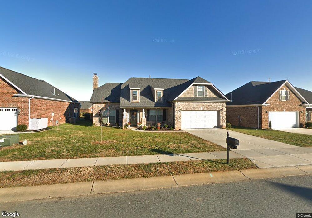
5217 Sustar Dr Unit 102 Monroe, NC 28110
Estimated Value: $505,000 - $558,000
4
Beds
3
Baths
2,390
Sq Ft
$219/Sq Ft
Est. Value
About This Home
This home is located at 5217 Sustar Dr Unit 102, Monroe, NC 28110 and is currently estimated at $524,173, approximately $219 per square foot. 5217 Sustar Dr Unit 102 is a home located in Union County with nearby schools including Sardis Elementary School, Porter Ridge Middle School, and Porter Ridge High School.
Ownership History
Date
Name
Owned For
Owner Type
Purchase Details
Closed on
Apr 17, 2017
Sold by
Sardis Properties Llc
Bought by
Better Jr Ramiro Antonio and Better Aleida G
Current Estimated Value
Home Financials for this Owner
Home Financials are based on the most recent Mortgage that was taken out on this home.
Original Mortgage
$263,500
Outstanding Balance
$217,554
Interest Rate
4.1%
Mortgage Type
VA
Estimated Equity
$306,619
Create a Home Valuation Report for This Property
The Home Valuation Report is an in-depth analysis detailing your home's value as well as a comparison with similar homes in the area
Purchase History
| Date | Buyer | Sale Price | Title Company |
|---|---|---|---|
| Better Jr Ramiro Antonio | $289,500 | None Available |
Source: Public Records
Mortgage History
| Date | Status | Borrower | Loan Amount |
|---|---|---|---|
| Open | Better Jr Ramiro Antonio | $263,500 |
Source: Public Records
Tax History
| Year | Tax Paid | Tax Assessment Tax Assessment Total Assessment is a certain percentage of the fair market value that is determined by local assessors to be the total taxable value of land and additions on the property. | Land | Improvement |
|---|---|---|---|---|
| 2025 | $2,292 | $525,600 | $0 | $0 |
| 2024 | $1,928 | $346,700 | $62,200 | $284,500 |
| 2023 | $1,907 | $346,700 | $62,200 | $284,500 |
| 2022 | $2,191 | $346,700 | $62,200 | $284,500 |
| 2021 | $2,191 | $346,700 | $62,200 | $284,500 |
| 2020 | $1,875 | $240,500 | $39,000 | $201,500 |
| 2019 | $1,875 | $240,500 | $39,000 | $201,500 |
| 2018 | $0 | $240,500 | $39,000 | $201,500 |
| 2017 | $1,978 | $237,900 | $39,000 | $198,900 |
| 2016 | $0 | $0 | $0 | $0 |
| 2015 | -- | $0 | $0 | $0 |
Source: Public Records
Map
Nearby Homes
- 5908 Heathrow Ct
- 3309 Arbor Pointe Dr
- 2801 Ashe Croft Dr
- 4001 Croftwood Ln
- 2907 Ashe Croft Dr
- 333 Knotty Wood Dr
- 0 W Highway 74
- 2842 Gray Fox Rd
- 2218 Tree Ridge Rd
- 3608 Braefield Dr
- 2014 Paddington Dr
- 3708 Wesley Chapel Stouts Rd
- 1022 Mendenhall St
- 2006 Chapman St
- 3619 Wesley Chapel Stouts Rd
- 1010 Glen Hollow Dr
- 3807 Edgeview Dr
- 1124 Landen Chase Dr
- 3610 Esther St
- 3702 Arthur St
- 5217 Sustar Dr
- 4409 Gwen Hartis Ct
- 4407 Gwen Hartis Ct Unit 127
- 5214 Sustar Dr
- 4411 Gwen Hartis Ct
- 4405 Gwen Hartis Ct Unit Lot 126
- 5223 Sustar Dr Unit Lot 105
- 5212 Sustar Dr
- 5220 Sustar Dr Unit 85
- 4403 Gwen Hartis Ct Unit 125
- 5301 Sustar Dr Unit 106
- 4413 Gwen Hartis Ct
- 5210 Sustar Dr
- 5203 Sustar Dr
- 5208 Sustar Dr
- 4406 Gwen Hartis Ct
- 5510 Burning Ridge Dr
- 5512 Burning Ridge Dr
- 5307 Sustar Dr Unit Lot 108
- 5506 Burning Ridge Dr
Your Personal Tour Guide
Ask me questions while you tour the home.