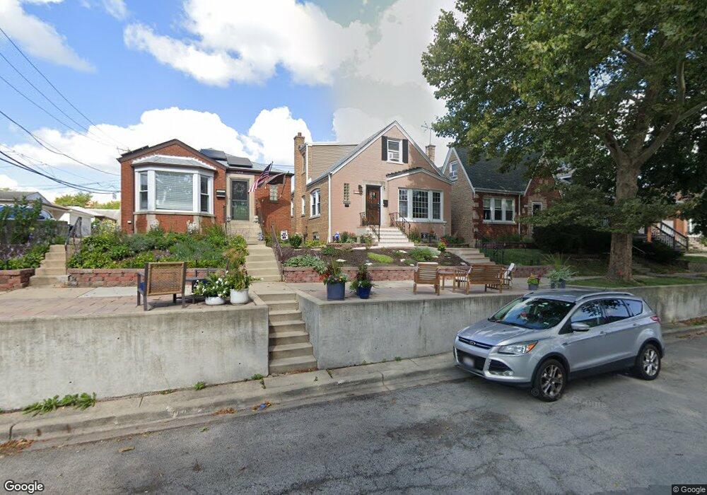
5218 N Normandy Ave Chicago, IL 60656
Norwood Park NeighborhoodEstimated Value: $426,000 - $529,000
3
Beds
2
Baths
1,710
Sq Ft
$271/Sq Ft
Est. Value
About This Home
This home is located at 5218 N Normandy Ave, Chicago, IL 60656 and is currently estimated at $463,604, approximately $271 per square foot. 5218 N Normandy Ave is a home located in Cook County with nearby schools including Garvy J Elementary School, William Howard Taft High School, and St. Monica Academy.
Ownership History
Date
Name
Owned For
Owner Type
Purchase Details
Closed on
Feb 19, 2019
Sold by
Jordak Ingrid E and Jordak Ingrid H
Bought by
Hermann Isabelle C
Current Estimated Value
Home Financials for this Owner
Home Financials are based on the most recent Mortgage that was taken out on this home.
Original Mortgage
$130,000
Outstanding Balance
$83,257
Interest Rate
4.4%
Mortgage Type
New Conventional
Estimated Equity
$380,347
Purchase Details
Closed on
Mar 31, 1998
Sold by
Hermann Christina
Bought by
Hermann Christina and Jordak Ingrid E
Create a Home Valuation Report for This Property
The Home Valuation Report is an in-depth analysis detailing your home's value as well as a comparison with similar homes in the area
Home Values in the Area
Average Home Value in this Area
Purchase History
| Date | Buyer | Sale Price | Title Company |
|---|---|---|---|
| Hermann Isabelle C | -- | Precision Title | |
| Hermann Christina | -- | -- |
Source: Public Records
Mortgage History
| Date | Status | Borrower | Loan Amount |
|---|---|---|---|
| Open | Hermann Isabelle C | $130,000 |
Source: Public Records
Tax History Compared to Growth
Tax History
| Year | Tax Paid | Tax Assessment Tax Assessment Total Assessment is a certain percentage of the fair market value that is determined by local assessors to be the total taxable value of land and additions on the property. | Land | Improvement |
|---|---|---|---|---|
| 2024 | $6,206 | $38,000 | $9,300 | $28,700 |
| 2023 | $6,290 | $32,732 | $7,444 | $25,288 |
| 2022 | $6,290 | $34,000 | $7,440 | $26,560 |
| 2021 | $6,168 | $34,003 | $7,443 | $26,560 |
| 2020 | $5,545 | $27,993 | $4,650 | $23,343 |
| 2019 | $5,009 | $31,104 | $4,650 | $26,454 |
| 2018 | $858 | $36,540 | $4,650 | $31,890 |
| 2017 | $919 | $26,330 | $4,092 | $22,238 |
| 2016 | $1,332 | $26,330 | $4,092 | $22,238 |
| 2015 | $1,280 | $27,716 | $4,092 | $23,624 |
| 2014 | $1,269 | $27,722 | $3,720 | $24,002 |
| 2013 | $1,274 | $27,722 | $3,720 | $24,002 |
Source: Public Records
Map
Nearby Homes
- 5245 N Rutherford Ave
- 6754 W Higgins Ave
- 5409 N New England Ave
- 5131 N Newland Ave
- 5452 N Natchez Ave
- 5107 N Sayre Ave
- 4841 N Rutherford Ave
- 6959 W Higgins Ave Unit 1S
- 5000 N Mobile Ave
- 5334 N Melvina Ave
- 4824 N Natchez Ave
- 4828 N Newcastle Ave
- 6520 W Gunnison St
- 5608 N Nagle Ave
- 6420 W Gunnison St
- 5048 N Nottingham Ave
- 4829 N Newland Ave
- 5526 N Nordica Ave
- 5345 N Neva Ave
- 5423 N Moody Ave
- 5214 N Normandy Ave
- 5220 N Normandy Ave
- 5224 N Normandy Ave
- 5226 N Normandy Ave
- 5230 N Normandy Ave
- 6640 W Foster Ave Unit 1
- 6640 W Foster Ave Unit 2
- 6634 W Foster Ave
- 6642 W Foster Ave
- 5221 N Rutherford Ave
- 6646 W Foster Ave
- 5215 N Rutherford Ave
- 5225 N Rutherford Ave
- 5234 N Normandy Ave
- 5219 N Rutherford Ave Unit 1
- 5219 N Rutherford Ave Unit 2
- 6648 W Foster Ave
- 5227 N Rutherford Ave
- 6652 W Foster Ave
- 5236 N Normandy Ave