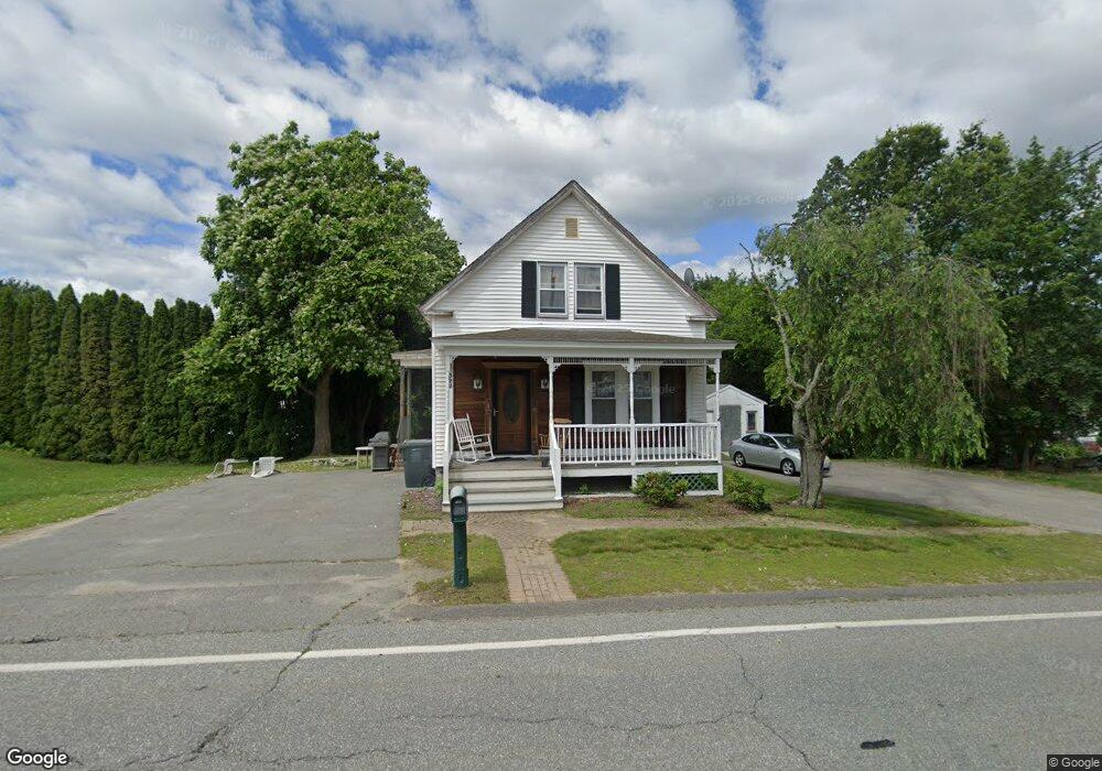
522 Hildreth St Dracut, MA 01826
Estimated Value: $472,000 - $486,684
3
Beds
1
Bath
1,150
Sq Ft
$416/Sq Ft
Est. Value
About This Home
This home is located at 522 Hildreth St, Dracut, MA 01826 and is currently estimated at $478,171, approximately $415 per square foot. 522 Hildreth St is a home located in Middlesex County with nearby schools including George H. Englesby Elementary School, Richardson Middle School, and Dracut Senior High School.
Ownership History
Date
Name
Owned For
Owner Type
Purchase Details
Closed on
Jun 27, 1996
Sold by
Dozois Claire
Bought by
Landry Dwight L and Landry Pamela
Current Estimated Value
Home Financials for this Owner
Home Financials are based on the most recent Mortgage that was taken out on this home.
Original Mortgage
$87,300
Interest Rate
8.05%
Mortgage Type
Purchase Money Mortgage
Create a Home Valuation Report for This Property
The Home Valuation Report is an in-depth analysis detailing your home's value as well as a comparison with similar homes in the area
Home Values in the Area
Average Home Value in this Area
Purchase History
| Date | Buyer | Sale Price | Title Company |
|---|---|---|---|
| Landry Dwight L | $90,000 | -- |
Source: Public Records
Mortgage History
| Date | Status | Borrower | Loan Amount |
|---|---|---|---|
| Open | Landry Dwight L | $140,000 | |
| Closed | Landry Dwight L | $90,000 | |
| Closed | Landry Dwight L | $87,300 |
Source: Public Records
Tax History
| Year | Tax Paid | Tax Assessment Tax Assessment Total Assessment is a certain percentage of the fair market value that is determined by local assessors to be the total taxable value of land and additions on the property. | Land | Improvement |
|---|---|---|---|---|
| 2025 | $4,263 | $421,200 | $224,600 | $196,600 |
| 2024 | $4,202 | $402,100 | $213,900 | $188,200 |
| 2023 | $4,032 | $348,200 | $186,000 | $162,200 |
| 2022 | $3,994 | $325,000 | $169,100 | $155,900 |
| 2021 | $11,162 | $296,200 | $153,600 | $142,600 |
| 2020 | $3,858 | $289,000 | $149,000 | $140,000 |
| 2019 | $13,668 | $261,500 | $141,900 | $119,600 |
| 2018 | $10,326 | $252,600 | $141,900 | $110,700 |
| 2017 | $3,444 | $252,600 | $141,900 | $110,700 |
| 2016 | $3,351 | $225,800 | $136,400 | $89,400 |
| 2015 | $3,252 | $217,800 | $136,400 | $81,400 |
| 2014 | $3,079 | $212,500 | $136,400 | $76,100 |
Source: Public Records
Map
Nearby Homes
- 551 Hildreth St Unit 10
- 417 Hildreth St Unit 30
- 16 Peabody Ave
- 367 Hildreth St Unit 14
- 367 Hildreth St Unit 33
- 75 Sladen St
- 345 Hildreth St Unit 14
- 26 Farmland Rd Unit C
- 15 Dana St
- 1391 Bridge St
- 23 18th St
- 40 Arlington Ave
- 175 Willard St Unit 9
- 35 Whitney Ave Unit 33
- 69 Arlington St
- 49 Sparks St
- 1563 Bridge St
- 54 Montaup Ave
- 1573 Bridge St
- 94 Hampson St
- 40 Tobey Rd Unit 40
- 532 Hildreth St
- 514 Hildreth St
- 523 Hildreth St
- 515 Hildreth St
- 529 Hildreth St
- 16 Tobey Rd
- 14 Tobey Rd Unit 16
- 16 Tobey Rd Unit A
- 14 Tobey Rd Unit 14
- 45 Tobey Rd Unit 45 51
- 535 Hildreth St
- 9 Tobey Rd Unit 11
- 542 Hildreth St
- 509 Hildreth St
- 9-11 Tobey Rd
- 9-11 Tobey Rd Unit 11
- 22 Tobey Rd
- 24 Tobey Rd Unit none
- 22 Tobey Rd Unit none
Your Personal Tour Guide
Ask me questions while you tour the home.