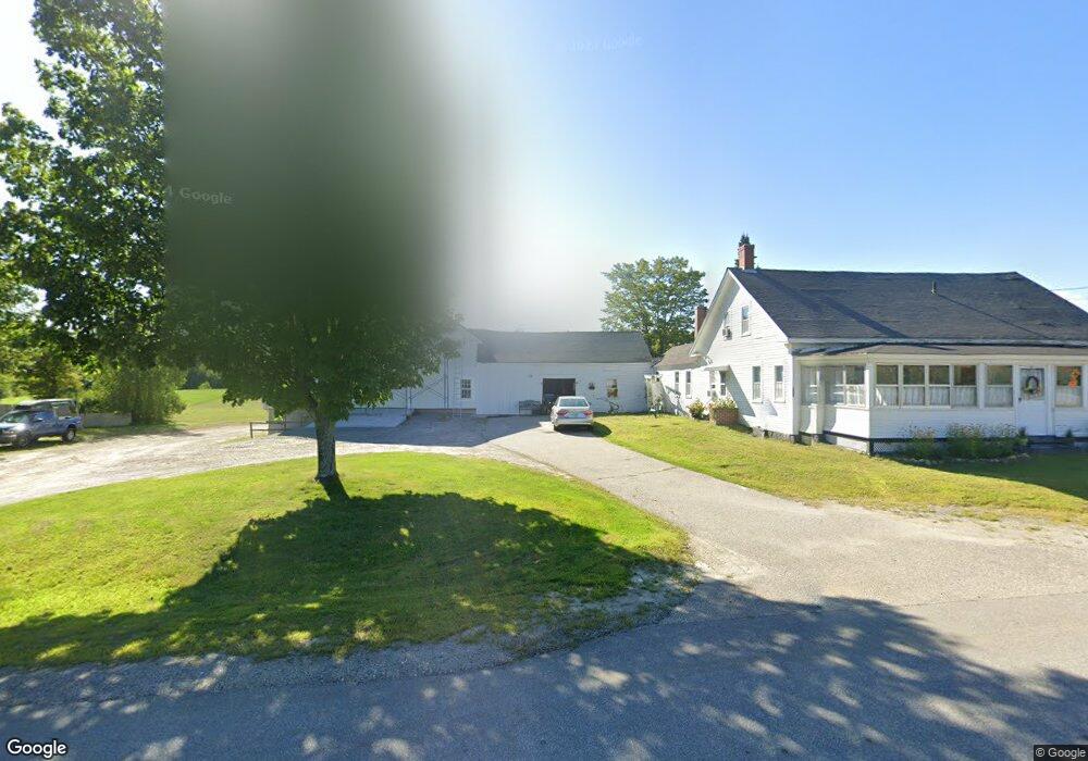
522 Laconia Rd Belmont, NH 03220
Estimated Value: $459,000 - $1,037,000
3
Beds
1
Bath
1,522
Sq Ft
$450/Sq Ft
Est. Value
About This Home
This home is located at 522 Laconia Rd, Belmont, NH 03220 and is currently estimated at $685,141, approximately $450 per square foot. 522 Laconia Rd is a home located in Belknap County with nearby schools including Belmont Elementary School, Belmont Middle School, and Belmont High School.
Ownership History
Date
Name
Owned For
Owner Type
Purchase Details
Closed on
Aug 3, 2009
Sold by
Rolfe Nelson H and Rolfe Theresa M
Bought by
Rolfe Joseph L and Rolfe Cindy A
Current Estimated Value
Home Financials for this Owner
Home Financials are based on the most recent Mortgage that was taken out on this home.
Original Mortgage
$259,000
Outstanding Balance
$170,754
Interest Rate
5.43%
Mortgage Type
Purchase Money Mortgage
Estimated Equity
$514,387
Create a Home Valuation Report for This Property
The Home Valuation Report is an in-depth analysis detailing your home's value as well as a comparison with similar homes in the area
Home Values in the Area
Average Home Value in this Area
Purchase History
| Date | Buyer | Sale Price | Title Company |
|---|---|---|---|
| Rolfe Joseph L | $350,000 | -- |
Source: Public Records
Mortgage History
| Date | Status | Borrower | Loan Amount |
|---|---|---|---|
| Open | Rolfe Joseph L | $259,000 |
Source: Public Records
Tax History Compared to Growth
Tax History
| Year | Tax Paid | Tax Assessment Tax Assessment Total Assessment is a certain percentage of the fair market value that is determined by local assessors to be the total taxable value of land and additions on the property. | Land | Improvement |
|---|---|---|---|---|
| 2024 | $8,828 | $560,882 | $80,382 | $480,500 |
| 2023 | $6,415 | $367,201 | $62,201 | $305,000 |
| 2022 | $6,461 | $338,080 | $54,680 | $283,400 |
| 2021 | $5,358 | $200,911 | $38,211 | $162,700 |
| 2020 | $5,137 | $202,714 | $38,514 | $164,200 |
| 2019 | $5,079 | $203,078 | $38,878 | $164,200 |
| 2017 | $5,120 | $173,795 | $46,395 | $127,400 |
| 2016 | $5,024 | $174,279 | $46,879 | $127,400 |
| 2015 | $4,941 | $174,765 | $47,365 | $127,400 |
| 2014 | $4,832 | $174,765 | $47,365 | $127,400 |
| 2013 | $4,876 | $217,289 | $77,389 | $139,900 |
Source: Public Records
Map
Nearby Homes
- 18 Highcrest Dr
- 11 Highcrest Dr
- 73 Seavey Rd
- 11 Valley Dr
- 5 Tee Dee Dr
- 218 Wild Acres Rd
- 357 Hurricane Rd
- 134 Leavitt Rd
- 38 Country Side Cir
- 36 Country Side Cir
- 42 Horne Rd
- 66 Bean Hill Rd
- 82 Plummer Hill Rd
- 0 Horne Rd Unit 5054405
- 221 Aiden Cir
- 8 Jodi Dr
- 36 Dearborn St
- 230 Aiden Cir
- 78 Granite Ridge Dr
- 126 Aiden Cir
- 528 Laconia Rd
- 532 Laconia Rd
- 6 Farrarville Rd
- 548 Laconia Rd
- 10-3 Farrarville Rd Unit 10-3
- 10-3 Farrarville Rd Unit 10-3
- 2 Lamprey Rd
- 1 Lamprey Rd
- 16 Farrarville Rd
- 10-2 Farrarville Rd
- 10-0 Farrarville Rd Unit 10-0
- 24 Farrarville Rd
- 0 Farrarville Rd
- 13 Farrarville Rd
- 5 Farrarville Rd
- 6 Lamprey Rd
- 17 Farrarville Rd
- 21 Farrarville Rd
- 19 Haven Lane Rd Unit 4
- 31 Lamprey Rd