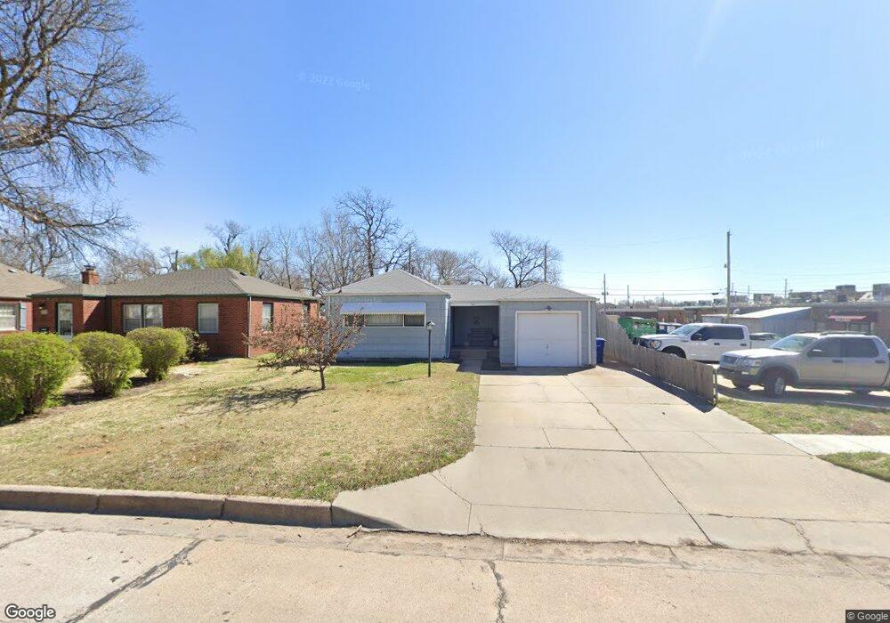
522 N Pershing St Wichita, KS 67208
Country Overlook NeighborhoodEstimated Value: $122,865 - $127,000
2
Beds
1
Bath
996
Sq Ft
$125/Sq Ft
Est. Value
About This Home
This home is located at 522 N Pershing St, Wichita, KS 67208 and is currently estimated at $124,933, approximately $125 per square foot. 522 N Pershing St is a home located in Sedgwick County with nearby schools including Adams Elementary School, Robinson Middle School, and Wichita High School East.
Ownership History
Date
Name
Owned For
Owner Type
Purchase Details
Closed on
Aug 26, 2008
Sold by
Binyon Thomas G and Wiechman Branda R
Bought by
Davis Beverty
Current Estimated Value
Purchase Details
Closed on
Feb 12, 2007
Sold by
Binyon Kernle W
Bought by
Binyon Thomas G
Home Financials for this Owner
Home Financials are based on the most recent Mortgage that was taken out on this home.
Original Mortgage
$44,000
Interest Rate
6.21%
Mortgage Type
New Conventional
Create a Home Valuation Report for This Property
The Home Valuation Report is an in-depth analysis detailing your home's value as well as a comparison with similar homes in the area
Home Values in the Area
Average Home Value in this Area
Purchase History
| Date | Buyer | Sale Price | Title Company |
|---|---|---|---|
| Davis Beverty | -- | None Available | |
| Binyon Thomas G | -- | Lts Title Services |
Source: Public Records
Mortgage History
| Date | Status | Borrower | Loan Amount |
|---|---|---|---|
| Previous Owner | Binyon Thomas G | $44,000 |
Source: Public Records
Tax History Compared to Growth
Tax History
| Year | Tax Paid | Tax Assessment Tax Assessment Total Assessment is a certain percentage of the fair market value that is determined by local assessors to be the total taxable value of land and additions on the property. | Land | Improvement |
|---|---|---|---|---|
| 2025 | $620 | $7,602 | $2,530 | $5,072 |
| 2023 | $620 | $6,510 | $2,128 | $4,382 |
| 2022 | $666 | $6,510 | $2,013 | $4,497 |
| 2021 | $718 | $6,509 | $1,610 | $4,899 |
| 2020 | $664 | $6,026 | $1,610 | $4,416 |
| 2019 | $639 | $5,798 | $1,610 | $4,188 |
| 2018 | $624 | $5,662 | $1,369 | $4,293 |
| 2017 | $624 | $0 | $0 | $0 |
| 2016 | $622 | $0 | $0 | $0 |
| 2015 | $624 | $0 | $0 | $0 |
| 2014 | $734 | $0 | $0 | $0 |
Source: Public Records
Map
Nearby Homes
- 440 N Crestway St
- 433 N Crestway St
- 448 N Broadview St
- 334 N Crestway St
- 815 N Oliver Ave
- 808 N Belmont Ave
- 421 N Harding Ave
- 4907 E Murdock St
- 537 N Fountain St
- 848 N Belmont Ave
- 852 N Belmont Ave
- 536 N Bluff St
- 331 N Coronado Place
- 246 N Oliver Ave
- 541 N Bluff St
- 644 N Bluff St
- 216 N Terrace Dr
- 930 N Crestway Ave
- 5109 E 3rd St N
- 353 N Pinecrest St
- 528 N Pershing St
- 532 N Pershing St
- 525 N Pershing St
- 540 N Pershing St
- 523 N Pershing St
- 527 N Pershing St
- 519 N Dellrose St
- 519 N Pershing St
- 521 N Dellrose St
- 517 N Dellrose St
- 525 N Dellrose St
- 4618 E Central Ave
- 535 N Pershing St
- 4530 E Central Ave
- 537 N Dellrose St
- 541 N Pershing St
- 543 N Dellrose St
- 4520 E Central Ave
- 547 N Pershing St
- 552 N Pershing St