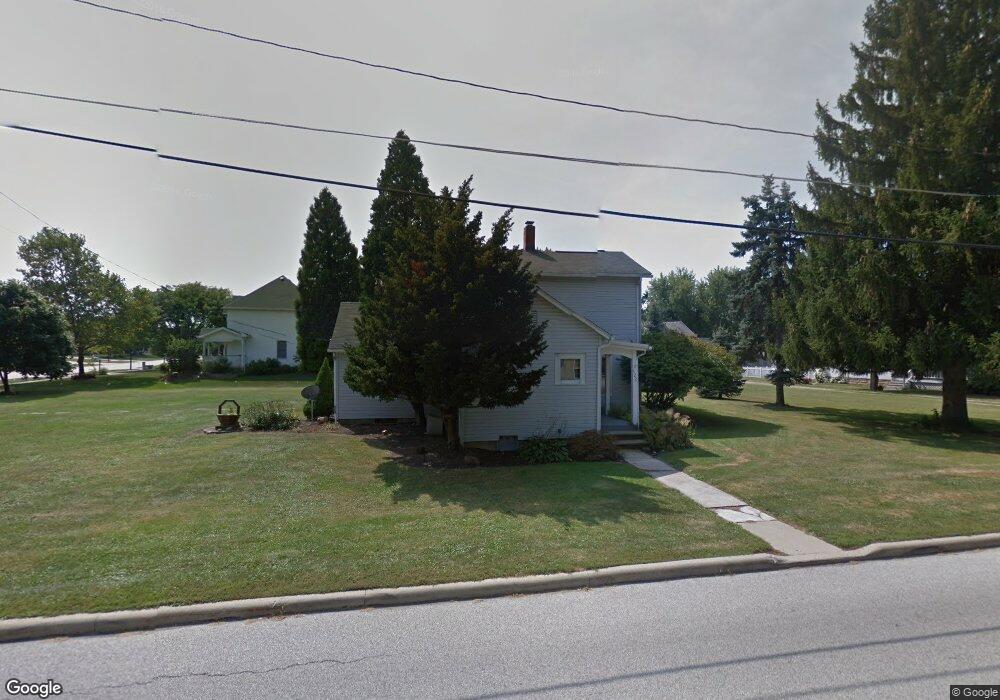
522 Shupe Ave Amherst, OH 44001
Estimated Value: $204,349 - $236,000
3
Beds
1
Bath
1,402
Sq Ft
$154/Sq Ft
Est. Value
About This Home
This home is located at 522 Shupe Ave, Amherst, OH 44001 and is currently estimated at $215,587, approximately $153 per square foot. 522 Shupe Ave is a home located in Lorain County with nearby schools including Powers Elementary School, Walter G. Nord Middle School, and Amherst Junior High School.
Ownership History
Date
Name
Owned For
Owner Type
Purchase Details
Closed on
Apr 19, 1999
Sold by
Stoyanoff Patricia L J and Sechkar Debo
Bought by
Rainey Daniel B and Sheffield Christina M
Current Estimated Value
Home Financials for this Owner
Home Financials are based on the most recent Mortgage that was taken out on this home.
Original Mortgage
$69,235
Outstanding Balance
$17,546
Interest Rate
7.05%
Estimated Equity
$198,041
Create a Home Valuation Report for This Property
The Home Valuation Report is an in-depth analysis detailing your home's value as well as a comparison with similar homes in the area
Home Values in the Area
Average Home Value in this Area
Purchase History
| Date | Buyer | Sale Price | Title Company |
|---|---|---|---|
| Rainey Daniel B | $59,800 | Tower City Title Agency Inc |
Source: Public Records
Mortgage History
| Date | Status | Borrower | Loan Amount |
|---|---|---|---|
| Open | Rainey Daniel B | $69,235 |
Source: Public Records
Tax History Compared to Growth
Tax History
| Year | Tax Paid | Tax Assessment Tax Assessment Total Assessment is a certain percentage of the fair market value that is determined by local assessors to be the total taxable value of land and additions on the property. | Land | Improvement |
|---|---|---|---|---|
| 2024 | $2,406 | $58,447 | $20,090 | $38,357 |
| 2023 | $1,431 | $28,900 | $7,522 | $21,378 |
| 2022 | $1,373 | $28,900 | $7,522 | $21,378 |
| 2021 | $1,331 | $28,900 | $7,520 | $21,380 |
| 2020 | $1,305 | $25,160 | $6,550 | $18,610 |
| 2019 | $1,279 | $25,160 | $6,550 | $18,610 |
| 2018 | $1,361 | $25,160 | $6,550 | $18,610 |
| 2017 | $1,436 | $26,370 | $11,520 | $14,850 |
| 2016 | $1,447 | $26,370 | $11,520 | $14,850 |
| 2015 | $1,439 | $26,370 | $11,520 | $14,850 |
| 2014 | $1,351 | $24,640 | $10,760 | $13,880 |
| 2013 | $1,355 | $24,640 | $10,760 | $13,880 |
Source: Public Records
Map
Nearby Homes
- V/L Middle Ridge Rd
- 328 Buttermere Ln Unit 328
- 133 Ambleside Way
- 281 English Lakes Blvd Unit 67281
- 653 Brennan Dr
- 2176 Myla Way
- 2180 Myla Way
- 621 Van Oaks Dr
- 891 Park Ave
- 923 Longitude Ln
- 0 Middle Ridge Rd Unit 5160578
- 0 Middle Ridge Rd Unit 5102632
- 335 Copper Creek
- 812 Bearing Ct
- 650 Eastpointe Ct
- 275 Cornell Ave
- 168 Orchard Hill Dr
- 1140 Woodside Dr
- 394 Long St
- 0 Stonebridge Dr
- 110 Ravenglass Blvd
- 793 Minerva St
- 480 Shupe Ave
- 526 Shupe Ave
- 105 Ravenglass Blvd
- 120 Ravenglass Blvd
- 451 Shupe Ave
- 104 Keswick Ct
- 115 Ravenglass Blvd
- 459 Shupe Ave
- 450 Shupe Ave
- 125 Ravenglass Blvd
- 440 Shupe Ave
- 774 Minerva St
- 471 Shupe Ave
- 106 Keswick Ct
- 431 Shupe Ave
- 481 Shupe Ave
- 135 Ravenglass Blvd
- 593 Shupe Ave